On this page
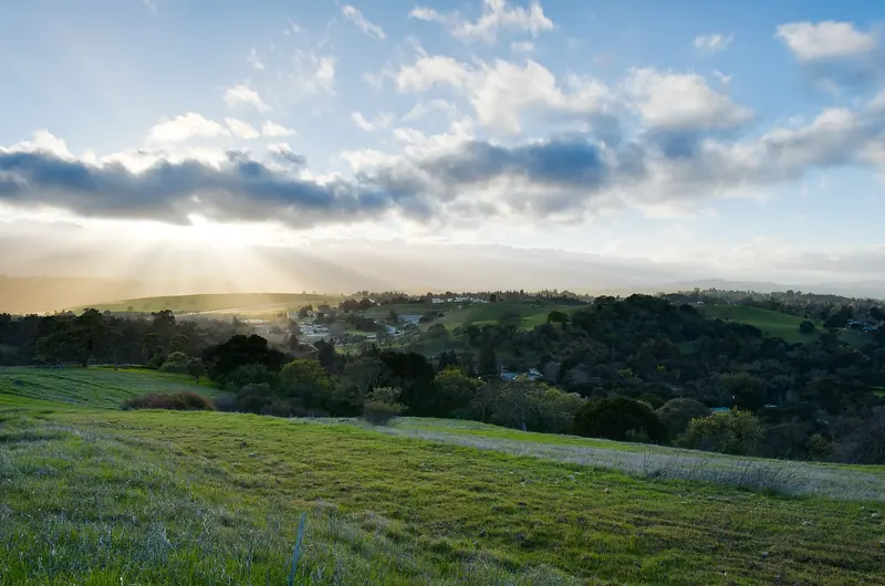
On any given morning the Dish is full of people. Students run it before class. Retirees walk it in pairs. Startup founders take meetings on it, earbuds in. The trail circles a giant radio telescope in the grassy hills behind Stanford and the views stretch from the bay to the Santa Cruz Mountains. Wikipedia puts the average traffic at 1,500 to 1,800 visitors a day.
The Dish is not a city park. It is private land in Stanford's foothills, set aside for research and conservation. The university lets the public walk it on its own terms. That means its own hours, its own rules and occasional closures. This guide covers all of it, plus the story of the telescope that gave the hike its name.
The Dish itself: a short history
The Dish is a steerable radio antenna about 150 feet across. Stanford Research Institute, now SRI International, built it in 1961 with funding from the U.S. Air Force. It cost $4.5 million at the time.
Its first job was a Cold War one. In the 1960s researchers used it to study radio signals bounced off the moon and the upper atmosphere. That work helped the United States learn about Soviet radar installations and design radar that could track missiles. Later the antenna talked to satellites and spacecraft. It sent signals to the Voyager probes. In 1982 it helped rescue a stranded amateur radio satellite called UoSAT-1.
The telescope is still in use. The U.S. government owns it and SRI International operates it. It has been used to command and calibrate spacecraft and for radio astronomy. Before NASA's InSight mission to Mars, the Dish tested the small CubeSats that would relay the lander's signals. When you walk past, look for the antenna tilting and turning. It is not a monument. It is working equipment.

The loop: distance and climb
The trail is a network of paved service roads. Most people walk the main loop from the Stanford Avenue gate. Stanford calls it a 3.5-mile trail. Adding up the segments on the university's own map gives about 3.7 miles from the gate and back. Allow 60 to 90 minutes at a steady walk.
The climb is real but short. The Stanford Avenue gate sits at about 176 feet above sea level. The high point on the loop is about 526 feet. Between them are several steep pitches and some rolling sections, so you gain and lose height a few times. Runners love it for that reason.
Which way to go
- Clockwise from Stanford Gate. Head uphill on the east side first. This is the longest climb, up to the high point near 526 feet. You then roll west past the telescope and come down the far side to Gerona Gate before returning along Junipero Serra Boulevard.
- Counterclockwise from Stanford Gate. Walk the flatter stretch of Reservoir Road parallel to Junipero Serra first, then climb from Gerona Gate toward the telescope and finish with the long descent on the east side.
- From Piers Gate on Alpine Road. Ranch Road climbs about 1.1 miles from the gate near San Francisquito Creek up to the telescope. This makes a good out-and-back on its own.
Mile markers and numbered posts line the route. The post numbers are also location markers. If you ever need to call 911, give the number on the nearest post.
Entrances and parking
There are four public gates. Each one is marked on the official Dish site.
- Stanford Gate. The main entrance, at Stanford Avenue and Junipero Serra Boulevard. Most people start here.
- Frenchman's Gate. On Junipero Serra Boulevard near Frenchmans Road, a short way west of the main gate.
- Gerona Gate. On Junipero Serra Boulevard near Campus Drive East, on the western end of the loop.
- Piers Gate. On Alpine Road beside San Francisquito Creek, on the far side of the hills.
There is no dedicated parking lot. Stanford directs visitors to Stanford Avenue for the main gate, Alpine Road for Piers Gate and Coyote Hill Road. Street spaces near the main gate fill early on weekend mornings, so arrive early or walk in from the College Terrace area. Read every parking sign carefully. Stanford encourages anyone who lives nearby to walk or bike instead of driving.
Hours and rules set by Stanford
The Dish is open from about sunrise to sunset. Stanford publishes these hours on its site:
| Month | Open | Close |
|---|---|---|
| January | 6:30 a.m. | 5 p.m. |
| February | 6:30 a.m. | 5:30 p.m. |
| March | 6 a.m. | 6:30 p.m. |
| April to August | 6 a.m. | 7:30 p.m. |
| September | 6:30 a.m. | 7 p.m. |
| October | 6:30 a.m. | 6 p.m. |
| November and December | 6:30 a.m. | 5 p.m. |
No visitors are allowed after closing. Stanford can also restrict or suspend access during Red Flag Warnings for fire weather, during heat and poor air quality, or for maintenance and research. The status is posted on the Dish website and at the gates, so check before you drive over.
The rules are posted at every entrance. Treat them as firm, since entry is by permission of the landowner:
- No dogs, except trained service animals.
- No bikes, skates or skateboards.
- Stay on the paved trail. Off-trail access is by permit only.
- No drones. The foothills are a no-fly zone.
- No smoking, alcohol, fires or fireworks.
- No hunting, fishing or dumping. Carry out your trash.
The path can be used by wheelchairs, manual or electric. Stanford warns that some sections are steep, so take care.
Wildlife
The Dish is part of Stanford's academic reserve and one of the last large unbroken stretches of open space in the lower foothills. Parts of it are managed to improve habitat for the threatened California tiger salamander, which breeds in seasonal ponds. Acorn woodpeckers nest in dead oak snags along the trail.
Stanford's entrance signs list mountain lions, bobcats, coyotes, wild turkeys, rattlesnakes and tarantulas among the residents. Coyotes are seen often. Give all wildlife space, never feed animals and do not approach them even if they approach you. Ticks and poison oak live in the grass beside the path, which is one more reason to stay on the pavement. Stanford asks people to report coyote encounters to Stanford Public Safety.
Best times to go
Early morning is the classic time. The air is cool, the light is soft and the trail is busy in a friendly way. Late afternoon brings golden light on the hills and views toward the bay. Just watch the closing time, which arrives early in winter.
Season matters too. After the first rains, usually in November or December, the hills turn green and stay that way into spring. February through April is the prettiest stretch. By late spring the grass goes gold and summer afternoons can be hot, with no shade anywhere on the loop. See our Palo Alto weather guide for month-by-month temperatures.
Good to know
- Bring water, sunscreen and a hat. There is almost no shade and no benches.
- A drinking fountain sits along Reservoir Road on the north side of the loop.
- Stanford runs a portable restroom just inside the main gate during open hours as a pilot program. There are no other restrooms.
- Weekday mornings are calmer than weekend mornings.
Make a day of it
The Dish sits on the edge of campus, so it pairs naturally with a Stanford visit. Drive or bike a few minutes to Palm Drive and walk the Main Quad. Step into Memorial Church or see the Rodin bronzes at the Cantor Arts Center. For a longer day in the hills, continue up Page Mill Road to Foothills Nature Preserve. You can also compare the Dish with the city's other parks and preserves. If you want a guide to fill in the Silicon Valley story around you, browse Stanford and Silicon Valley tours.
Frequently asked questions
How long is the Stanford Dish hike?
The main loop is about 3.5 miles. Measured on Stanford's own trail map from the Stanford Avenue gate it comes to roughly 3.7 miles. Most people finish in 1 to 1.5 hours at a steady walk.
Is the Stanford Dish hike hard?
It is moderate. The path is paved but has several steep climbs and the high point is about 350 feet above the main gate. There is very little shade, so it feels harder on hot afternoons.
What are the Stanford Dish hours?
Stanford sets the hours by month. They run from about sunrise to sunset, for example 6 a.m. to 7:30 p.m. from April through August and 6:30 a.m. to 5 p.m. in winter. Check dish.stanford.edu before you go since the area can close for fire danger.
Can I bring my dog to the Dish?
No. Dogs are not allowed in the Dish area except trained service animals. Bikes, skates, drones, smoking and alcohol are also banned.
Where do you park for the Dish?
Stanford points visitors to street parking near the Stanford Avenue gate, the Alpine Road gate and Coyote Hill Road. Spaces near the main gate fill early on weekends. Stanford encourages people who live nearby to walk or bike.