On this page
Palo Alto has the kind of weather people move for. Summers are long, dry and sunny. Winters are short, cool and green. Most days of the year you can walk downtown in a light layer and eat dinner outside. There are only a handful of truly hot days and only a handful of cold ones.
The numbers on this page come from NOAA's climate normals for Palo Alto, which average the weather from 1991 to 2020. They tell you what a typical month looks like. Individual years can swing a lot, especially for rain. Use the month table to plan, then check a forecast in the week before you travel.
The climate in a nutshell
Palo Alto has a Mediterranean climate. That means warm, dry summers and mild, wet winters, the same pattern you find around the Mediterranean Sea, in central Chile and in parts of South Africa and Australia. The city averages about 15 inches of rain a year. About 85 percent of it falls between November and March.
The location shapes the details. Palo Alto sits on flat land between San Francisco Bay and the Santa Cruz Mountains. The mountains block much of the cold fog that rolls in from the Pacific, so the city is sunnier and warmer than San Francisco or the coast. The bay moderates the extremes. It keeps winter nights from getting very cold and sends a cooling breeze across town on many summer afternoons.
Daily swings are large. A summer day that peaks near 80°F can drop into the mid 50s by dawn. That gap catches a lot of visitors off guard. Pack for both ends of the day.
Palo Alto weather by month
Averages are NOAA 1991 to 2020 climate normals. Highs and lows are in degrees Fahrenheit. Rain is the average monthly total in inches.
| Month | Avg high | Avg low | Rain (in) | What to expect |
|---|---|---|---|---|
| January | 57.8°F | 39.0°F | 2.95 | Cool, green, rainy spells |
| February | 60.7°F | 41.3°F | 3.18 | Wettest month, early blossoms |
| March | 65.5°F | 43.6°F | 2.19 | Showers fading, wildflowers |
| April | 69.6°F | 45.3°F | 0.97 | Mild and green |
| May | 73.3°F | 49.5°F | 0.44 | Warm, hills turning gold |
| June | 78.5°F | 52.7°F | 0.10 | Dry, some gray mornings |
| July | 79.4°F | 55.7°F | 0.00 | Sunny and dry |
| August | 78.7°F | 55.3°F | 0.03 | Sunny and dry |
| September | 79.6°F | 53.0°F | 0.07 | Warmest month, heat waves possible |
| October | 74.0°F | 48.4°F | 0.64 | Warm days, first rain possible |
| November | 63.7°F | 42.5°F | 1.60 | Rain season begins |
| December | 57.6°F | 38.6°F | 2.95 | Coolest nights, rainy spells |
Month by month guide
Winter: December to February
Winter is the rainy season, but it is not gray all the time. Storms tend to come in waves. A few days of steady rain are followed by clear, crisp days with snow-white clouds and views of the hills. Highs sit near 58°F in December and January and lows dip into the high 30s. Frost on car windows is normal on clear mornings.
February is the wettest month on average, with just over 3 inches of rain. It is also when the first fruit trees blossom and the foothills turn their brightest green. The Stanford Dish and the Baylands are at their most photogenic, as long as you dodge the storms. Winter is peak bird season at the Baylands.
Spring: March to May
Spring warms up quickly. March still brings showers, but by April rain is light and highs reach the upper 60s. Wildflowers bloom in the hills and the city's gardens are in full color. May is warm and nearly dry, with highs in the low to mid 70s. The green hills start turning gold by late May.
This is one of the best times to hike. The trails at Foothills Nature Preserve are comfortable and the air is often very clear after the last storms.
Summer: June to August
Summer is dry and reliable. July averages zero rain. Highs sit in the upper 70s and many days climb into the 80s. Nights stay cool, usually in the mid 50s.
Some mornings start under a gray marine layer, especially in June. It usually burns off by late morning. In the afternoon a breeze often comes off the bay, which keeps the Baylands cooler and windier than downtown. Heat waves do happen. Inland valleys and the foothills can run several degrees hotter than the flats near the bay.
Fall: September to November
Locals will tell you that September and October are the real summer. September is the warmest month on average, with highs near 80°F. It is also the month for heat waves. The all-time record of 108°F came on September 6, 2022.
October stays warm and mostly dry, with highs in the mid 70s. The first rain of the season often arrives in late October or November. By November the rainy season is under way, highs fall into the low to mid 60s and the hills start to green up again.
Month by month
Each month has its own page with average highs and lows, rainfall, sun times and what to pack.
- January weather in Palo Alto
- February weather in Palo Alto
- March weather in Palo Alto
- April weather in Palo Alto
- May weather in Palo Alto
- June weather in Palo Alto
- July weather in Palo Alto
- August weather in Palo Alto
- September weather in Palo Alto
- October weather in Palo Alto
- November weather in Palo Alto
- December weather in Palo Alto
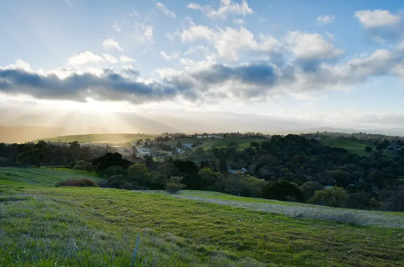

Summer fog versus inland warmth
Many visitors arrive expecting San Francisco weather. Palo Alto is different. In summer, cold ocean water and a high pressure system offshore build a thick layer of marine fog along the coast. It pours through the Golden Gate and over low gaps in the hills. San Francisco can sit under that layer for days in July and August.
Palo Alto is roughly 30 to 35 miles south of the city and on the bay side of the Santa Cruz Mountains. The ridge blocks most of the fog. On a typical summer day the city is sunny and in the upper 70s while parts of San Francisco stay much cooler and gray. If you are planning a day trip, pack a jacket for the city even when Palo Alto is warm. The same goes for the coast at Half Moon Bay, which is often foggy and cool in summer.
Within Palo Alto there are small differences too. The flat neighborhoods near the bay catch the afternoon breeze. The foothills along Page Mill Road and Arastradero Road heat up more and cool down faster at night.
Rain season and storms
The rainy season runs roughly from November through March. Most rain arrives with Pacific storms. Some winters bring atmospheric rivers, long plumes of moisture that can drop several inches in a few days. Others are dry. Totals can swing widely from year to year, so the 15-inch average hides a lot of variety.
Heavy rain can cause local flooding near creeks. City open space trails may close for a day or two until they dry out. Pearson-Arastradero Preserve marks some trails as seasonal for this reason. Check the National Weather Service Bay Area office for forecasts and warnings.
The dry season has its own hazard. From late summer into fall, dry grass and offshore winds raise wildfire risk in the hills. During Red Flag Warnings Stanford may restrict access to the Dish and smoke from distant fires can affect air quality. Check air quality before strenuous outdoor plans in late summer and fall.
What to pack
Layers matter more than anything. Even in summer, mornings and evenings are cool. Here is a simple list by season:
- All year: a light jacket or fleece, comfortable walking shoes, sunglasses and sunscreen. The sun is strong even when the air feels cool.
- Winter: a rain jacket or umbrella, a warmer layer for evenings near 40°F and shoes that can handle wet sidewalks.
- Spring and fall: short sleeves for the afternoon plus a sweater for the evening.
- Summer: a hat and a water bottle for hikes plus a real jacket if you plan to visit San Francisco or the coast.
Dress in Palo Alto is casual. Jeans and a nice sweater work for most restaurants. If you want peace of mind for a long trip, you can compare travel insurance plans.
The best time to visit
There is no bad season in Palo Alto, but some are better than others for certain plans.
- September and October bring the most dependable warm weather. Stanford is back in session and campus feels lively. Watch for heat waves in September.
- April and May are mild, mostly dry and green. This is prime hiking and garden season.
- June through August are sunny and dry. They are great for outdoor dining and the Bay Trail. Summer is also a busy travel time on campus, so book rooms early.
- November through March bring rain but also lower demand for some hotels, green hills and peak birding.
Hotel prices in Palo Alto follow the university calendar as much as the weather. Graduation in June, move-in weeks and big conference dates can fill rooms fast. It pays to compare Palo Alto hotels as soon as your dates are firm. For more help, see our trip planning guide and the events calendar. Ideas for each season are in our list of things to do in Palo Alto.
In this section
Frequently asked questions
What is the best month to visit Palo Alto?
September and October are hard to beat. Days are warm and sunny, rain is rare and the evenings are mild. April and May are a close second, with green hills and wildflowers.
Does it rain a lot in Palo Alto?
No. The city averages about 15 inches of rain a year. Nearly all of it falls from November through March. June through September usually see almost none.
Is Palo Alto foggy like San Francisco?
Much less so. The Santa Cruz Mountains block most of the coastal fog. Summer mornings can start gray, but the sky usually clears by late morning and afternoons are warm.
How hot does Palo Alto get in summer?
Average highs run in the upper 70s from June through September. Heat waves push temperatures into the 90s and beyond a few times most years. The record is 108°F, set on September 6, 2022.
Does it snow in Palo Alto?
Snow in the city itself is extremely rare. Winter lows average in the high 30s, so frost on lawns and car windows is common on clear nights. Snow very occasionally dusts the higher peaks around the Bay Area.