On this page
College Terrace is one of the most distinctive small neighborhoods in Palo Alto. It is a tight grid of mostly residential streets squeezed between Stanford University and El Camino Real. Almost every cross street carries the name of a college. Four little parks sit exactly where the original surveyor put them in the 1880s. A Spanish-style library from 1936 still serves as the neighborhood's living room.
It is also a place with a grudge that has long since turned into a good story. Before Palo Alto existed, this tract was called Palo Alto. This guide explains how it lost that name, how its streets were named, what to see on a walk and what daily life is like here today.
A town that gave up its name
In 1870 two German immigrants, Peter Spacher and Frederick Weisshaar, bought about 120 acres of farmland next to what would become the Stanford campus. When Leland Stanford began assembling land for his stock farm and university, he owned property on three sides of their parcel. They declined to sell to him.
In 1887, as construction started on the university, Spacher and Weisshaar sold the land to Alexander Gordon, a farmer from San Mateo. Gordon saw the obvious opportunity. A university was coming and its faculty, staff and suppliers would need places to live. He divided the land into town lots and named his new town Palo Alto.
Stanford wanted that name for the townsite that Timothy Hopkins was laying out north of campus, then called University Park. The two men reached an agreement. Gordon renamed his tract College Terrace and the Hopkins town took the Palo Alto name. Our history of Palo Alto covers how University Park grew into the city.
College Terrace was later tied to its neighbor Mayfield, the older town centered on what is now California Avenue. When Palo Alto annexed Mayfield in 1925, College Terrace came along with it.
Streets named for colleges
Gordon named the cross streets in alphabetical order after well-known colleges and universities. College Avenue runs down the middle of the neighborhood, with Stanford Avenue on one side and California Avenue on the other. The cross streets march from Amherst Street near campus toward El Camino Real.
- Amherst, Bowdoin, Columbia, Cornell, Dartmouth, Harvard
- Oberlin, Princeton, Wellesley, Williams, Yale
Sharp-eyed visitors notice that Cornell Street is out of order. It was originally Washington Street. In 1925, when Mayfield joined Palo Alto, duplicate street names had to go. Washington became Cornell. College Avenue itself was once called Palo Alto Avenue, a leftover from Gordon's first plan. It was renamed at the same time. Mayfield's main street, Lincoln, became California Avenue in the same round of changes.
An early map from around 1900 also shows Oxford and Cambridge streets running through to Amherst. Oxford Avenue still runs to El Camino Real at the neighborhood's small commercial edge.
Four parks from the original plan
Gordon's plan set aside four small parks. All four still exist. In 1968 the city renamed them for people tied to the area. They are small, quiet and close enough that no house is more than a few minutes' walk from one.
| Park today | Original name | Location | Named for |
|---|---|---|---|
| Mayfield Park | Hollywood Park | Wellesley, beside the library | The former town of Mayfield |
| Donaldina M. Cameron Park | Berkeley Park | Wellesley, between College and Stanford | A Presbyterian missionary in San Francisco's Chinatown who lived locally |
| Frederick W. Weisshaar Park | Hampton Park | Dartmouth, between California and College | One of the two original landowners |
| William C. Werry Park | Eton Park | Dartmouth, between College and Stanford | A Mayfield resident and Palo Alto postmaster from 1924 to 1935 |
According to the residents' association, Cameron and Werry parks have playgrounds and Weisshaar Park has two tennis courts. All four have open lawns. City parks close from 10:30 p.m. until sunrise.
The College Terrace Library
The College Terrace Library at 2300 Wellesley Street is the oldest of Palo Alto's branch libraries. It was built in 1936 in the Spanish Colonial Revival style as a Works Progress Administration project. The building was designed by local architect Charles K. Sumner and was fully renovated in 2010.
Inside are a reading room, a children's room with storytimes, public computers and free Wi-Fi. The library has recently been open Tuesday through Saturday, 10 a.m. to 6 p.m. Check the Palo Alto City Library website for current hours. The residents' association also holds its board meetings here, which tells you how central the building is to neighborhood life.
Book lovers will also spot several Little Free Libraries on College Terrace streets, small boxes where neighbors swap books.

Next door to Stanford
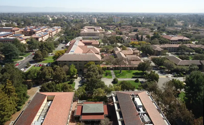
Location is the neighborhood's biggest draw. Its northern edge is Stanford Avenue, directly across from Escondido Village, a large Stanford housing area for students and staff. From there it is a short bike ride to the Main Quad and the central campus. Our guide to visiting Stanford covers what to see once you cross over.
Stanford Research Park, the 700-acre business park that Stanford and the city launched in 1951, spreads along Page Mill Road a short ride to the south. It holds more than 150 companies. Many College Terrace residents work either on campus or in the research park. That mix has shaped the neighborhood for decades, with a steady turnover of visiting scholars, graduate families and longtime owners.
The flip side of being close to a major employer is pressure on housing and parking. The residents' association regularly weighs in on Stanford's long-range campus plans, parking rules and proposed developments. In 2021, for example, the City Council restricted a zoning tool called Planned Home Zoning in single-family neighborhoods, which effectively ended a proposed apartment project at Wellesley Street and College Avenue.
Homes and daily life
The neighborhood is about 12 blocks long and two blocks wide and is almost entirely residential. It has more than 900 households. Houses sit close together on a regular grid. The building stock spans older cottages and bungalows, mid-century homes and many recent rebuilds.
Notable former residents include the architect Birge Clark, the theologian Robert McAfee Brown and the folk singer Joan Baez.
A few businesses sit at the El Camino Real end, between Yale Street and the highway, including a neighborhood grocery. For a bigger choice of restaurants, cross El Camino Real to California Avenue or ride north to downtown. The College Terrace Residents' Association organizes a summer block party and a holiday party and publishes news on local issues. For schools and city services, see our guide to living in Palo Alto.
A short walk through College Terrace
You can see the whole neighborhood in under an hour on foot. Here is an easy loop:
- Start at El Camino Real and College Avenue and walk west along College Avenue, the neighborhood's spine.
- Turn onto Wellesley Street to see the 1936 library and Mayfield Park beside it.
- Continue toward Stanford Avenue to Cameron Park, then cut over to Dartmouth Street for Werry and Weisshaar parks.
- Walk west past Columbia, Bowdoin and Amherst streets and notice the alphabetical order, with Cornell out of place.
- Finish on Stanford Avenue facing campus. Continue into Stanford if you have time.
Palo Alto Stanford Heritage, the local preservation group, publishes a self-guided walking tour of historic College Terrace. The residents' association says a docent-led tour is typically offered each October.
Good to know
- Nearly every home is private. Enjoy the architecture from the sidewalk.
- Street parking is tight near campus. Arriving by bike or on foot is easier.
- There are no hotels inside College Terrace. El Camino Real nearby has the closest lodging.
If you want to stay within walking distance of campus, compare hotels near Stanford or see our where to stay guide. To see how College Terrace compares with the rest of the city, visit the neighborhoods overview.
Frequently asked questions
Why are College Terrace streets named after colleges?
Alexander Gordon, who subdivided the land in 1887, named the cross streets alphabetically after well-known colleges and universities. They run from Amherst and Bowdoin to Wellesley, Williams and Yale. Cornell Street breaks the order because it was renamed from Washington Street in 1925.
Was College Terrace originally called Palo Alto?
Yes. Gordon first called his development Palo Alto. Leland Stanford wanted that name for the new university town to the north, so Gordon agreed to rename his tract College Terrace and University Park became Palo Alto.
When did College Terrace become part of Palo Alto?
College Terrace was tied to the neighboring town of Mayfield. It became part of Palo Alto when Mayfield was annexed in 1925. Several street names changed that year to avoid duplicates.
What are the College Terrace Library hours?
The College Terrace Library at 2300 Wellesley Street has recently been open Tuesday through Saturday from 10 a.m. to 6 p.m. and closed Sunday and Monday. Hours can change, so check the Palo Alto City Library website before visiting.
Is College Terrace walking distance to Stanford?
Yes. The neighborhood's northern edge is Stanford Avenue, which borders university housing on the south side of campus. Many residents walk or bike to class and work.