On this page
Most Palo Altans cross Matadero Creek several times a week without noticing. It slips under El Camino Real beside the Creekside Inn, runs behind houses in Ventura and Midtown in a concrete trough and disappears under Highway 101. In Barron Park the same creek is a shady, willow-lined stream with herons, frogs and a donkey pasture beside it. Few local waterways change character so completely in such a short distance.
This page follows the creek from its source in the Los Altos Hills to its mouth in the Baylands. It covers the flood projects that turned much of it into a channel, the city's study of bringing a natural creek back in the Ventura neighborhood and the places where you can see it today. Our Bol Park guide covers the park itself and the donkeys in more detail.
From the hills to the bay
According to the U.S. Geological Survey figures cited by Wikipedia, Matadero Creek rises at about 640 feet just north of Altamont Road and west of Black Mountain Road in Los Altos Hills. It flows northeast for about 8 miles and drains a watershed of about 14 square miles. Roughly 11 square miles of that is hill country and only about 3 square miles is valley floor, which is why the creek can rise so fast after a hard rain.
Two tributaries matter most. Deer Creek starts nearby in Los Altos Hills, passes under Interstate 280 at La Barranca Road and joins the main stem just south of Foothill Expressway. Arastradero Creek starts near the end of Alexis Drive, feeds the two small reservoirs at Pearson-Arastradero Preserve and meets Matadero Creek near the junction of Arastradero Road and Page Mill Road. A third stream, Santa Rita Creek, drains Stanford faculty housing and was linked to Matadero Creek by a man-made ditch known as the Stanford Channel.
From there the creek crosses Stanford land and enters Barron Park, where it runs beside Bol Park and its bike path. It crosses El Camino Real at the Creekside Inn, then bends southeast along the Caltrain tracks north of Lambert Avenue before passing under them. Through Ventura and Midtown it runs in a concrete channel to Highway 101. Beyond the freeway it enters the Palo Alto Flood Basin and joins Adobe Creek at the north end of Mayfield Slough. A tide gate there lets the combined water out to San Francisco Bay.
A creek with four names
Maps from the 1830s and 1840s call it the Arroyo del Matadero. A matadero is a slaughtering place in Spanish, a reminder of the cattle ranchos that once covered this plain. On an 1862 railroad map it appears as Crosby's Creek, after Elisha Crosby, who bought part of the Robles family's rancho in 1853 and started Mayfield Farm. An 1863 plat of the rancho already used the name Matadero Creek. Then an 1899 topographic map labeled it Madera Creek, the Spanish word for timber. Matadero is the name that stuck.
In 1875 the French financier known locally as Peter Coutts bought more than a thousand acres around today's College Terrace and named it Ayrshire Farm. His 50-foot brick tower near Matadero Creek likely marked the south corner of the property. Leland Stanford bought the farm in 1882 and added it to his stock farm. Our page on the Palo Alto Stock Farm tells that story.
The natural reach at Bol Park
Bol Park is where most people meet the creek. The water runs under oaks and willows beside the lawn and the paved path, with the donkey pasture close by. Wikipedia's article, which draws on local stream monitoring, describes the creek as perennial from Bol Park up to its headwaters. On June 27, 2012, the creek suddenly dropped and went dry below Matadero Avenue for a time, a change that observers linked to groundwater cleanup work in the watershed.
The Barron Park reach also has a long frog story. In the 1970s the nightly chorus of Pacific tree frogs along the creek was described as almost deafening. A solvent spill in June 1980 nearly wiped them out. A 2025 environmental DNA survey by the Urban Wildlife Research Project still found tree frog DNA at many sites, along with native fish such as Sacramento sucker, California roach and three-spined stickleback.

Floods and the concrete channel
Matadero and Barron creeks have flooded Barron Park many times. A 2006 article by the Barron Park Association's emergency chair counts at least 16 floods along the neighborhood's creeks since 1930. In January 1983 much of Barron Park went under water from both creeks.
The Santa Clara Valley Water District, now called Valley Water, responded with a large project. The association's account describes a 4,300-foot concrete box culvert that runs from a sediment basin behind Gunn High School along the bike path past Bol Park and then along Stanford Research Park to El Camino Real near the Creekside Inn. It lets the district send floodwater from Barron Creek into Matadero Creek and carry extra Matadero flow underground, so the natural channel at Bol Park could stay as it is.
A design flaw followed. A federal review found that the Louis Road bridge downstream could pass only a 50-year flood. Between 1994 and 2005 the district fixed this, according to the same article, by:
- replacing the Louis Road bridge with a larger one
- rebuilding floodwalls from West Bayshore Road to Alma Street
- improving bridge headwalls at Greer, Ross, Cowper and Waverley
- building an overflow bypass channel below Highway 101
Downstream of Foothill Expressway the creek has been heavily modified. From El Camino Real to Highway 101 it runs in a concrete channel, extended from the Caltrain tracks to El Camino Real in 1990. Low spots near the creek can still flood in extreme storms. Our rain and storm season guide covers sandbags and alerts.
The flood basin and its tide gate
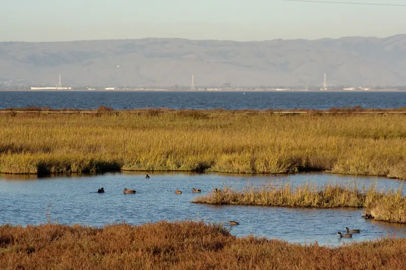
The other half of the flood system is at the bay. In 1955 a high tide trapped storm runoff from Matadero, Adobe and Barron creeks and the water backed up into Palo Alto. The Palo Alto Flood Basin was built in response. Valley Water says its tide gate structure dates from 1957. It holds the basin about 2 feet below sea level so it can soak up storm runoff, which has turned former salt marsh into mostly freshwater marsh.
Valley Water is now working on a seismic retrofit and rehabilitation of the aging gate. Its August 2025 fact sheet puts the structure half a mile northeast of the Byxbee Park parking lot on the Adobe Creek Loop Trail, says design was finished in May 2025 and shows construction in 2026 and 2027. The same sheet marked a temporary closure of a 0.8-mile segment of the loop trail, including a window from September 1 to October 15, 2026. A longer-term replacement gate is planned with the U.S. Army Corps of Engineers. Check Valley Water before you walk out to the gate.
Restoring the creek in Ventura
The most ambitious idea for the creek is to take out some of the concrete. In September 2020 the consulting firm WRA prepared a Matadero Creek Conceptual Alternative Analysis for the city as part of the North Ventura planning effort. It studied the reach between Park Boulevard and El Camino Real, next to Boulware Park and the 340 Portage Avenue site. The report describes a U-shaped concrete channel about 25 feet wide and 12 feet deep, maintained by Valley Water, that does not hold a 100-year flood with an adequate safety margin.
| Concept | Corridor width | Study finding |
|---|---|---|
| 1. Enhanced easement corridor | 60 feet | Likely infeasible, raises water upstream |
| 1A. Corridor plus Boulware Park | 60 feet plus park land | Feasible, lowers upstream water about half a foot |
| 2. Widened corridor, gentler banks | 85 feet | Likely infeasible on its own |
| 2A. Widened corridor plus Boulware Park | 85 feet plus park land | Feasible, lowers upstream water about half a foot |
| 3. Maximum renaturalization | 100 feet | Feasible, lowers upstream water by more |
The feasible options would extend a walking path from Boulware Park to Park Boulevard, passing under the Lambert Avenue bridge. The City Council adopted the North Ventura Coordinated Area Plan on August 5, 2024. The city lists the final WRA renaturalization report among its plan documents. We found no published design or construction schedule for the creek work, so treat it as a long-range goal for now.
Wildlife along the creek
For a creek that spends miles in concrete, Matadero supports a surprising cast. Great blue herons and egrets hunt in the channel. Gray foxes were documented near its mouth in 2006. In 2022 a pair of beavers turned up at the mouth in the flood basin and a young beaver appeared on a trail camera in 2023. Wikipedia's account traces them to beavers moved to upper Los Gatos Creek in the 1980s, which spread down the Guadalupe River and along the bay.
Steelhead once ran up the creek. State fish and game records describe steelhead caught at the confluence with Adobe Creek in 1985 through 1987 and at least six fish passing the tide gates in April 1987. The 2025 environmental DNA survey found no trace of them, which suggests the tide gate and the long concrete channel now block the run. Our birdwatching guide covers the best spots for herons and shorebirds in the Baylands.
Where to see Matadero Creek
- Bol Park, 3590 Laguna Avenue. The best natural reach. Park on nearby residential streets and walk the path. Bikes are welcome on the paved path.
- The Bol Park bike path. The paved path runs about 1.25 miles from Hanover Street to Miranda Avenue and Arastradero Road, with the creek beside it through the park. The flood culvert runs beneath part of the route.
- El Camino Real. Look down from the sidewalk at the Creekside Inn to see where the natural creek gives way to concrete.
- The Baylands. The Adobe Creek Loop Trail passes the creek's mouth and the tide gate. See our Baylands guide and the companion page on Adobe Creek.
Rules and safety
Good to know
- Stay out of the channel. The concrete reaches are fenced flood control property. Water rises fast and the walls are slick.
- Dogs. Palo Alto requires dogs on a leash in parks and open space outside fenced dog parks. In the Baylands the leash can be no longer than 6 feet.
- Ticks and poison oak. Both grow in the creekside brush. The city's tick checklist suggests repellent, long pants tucked into socks, staying in the middle of trails and a shower and tick check within two hours of getting home. Midpen notes that poison oak oil stays potent on bare winter stems.
- Mountain lions. They live in the foothills that feed the creek. Midpen's advice applies anywhere: do not run, keep children close, face the animal and make yourself look big.
Frequently asked questions
Where does Matadero Creek start and end?
It begins in the foothills of Los Altos Hills at about 640 feet, just north of Altamont Road. It flows northeast for about 8 miles through Stanford lands, Barron Park and south Palo Alto, then enters the Palo Alto Flood Basin. There it joins Adobe Creek at the north end of Mayfield Slough before draining to the bay through a tide gate.
Does Matadero Creek have water all year?
Wikipedia's account, based on local monitoring, describes the creek as perennial in Bol Park and upstream. Below El Camino Real it runs in a concrete channel that carries little water in a dry summer. After winter storms the whole creek can rise quickly.
Is Palo Alto going to remove the concrete from Matadero Creek?
Not yet. A 2020 study for the city looked at five ways to widen and renaturalize the concrete channel between El Camino Real and Park Boulevard. The City Council adopted the North Ventura Coordinated Area Plan on August 5, 2024. The city lists the study among its plan documents. We found no published construction schedule.
Are there beavers in Matadero Creek?
Yes. A pair of North American beavers was documented at the mouth of the creek in the Palo Alto Flood Basin in 2022 and a young beaver was caught on a trail camera in 2023. They are thought to descend from beavers released in the Los Gatos Creek watershed in the 1980s.
Can I walk along Matadero Creek?
Not along its whole length. The best public spots are Bol Park and its bike path in Barron Park and the Adobe Creek Loop Trail in the Baylands, which passes the creek's mouth. The concrete channels in town are fenced flood control property and are off limits.