On this page
Palo Alto gets about 15 inches of rain in an average year and most of it falls between November and March. That total hides how lumpy the season is. A dry December can be followed by a week in which storm after storm rolls in from the Pacific, the creeks rise fast and the city opens its sandbag stations around the clock. Our weather guide covers the monthly averages. This page is about what to do when the rain actually arrives.
The advice here comes from the city's flood and winter storm pages, its Storm Update page, the creek monitor and guidance from Valley Water, the county flood control agency. Phone numbers and locations were read from those pages in late October 2026. For the bigger picture of hazards in town, read our emergency preparedness guide.
What storm season looks like
Winter storms here tend to come in waves. A front brings a day or two of steady rain and gusty wind, then the sky clears and the hills turn green. The storms that cause trouble are the long, wet ones. Forecasters often call them atmospheric rivers: narrow bands of moist air that stream in from the tropical Pacific and can sit over the Bay Area for a day or more. When one stalls over the Santa Cruz Mountains, the creeks that drain those hills carry the water straight through Palo Alto to the bay.
The city's storm season notice, published October 26, 2026, said a strong El Niño was forecast for the coming winter and that the city was preparing on that basis. El Niño winters do not guarantee floods, but they raise the odds of heavy rain. Treat the forecast as a reason to get ready in October, not as a promise of a wet year.
Which areas flood
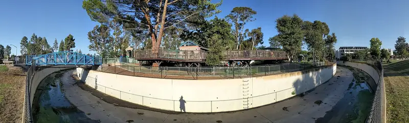
The main flood risk comes from San Francisquito Creek along the city's northern border with Menlo Park and East Palo Alto. It overflowed at the Pope-Chaucer Street Bridge in February 1998 and again on December 31, 2022. Our Crescent Park guide covers that history. The city also lists the bay and three south Palo Alto creeks as flood sources: Matadero, Adobe and Barron. Our guides to Matadero Creek and Adobe Creek describe where they run.
Reading the creek monitor
The city runs a creek monitor and camera page that is worth bookmarking before the first big storm. It shows water depth at four points and live images from two cameras on San Francisquito Creek, one at the Pope-Chaucer Bridge and one at West Bayshore Road.
For each monitoring point the page lists the depth at which the channel is about half full and about 70 percent full. These are the figures the city published:
| Location | 50 percent capacity | 70 percent capacity |
|---|---|---|
| San Francisquito Creek at Waverley Street | 16 feet | 20 feet |
| San Francisquito Creek at Chaucer Street | 13.2 feet | 17.9 feet |
| Matadero Creek at West Bayshore Road | 7.6 feet | 10 feet |
| Adobe Creek at East Meadow Drive | 6.4 feet | 8.7 feet |
The number at the top of each graphic is roughly the depth at which water starts to spill. The city adds two cautions. Floodwalls and levees mean a creek can rise several feet above the bottom of a bridge before it overtops, so a high reading is not always dangerous. Flooding can also happen while the readings still look safe. The page says plainly that if you see an unsafe condition, you should not wait to be told to act. It also notes that monitoring runs when conditions warrant and staffing permits.
Other gauges
The same page links to rain and stream gauges run by the San Francisquito Creek Joint Powers Authority, Valley Water's real-time ALERT system, a USGS stream gauge on San Francisquito Creek, tide predictions for the Palo Alto Yacht Harbor and river forecasts from the California Nevada River Forecast Center. High tides matter because creeks drain more slowly into a full bay.
Flood stages and alerts
During storms the city's Storm Update page uses four stages tied to creek flow. Knowing them helps you read the city's messages.
- Monitoring. Flood risk is low and staff are watching creek levels.
- Flood Watch. Risk is low to moderate. Prepare your property.
- Flood Warning. Flooding is very likely soon. Be ready to evacuate. The page ties this stage to a flow of 4,900 cubic feet per second.
- Voluntary Evacuation. Flooding is imminent or happening. Consider leaving. The page ties this stage to 5,400 cubic feet per second.
The fastest way to hear about evacuations is AlertSCC, the county's free alert system. Our police, fire and emergency alerts guide explains how to sign up. The city also posts on its social media accounts. Its flood page names KCBS (740 AM and 106.9 FM) and KZSU (90.1 FM) as radio sources. A recorded public information line runs at (650) 329-2420 during emergencies.

Sandbags
The city stocks sand and bags from November through March. For the 2026 to 2027 season the Storm Update page said the stations would be ready by November 1 and listed four locations:
- Rinconada tennis courts, at the corner of Newell Road and Hopkins Avenue
- Mitchell Park, 600 East Meadow Drive
- Palo Alto Airport terminal, 1925 Embarcadero Road
- Johnson Park, at Waverley Street and Everett Avenue
Staff restock the stations as needed. The city's advice is to fill each bag only about a third of the way. Overfilled bags are heavy, hard to stack and leave gaps. The city also posts a flyer on how to fill and place sandbags. Neighboring cities run their own stations, including East Palo Alto's maintenance yard on Tara Street and several Menlo Park sites, according to the city's sandbag map.
Sandbags slow water. They do not stop it. The city suggests weather-resistant flood tape for small gaps around doors and garage edges and temporary flood barriers to steer shallow runoff away from entrances. Keep plastic sheeting, plywood and basic tools on hand if your house sits low.
Storm drains and leaves
Every storm drain in Palo Alto flows to a creek and then to the bay, with no treatment along the way. That has two consequences. Anything dumped into a drain ends up in the creek, which is why dumping is illegal. And a drain clogged with leaves sends water across the street and into driveways.
- Clear your inlet. Before and during storms, use a rake to pull leaves and branches off the drain grate near your house.
- Use the green cart. Leaves belong in your compost cart, not in the gutter. Raking or blowing leaves into the street violates the municipal code. Our street sweeping guide explains the leaf season schedule.
- Report problems. Call Public Works at (650) 496-6974 on weekdays from 7 a.m. to 4 p.m. for blocked drains, fallen trees, sinkholes, landslides or levee damage. After hours, call (650) 329-2413. You can also use the city's Palo Alto 311 app.
- Report dumping. The pollution hotline is (650) 329-2943. Valley Water's creek pollution line is (888) 510-5151.
Driving and walking in floods
Valley Water's flood safety page puts the risk in numbers. Six inches of moving water can knock an adult off their feet. About 12 inches of flowing water can carry off a small car and 18 to 24 inches can move a larger vehicle. Never walk or drive through a flooded road, however shallow it looks. Never drive around a barrier. Underpasses and low spots near the creeks are the usual trouble areas.
Storms also bring down tree limbs. Palo Alto has a large street tree canopy, which our urban forest guide describes. Winter winds on wet soil topple trees every year. Fallen trees and wires can cut power. Our power outages guide covers what to do when the lights go out. Stay at least as far from a downed wire as you would from a live one, because you cannot tell the difference.
Flood maps and insurance
Parts of Palo Alto are in a FEMA flood zone. Look up your address at the FEMA Flood Map Service Center before you buy or rent near a creek. The city can also provide flood map information, details about mandatory flood insurance and a map of flooding not shown on FEMA's maps, on request.
Standard homeowners and renters policies do not cover flood damage. Flood insurance comes from separate policies sold through agents. Valley Water notes that a new policy typically has a 30-day waiting period, so a policy bought during a storm will not help with that storm. Talk to a licensed agent about your situation.
Cold nights and warming locations
Storms are often followed by cold, clear nights. When Santa Clara County issues an Inclement Weather Alert for cold, the city opens overnight warming locations from 7 p.m. to 7 a.m. The Storm Update page names the El Camino Room at the Downtown Library and the Sycamore Room at the Bryant Street Community Center, 429 Bryant Street, as examples. Check the city's news page on the night itself, since sites can change.
Good to know
- Bookmark paloalto.gov/creekmonitor before the first big storm.
- Sandbag stations open by November 1. Fill bags about a third full.
- Rake leaves off your storm drain grate during rain and never into the street.
- Save (650) 329-2413 for flooding and (650) 496-6974 for blocked drains on weekdays.
- Buy flood insurance well before storms. New policies usually wait 30 days.
- Rainy weekend? See our rainy day ideas.
Frequently asked questions
Where can I get sandbags in Palo Alto?
The city's Storm Update page lists four stations for the 2026 to 2027 season: Rinconada tennis courts at Newell Road and Hopkins Avenue, Mitchell Park at 600 East Meadow Drive, the Palo Alto Airport terminal at 1925 Embarcadero Road and Johnson Park at Waverley and Everett. The city said they would be ready by November 1. Fill each bag only about a third full.
How do I check San Francisquito Creek levels?
Open the city's creek monitor at paloalto.gov/creekmonitor. It shows depth readings for San Francisquito Creek at Waverley Street and Chaucer Street, Matadero Creek at West Bayshore Road and Adobe Creek at East Meadow Drive. It also links to cameras at the Pope-Chaucer Bridge and West Bayshore Road.
Who do I call about a flooded street or blocked storm drain in Palo Alto?
Call Public Works at (650) 496-6974 on weekdays from 7 a.m. to 4 p.m. for blocked drains, fallen trees, sinkholes or levee damage. After hours and for flooding at any time, call the 24-hour dispatch line at (650) 329-2413. Call 911 only if lives are at risk.
Does homeowners insurance cover flood damage in Palo Alto?
No. The city and Valley Water both point out that regular homeowners policies do not cover flood damage. Flood insurance is sold separately through agents and FloodSmart.gov. Valley Water notes there is typically a 30-day wait before a new policy takes effect, so buy it before the storms.
Can I rake leaves into the street before a storm?
No. Placing leaves or other green waste in the street violates the municipal code and can clog storm drains. Put leaves in your green compost cart. During rain, rake leaves off the storm drain grate in front of your house so water can drain.