On this page
Most of the time Palo Alto is a calm place with mild weather. The risks are real, though. Two of California's most dangerous faults lie within easy driving distance. The foothills on the western edge of town are wildland that can burn. San Francisquito Creek along the northern border flooded about 1,700 properties in 1998. Winter storms and summer heat add to the list.
The city's Office of Emergency Services, known as OES, runs an all-hazards program and a large volunteer network. This page gathers what the city and state ask residents to do: what the main hazards are, how to get alerts, how to join neighborhood preparedness and what to keep in a kit. It is general information drawn from official sources. For a specific property, read the official maps linked below.
Earthquakes and nearby faults
Palo Alto sits between two of the Bay Area's main faults.
- San Andreas Fault. It runs along the length of the Peninsula a few miles west of the city, through the hills near Portola Valley and Woodside. Its 1906 rupture damaged Stanford heavily.
- Hayward Fault. It runs along the base of the East Bay hills on the far side of the bay. The last major Hayward earthquake struck in 1868.
Smaller faults run through the foothills closer to town. The 1989 Loma Prieta earthquake, centered in the Santa Cruz Mountains, also damaged buildings on the Stanford campus. In its long-term forecast, the U.S. Geological Survey put the chance of at least one magnitude 6.7 or larger earthquake in the San Francisco Bay region between 2014 and 2043 at 72 percent.
Shaking and soil
How hard the ground shakes depends partly on soil. The Palo Alto annex to the county's 2023 hazard mitigation plan says liquefaction potential is moderate to high starting near the center of the city and rising toward the bay. Homes on softer soils closer to the bay can shake harder than those on firmer ground. Securing heavy furniture and checking older houses for needed retrofits matter everywhere.
What the city asks you to do
The city's earthquake page says to plan on being isolated and on your own for at least three days and nights after a major quake, since emergency services may be delayed and power, water, gas and phone service may fail.
- Practice Drop, Cover and Hold On. The Great ShakeOut drill falls on the third Thursday of October each year.
- Install the state's MyShake app, which can send a warning seconds before shaking reaches you.
- Secure water heaters, bookcases and appliances to wall studs. Store heavy and breakable items low.
- Learn where your gas, water and electric shutoffs are, as the city's family planning page advises. If you smell gas, leave and call 911 or the city utility at (650) 329-2579.
Wildfire in the foothills
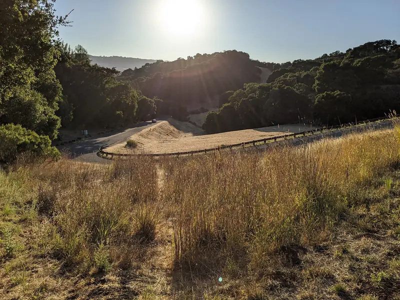
The western part of Palo Alto, mostly beyond Interstate 280, rises into the Santa Cruz Mountains. It includes the Palo Alto Hills neighborhood, the Foothills Nature Preserve and the Pearson-Arastradero Preserve. This is the city's wildland urban interface. The Palo Alto annex to the hazard mitigation plan counts 1,711 people, about 2.5 percent of residents, living within wildfire hazard areas.
The city's wildfire page follows CAL FIRE's Ready, Set, Go approach and says residents in the flatlands should prepare too, since smoke and embers travel. Key steps:
- Know your zone. Santa Clara County fire agencies use Genasys Protect for evacuation zones. Look up your address at protect.genasys.com and write your zone down.
- Know the terms. An Evacuation Order means leave now because there is an immediate threat. An Evacuation Warning means there is a potential threat and anyone who needs extra time, including people with pets or livestock, should go.
- Plan for power shutoffs. City of Palo Alto Utilities can turn off lines in fire-prone areas during extreme weather as a last resort. Our utilities guide explains Public Safety Power Shutoffs.
- Prepare the house. CAL FIRE's Ready for Wildfire site covers defensible space and home hardening.

Floods and San Francisquito Creek
The city's main flood risk is San Francisquito Creek, which forms the border with Menlo Park and East Palo Alto. On February 3, 1998, after days of heavy rain, the creek overflowed at the narrow Pope-Chaucer Street Bridge and flooded about 1,700 properties in the three cities. On December 31, 2022, water backed up at the same bridge and flooded the nearby neighborhood again. Our Crescent Park guide covers that history and the joint flood protection work along the creek.
Other sources of flooding are the bay itself and Matadero, Adobe and Barron creeks in south Palo Alto. The city's flood and winter storm page puts the risk period at November through March.
- Check your flood zone. Portions of Palo Alto are mapped by FEMA as flood hazard areas. Enter your address at the FEMA Flood Map Service Center. The city can also share flood map details and information about mandatory flood insurance.
- Think about insurance. Standard homeowners policies do not cover flood damage. FloodSmart.gov explains federal flood insurance. Talk to a licensed agent about your situation.
- Get sandbags. From November through March, sandbags are available at Palo Alto Airport, Mitchell Park, Rinconada Park and Johnson Park.
- Watch the creek. The city publishes a creek monitor with water levels and a camera during storms.
- Report dumping. Debris in storm drains and creeks makes flooding worse. The pollution hotline is (650) 329-2943.
Sea level rise is a longer-term concern for the low-lying land east of Highway 101. The hazard plan cites projections of 3 feet to more than 10 feet of rise in San Francisco Bay by 2100, depending on the scenario.
Getting alerts
The single most useful step takes two minutes. Sign up for AlertSCC, Santa Clara County's free emergency notification system. It sends texts, calls and emails about evacuations, shelter-in-place orders and other urgent events at the addresses you register. Add your home, your work and your children's schools.
- Leave Wireless Emergency Alerts turned on in your phone settings.
- Check that MyCPAU has your mobile number for power outage texts from the city utility.
- Check the city's Stay Informed page for its social media accounts and radio options.
- Know the non-emergency police and fire dispatch line, (650) 329-2413. Use 911 only for emergencies.
The Office of Emergency Services and its volunteers
OES works from the Public Safety Building at 250 Sherman Avenue near California Avenue. It plans for hazards, monitors threats and runs response equipment such as a mobile emergency operations center and a solar generator trailer. You can reach it at (650) 617-3197 or oes@paloalto.gov.
Much of the city's neighborhood-level plan depends on volunteers in the Emergency Services Volunteer program. You can join if you live or work in Palo Alto.
| Role | What it involves | Training |
|---|---|---|
| Block Preparedness Coordinator | Checks on neighbors after a disaster and reports critical problems up the chain. Builds a contact network on the block before anything happens. | Introductory class offered quarterly, with Neighborhood Watch training. An online option exists. |
| Neighborhood Preparedness Coordinator | Receives reports from block coordinators across a neighborhood. | Through the volunteer program. |
| Community Emergency Response Team (CERT) | Basic first aid, light search and rescue and disaster support. | About 24 hours in 7 sessions, offered spring and fall. |
| Auxiliary Communications Services | Amateur radio and other communications when phones fail. | Licensed and unlicensed volunteers both welcome. |
The Block Preparedness Coordinator class is free and open to the public. A June 24, 2026 session at the Public Safety Building ran from 6:30 to 9 p.m. Watch the city's events calendar for the next date or email esv@paloalto.gov. More ways to help are on our volunteering page.
Building a kit and a plan
National guidance often says three days of supplies. Palo Alto's preparedness page for families asks for more: enough supplies for 14 days for your household and pets. It suggests keeping supplies in three places.
- At home: 14 days of water, food, medications, first aid supplies, lights, batteries and sanitation supplies. The city links to printable supply lists and to FEMA's Ready.gov kit list.
- In the car: a smaller kit for when a disaster strikes during a commute.
- Under the bed: a pair of shoes, a whistle and a bottle of water.
The plan
- Pick an out-of-area contact and make sure everyone in the household has the number.
- Choose a place to reunite if you are separated.
- Learn your school or daycare's release policy and who is allowed to pick up children.
- Make two exits from each room part of your plan.
- Keep copies of insurance papers, IDs and medical records ready to take.
- Plan for infants, older adults, people with disabilities and pets. Our resources for older adults page lists local support.
Good to know
- Sign up for AlertSCC and add every address your family uses.
- Look up your Genasys Protect evacuation zone before fire season.
- Check the FEMA flood map before you buy or rent near a creek.
- Store 14 days of supplies, as the city recommends.
- Summer heat brings its own risks. See our weather guide for what to expect by season.
Frequently asked questions
What fault lines are near Palo Alto?
The San Andreas Fault runs along the Peninsula a few miles west of the city, through the hills near Portola Valley and Woodside. The Hayward Fault runs along the base of the East Bay hills across the bay. Both have produced large earthquakes and the USGS considers both capable of more.
How do I get emergency alerts in Palo Alto?
Sign up for AlertSCC, Santa Clara County's free emergency notification system, at alertscc.org. Keep Wireless Emergency Alerts turned on in your phone settings. Utility customers get power outage texts at the mobile numbers on their account and can manage them in MyCPAU.
Is my Palo Alto home in a flood zone?
Parts of Palo Alto are in a FEMA flood zone, mainly near San Francisquito Creek and the bay. Enter your address at the FEMA Flood Map Service Center to check. The city can also provide flood map information on request. Regular homeowners insurance does not cover flood damage.
Where can I get sandbags in Palo Alto?
From November through March the city stocks sandbags at Palo Alto Airport, Mitchell Park, Rinconada Park and Johnson Park. The city's flood preparedness page has a location map and instructions for filling and placing them.
What is a Block Preparedness Coordinator?
A Block Preparedness Coordinator is a resident volunteer who checks on neighbors after a disaster and reports serious problems to a Neighborhood Preparedness Coordinator. The city's Office of Emergency Services offers a free introductory class that includes Neighborhood Watch training.