On this page
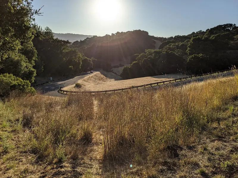
Palo Alto Hills feels like a different city from the flat grid below. It sits in the foothills of the Santa Cruz Mountains, west of Interstate 280, at the end of long winding roads. Houses stand on large, uneven lots with views across the bay. Open space preserves surround it. The nearest grocery store is several miles away.
It is also one of the smallest neighborhoods in Palo Alto and one of the most exposed to wildfire. This guide covers where it is, how it developed around its golf club, the homes, the preserves nearby, wildfire and road safety, schools and what living here is like.
Where Palo Alto Hills is
Palo Alto's city limits extend well beyond the valley floor into the foothills. Most of that land is open space, including Foothills Nature Preserve and Pearson-Arastradero Preserve. Palo Alto Hills is the residential pocket within it, reached from Page Mill Road west of I-280.
There is no official boundary. Palo Alto Weekly's 2012 neighborhood guide placed the neighborhood off Page Mill Road and listed Alexis Drive, Country Club Court, Bandera Drive and Laurel Glen Drive as its streets. It counted 78 households at the time. The Palo Alto Hills Golf and Country Club at 3000 Alexis Drive sits at its center. To get there, take Page Mill Road west from I-280 for about 1.5 miles and turn right on Alexis Drive at the large Palo Alto Hills sign, according to the club.
Neighboring jurisdictions are close. The city's own descriptions of Page Mill, Arastradero and Los Trancos roads mention borders with Los Altos Hills and Portola Valley. Some nearby hillside addresses are in those towns or in unincorporated Santa Clara County, so check the city limit for any specific property.
The country club and the neighborhood
The neighborhood grew up with its golf club. According to the club's history, Palo Alto Hills Golf and Country Club was incorporated on August 22, 1958. It began on 145 acres of leased land. A nine-hole course opened on May 1, 1960. The course grew to 18 holes in 1961.
In 1962 the club converted its lease into a purchase on a 30-year note. It made the final payment in May 1990 and describes itself as the first club in the Bay Area to own its land. A major course renovation and clubhouse expansion were completed in 1996. Its website says the course was renovated again in 2022. The club is private, with a pool, tennis, dining and event spaces for members.
Residents have long treated the club as more than a golf course. Palo Alto Weekly reported in 2012 that it was the neighborhood's focal point and the place residents planned to gather in an emergency. The Palo Alto Hills Neighborhood Association organizes neighbors and has held an annual holiday get-together.
Homes and lots
Homes in Palo Alto Hills are custom single-family houses on large hillside lots, many with views over the valley and the bay. Lots vary widely in shape and slope. Some back onto open space or the golf course.
Sales are rare because the neighborhood is so small. Palo Alto Weekly recorded two sales in 2011. Because each property is so different, prices are hard to compare. We do not quote figures here. Our Palo Alto real estate guide explains how the wider market works.
Foothills Nature Preserve and nearby trails
Open space is the neighborhood's biggest asset. Foothills Nature Preserve at 3300 Page Mill Road covers about 1,400 acres of oak woodland, chaparral and grassy ridges. For about half a century it was open only to Palo Alto residents and their guests. It opened to the public on December 17, 2020. The city charges a vehicle fee and caps how many people can be inside at once.
Pearson-Arastradero Preserve borders the golf club, with about 10 miles of trails shared by hikers, bikes and horses. The small Esther Clark Nature Preserve lies lower down off Arastradero Road. Our hiking guide covers longer routes in the Midpeninsula Regional Open Space District preserves further up the ridge.

Wildlife is part of daily life. Residents interviewed by Palo Alto Weekly mentioned bobcats, coyotes, jackrabbits, rodents and rattlesnakes. Keep small pets indoors at night, fence vegetable gardens and watch where you step on summer trails.
Wildfire, roads and evacuation
Wildfire is the most serious risk in the Palo Alto foothills. When CAL FIRE released new fire hazard severity zone maps for Palo Alto at the end of February 2025, the city said most of Palo Alto west of Foothill Expressway was designated moderate while the Palo Alto Hills were designated high or very high. The city expected to adopt the designations by ordinance in 2025. Designations can affect building codes, inspections and weed abatement rules.
The roads matter as much as the maps. Page Mill Road, Arastradero Road and Los Trancos Road are the evacuation routes for this part of the foothills. Each spring the Santa Clara County Fire Safe Council and the city clear vegetation along them. The 2026 work ran from May 18 to June 12 and covered about 5 miles of Page Mill Road from the Los Altos Hills boundary to past the Montebello Open Space Preserve parking lot, about 1.8 miles of Arastradero Road and about 0.7 miles of Los Trancos Road. The city also uses wildfire cameras and sensors on Foothills Park, Black Mountain and nearby ridges.
Good to know
- Know your evacuation zone and sign up for AlertSCC, Santa Clara County's emergency alert system.
- Keep defensible space around homes and check the city's wildfire preparedness updates for local rules.
- Expect single-lane closures during vegetation work in late spring and early summer.
- Home insurance in wildfire-prone parts of California has become harder to get. Shop early if you plan to buy.
Page Mill Road is also one of the most popular road cycling climbs in the region. It is steep, narrow and full of blind curves. Drivers should expect cyclists on weekend mornings and pass only where it is safe. Our biking guide covers the foothill routes from the rider's side.
Schools
Palo Alto Hills is in the Palo Alto Unified School District. Palo Alto Weekly's 2012 guide listed Nixon Elementary, Terman Middle School and Gunn High School. Terman was renamed Ellen Fletcher Middle School in 2018. All three campuses are a drive down the hill. Boundaries can change, so confirm any address with the PAUSD school finder. Our schools guide explains the district.
Shopping and errands
There are no stores in the neighborhood. Palo Alto Weekly's 2012 guide put the nearest grocery store almost 5 miles away and named El Camino Real, downtown Los Altos and California Avenue as the main shopping areas. Plan errands as round trips by car.
Getting around
A car is essential. There is no bus service on Page Mill Road above I-280. The nearest Caltrain station, California Avenue, is a long drive down the hill. I-280 is close, which makes commutes north toward San Francisco or south toward San Jose easy outside rush hours. Visitors without a car will find the area hard to reach. If you are flying in to visit family here, you can compare rental cars for the trip.
What living here is like
Residents value privacy, quiet, views and immediate access to some of the best open space on the Peninsula. Neighbors interviewed by Palo Alto Weekly also named the downsides: isolation, long drives for errands, wildlife and the work of maintaining large hillside lots. Fire season adds a layer of planning that residents of the flatlands rarely think about.
There are no hotels in Palo Alto Hills. Visiting relatives usually stay in town and drive up. You can compare hotels in Palo Alto or look for a house rental nearby. To compare the foothills with the rest of town, read our guide to Barron Park below the hills or the neighborhoods overview.
Frequently asked questions
Where is the Palo Alto Hills neighborhood?
It is in the foothills west of Interstate 280, reached from Page Mill Road. The Palo Alto Hills Golf and Country Club recommends taking Page Mill Road west from I-280 for about 1.5 miles and turning right on Alexis Drive at the Palo Alto Hills sign. Residential streets include Alexis Drive, Laurel Glen Drive, Bandera Drive and Country Club Court.
Is the Palo Alto Hills Golf and Country Club private?
Yes. It is a private membership club at 3000 Alexis Drive. It was incorporated in 1958, opened nine holes in 1960 and expanded to 18 holes in 1961. Its website says the course was renovated in 2022. The club also hosts weddings and private events.
Is Palo Alto Hills in a wildfire zone?
Yes. When CAL FIRE released new fire hazard severity zone maps for Palo Alto in February 2025, the city said the Palo Alto Hills were designated high or very high. Residents should know their evacuation zone, keep defensible space and sign up for county emergency alerts.
Which schools serve Palo Alto Hills?
Palo Alto Weekly's 2012 neighborhood guide listed Nixon Elementary, Terman Middle School and Gunn High School. Terman is now Ellen Fletcher Middle School. Boundaries can change, so confirm any address with the Palo Alto Unified School District school finder.
Can you walk from Palo Alto Hills to Foothills Nature Preserve?
The preserve's entrance is on Page Mill Road at 3300 Page Mill, a short drive up the road. It has been open to the public since December 2020, with a vehicle fee and a cap on visitors. Walking along Page Mill Road is not recommended because it has narrow shoulders and blind curves.