On this page
The Stevens Creek Trail is Mountain View's backbone for walking and cycling. It follows Stevens Creek from the marshes at Shoreline south through the city, with bridges and underpasses at every major road. You can ride from the bay to the edge of Sunnyvale without waiting at a single traffic light on a busy street. For Palo Alto residents it is the easiest way to link the Bay Trail with downtown Mountain View and the neighborhoods to the south.
This guide covers the trail's route and segments, where to get on, how long it is according to the people who track it most closely and what is planned. For the bay end, see our Shoreline Park guide.
How long it is
The Mountain View section runs about five miles. A June 2026 Mountain View Voice report described the existing path as roughly five miles long, from Shoreline Park to Heatherstone Way and Dale Avenue. The volunteer Friends of Stevens Creek Trail give a slightly more precise figure of 4.8 miles. Either way, a round trip from end to end is about ten miles, an easy hour on a bike or a long morning on foot.
The bigger vision is far longer. Advocates have long planned a continuous trail of about 27 miles from the headwaters of Stevens Creek in the Santa Cruz Mountains to San Francisco Bay. Today it exists as separate pieces, mainly the Mountain View section and a shorter one in Cupertino. Building the gaps has taken decades and much of the route is still only on paper.
The route, north to south
The bay end: Shoreline to Highway 101
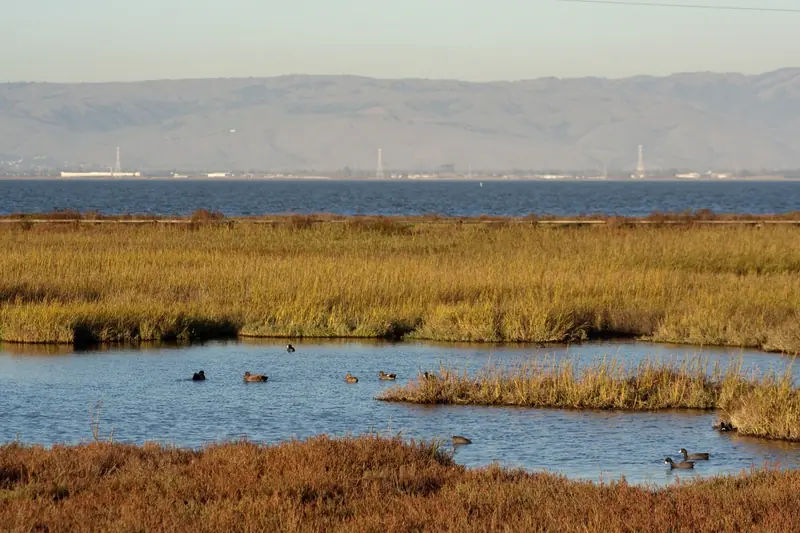
The trail begins in the tidal marsh on the east side of Shoreline at Mountain View, where it meets the San Francisco Bay Trail. This is the most open stretch, with wide views of the bay, the marsh and the hangars at Moffett Field. It is also the windiest. Access points include Shoreline Park itself, Crittenden Lane and La Avenida. The trail then ducks under Highway 101.
The middle: Highway 101 to Central Expressway
South of the freeway the trail passes Whisman Park, where a bridge connects to the park and to the Hetch Hetchy Trail. It climbs over Moffett Boulevard on a pedestrian overcrossing dedicated in June 2009, then runs under Middlefield Road and past Creekside Park and the Central Avenue entrance.
The station crossing
Next comes the trail's most impressive structure: a pedestrian bridge of about 1,100 feet that carries the path over Evelyn Avenue, Central Expressway, the Caltrain tracks and VTA light rail. It lands close to the Mountain View station, which makes the trail useful for commuters as well as weekend riders. Downtown and Castro Street are a few minutes away.
The southern neighborhoods: Dana Street to Dale Avenue
The trail continues past Landels Park and Edith Landels School near Dana Street, crosses over Highway 237 and a Highway 85 ramp. Then it reaches the Yuba Drive entrance. It passes under El Camino Real in a tunnel. The stretch from El Camino Real to Sleeper Avenue, about three quarters of a mile, opened in June 2009. The final section, from Sleeper Avenue over Highway 85 to Dale Avenue and Heatherstone Way, opened in June 2012. This southern end runs beside Highway 85 and is noisier than the rest.
Access points at a glance
These entrances come from trail maps and the Friends group's records. Parking is mostly on residential streets, so be considerate of neighbors.
| Access point | Area | Notes |
|---|---|---|
| Shoreline at Mountain View | Bay end | Connects to the Bay Trail; park inside Shoreline |
| Crittenden Lane and La Avenida | North Bayshore | Trailheads near offices, busy on weekdays |
| Whisman Park | North of Middlefield | Bridge to the park and the Hetch Hetchy Trail |
| Moffett Boulevard | North of Middlefield | Pedestrian overcrossing |
| Central Avenue and Creekside Park | Near downtown | Neighborhood entrances with creek bridges |
| Evelyn Avenue bridge | Transit center | Closest entrance to Caltrain and light rail |
| Landels Park, Dana Street | South of downtown | School lot not open to the public on school days; use street parking |
| Yuba Drive | South of downtown | Street parking, bike rack and drinking fountain |
| El Camino Real | Midtown | Tunnel under El Camino; VTA buses nearby |
| Sleeper Avenue | Near Cuesta Park | Street parking or park at Cuesta Park |
| Dale Avenue and Heatherstone Way | South end | Bridge over Highway 85; street parking only |

Getting there from Palo Alto
- By bike along the bay. Ride the Bay Trail from the Palo Alto Baylands past Shoreline Park to the Stevens Creek junction. Our Bay Trail guide describes the route.
- By train. Take Caltrain to Mountain View and join the trail at the Evelyn Avenue bridge near the station. Our Caltrain guide covers bikes on board.
- By car. Drive to Shoreline for the northern half or to the Sleeper Avenue area and Cuesta Park for the southern half.
A good loop for cyclists is Palo Alto to Shoreline on the Bay Trail, south on the Stevens Creek Trail to downtown Mountain View for lunch, then back to Palo Alto on surface streets or by train. Our biking guide covers the Palo Alto side.
What is planned next
The southern end has stopped at Dale Avenue since 2012. A Mountain View Voice report from June 2026 says the City Council voted 6 to 0 to start preliminary design on a roughly 0.8-mile extension. It would run from the current end to West Remington Drive in Sunnyvale and connect to Mountain View and Alta Vista high schools. The preliminary design and environmental phase is expected to take about two and a half years and cost about $6 million, funded in part by a VTA grant, the city's park land fund and Sunnyvale. A final design comes after that, so construction is still years away.
The city also plans to study an east-west bridge for people on foot and bikes over Highway 85 to link the trail to the two high schools. Mountain View and Sunnyvale have worked on this piece for more than ten years, slowed by funding and staffing. A board member of the Friends group described the full trail as "just over halfway done" after 30 years.
The Cupertino section
A separate piece of the Stevens Creek Trail runs in Cupertino, near the creek's upper reaches. It links Blackberry Farm and McClellan Ranch and continues past Deep Cliff Golf Course to Linda Vista Park. Parking is available at Blackberry Farm and at McClellan Ranch. The Linda Vista end has steep grades. It is a pleasant short walk if you are already visiting Rancho San Antonio, which is not far away, but it does not connect to the Mountain View section.
Trail etiquette and tips
- Share the path. Walkers, runners, kids on scooters and commuters on bikes all use it. Ring a bell or call out before passing.
- Watch the bridges. Several bridges and overcrossings have short climbs and blind curves. Slow down.
- Expect commuters. Weekday mornings and evenings bring bike commuters to North Bayshore offices.
- Check closures. Sections occasionally close for creek work or maintenance. Mountain View's parks department posts closures.
- Look for birds. The marsh at the bay end is good for shorebirds and egrets. See our birdwatching guide.
Runners will find it one of the best routes in the area, with mile after mile of car-free pavement. Our running routes guide lists it with Palo Alto options. If you would rather ride with a guide, you can browse Bay Area bike tours.
Good to know
- The Mountain View section is about five miles, from Shoreline to Dale Avenue and Heatherstone Way.
- There is no big trailhead lot. Park on side streets, at Cuesta Park or inside Shoreline.
- The Evelyn Avenue bridge puts the trail a few minutes from the Mountain View Caltrain station.
- The Cupertino section is separate and does not connect.
Frequently asked questions
How long is the Stevens Creek Trail?
The Mountain View section runs about five miles from Shoreline Park on the bay to Dale Avenue and Heatherstone Way near Highway 85. The Friends of Stevens Creek Trail put it at 4.8 miles. Cupertino has a separate shorter section near Blackberry Farm and McClellan Ranch.
Where does the Stevens Creek Trail start and end?
In Mountain View it starts at Shoreline at Mountain View, where it meets the San Francisco Bay Trail. It ends for now at Dale Avenue and Heatherstone Way, just across a bridge over Highway 85, on the edge of Sunnyvale.
Where can I park for the Stevens Creek Trail?
There is no large dedicated lot in Mountain View. Visitors park on side streets near access points such as Yuba Drive and Sleeper Avenue, at Cuesta Park near the southern end or inside Shoreline Park at the northern end. Always follow posted signs.
Can I reach the Stevens Creek Trail by train?
Yes. The trail crosses Evelyn Avenue, Central Expressway and the rail lines on a long pedestrian bridge close to the Mountain View Caltrain and light rail station. From Palo Alto, take Caltrain to Mountain View and walk or ride a few minutes to the trail.
Will the Stevens Creek Trail be extended?
Yes, slowly. In 2026 Mountain View's council voted to start preliminary design on a roughly 0.8-mile extension from the current southern end toward West Remington Drive in Sunnyvale, near Mountain View and Alta Vista high schools. Design and environmental work is expected to take about two and a half years before construction can be scheduled.