On this page
Palo Alto is a running town. Early on a weekday you will see packs of runners on the Dish, solo runners on the Bryant Street bike boulevard and people logging flat miles on the Baylands levees. The weather helps. Rain falls mostly between November and March, summer mornings are cool and the city has very few days when it is too cold to run.
This page groups the best routes by type: the big hill loop at Stanford, the flat shoreline, quiet streets, the campus and the dirt trails in the foothills. We give distances only where an official source publishes them. For everything else, use your watch and enjoy the freedom of making your own loop.
Routes at a glance
| Route | Surface | Terrain | Best for |
|---|---|---|---|
| Stanford Dish loop | Paved | Steep rollers | Hill workouts and views |
| Baylands levees and Bay Trail | Gravel and paved | Flat | Long easy runs and tempo runs |
| Bryant Street | Street and sidewalk | Flat | Out-and-back runs from downtown |
| Stanford campus | Paved paths and roads | Flat to gentle | Easy loops with something to look at |
| Bol Park path | Paved | Gentle grade | Linking Barron Park to Arastradero |
| Pearson-Arastradero | Dirt | Rolling hills | Beginner trail running |
| Foothills Nature Preserve | Dirt | Steep | Long trail runs with climbing |
The Stanford Dish
The Dish loop is the default hill run in Palo Alto. It follows paved service roads through Stanford's foothills around a 150-foot radio telescope. The main loop is about 3.5 to 3.7 miles, depending on where you start. The high point is about 526 feet above sea level and the climbs come in short, steep pitches rather than one long grind.
Runners usually start at the Stanford Avenue gate on Junipero Serra Boulevard. The first stretch climbs quickly, so start easier than you think. There is almost no shade, which makes summer afternoons tough. Stanford sets the hours by month, closes the area around sunset and does not allow dogs or bikes. The road is shared with a lot of walkers, so run single file on busy weekend mornings and pass with a word of warning.
A good workout is two laps, or one lap with hill repeats on the steepest section. Our full Dish guide covers the gates, hours and parking.
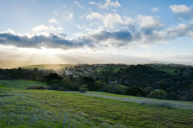

The Baylands and the Bay Trail
For flat miles nothing beats the shoreline. The Baylands Nature Preserve has about 15 miles of multi-use trails on levees around sloughs, ponds and marsh. Most of the surface is packed gravel, which is easier on the legs than pavement. The preserve is open from 8 a.m. to sunset and parking is free.
The regional Bay Trail runs through the preserve. Head south and you can follow the shore past Byxbee Park toward Shoreline Park in Mountain View. Head north and you can continue toward East Palo Alto and Menlo Park. Because you can turn around anywhere, it is the best place in town for a long run of any length. The Adobe Creek Loop on the south side of the preserve is a popular closed loop if you prefer not to run out and back.
Two things to plan for. First, wind. It usually builds after noon and blows hard from the bay, so a run that feels easy going out can be a slog coming back. Run into the wind first if you can. Second, shade. There is almost none, so carry water on warm days.
Bryant Street and the flat neighborhoods
Bryant Street is the spine of the city's bike network. It is officially the Ellen Fletcher Bicycle Boulevard, named for a former council member and bike advocate. Traffic diverters keep cars light, which makes it pleasant for runners too. Most runners use the sidewalks, which are shaded by big street trees for long stretches.
A classic route starts downtown and heads south through Professorville, past the old houses on Bryant and Ramona, then continues through Old Palo Alto toward Midtown. Turn around wherever you like. The streets are flat, the corners are frequent and the sights change every block, which makes the miles pass quickly.
Watch the big crossings. Embarcadero Road and Oregon Expressway carry heavy traffic, so cross at the signals. If you head toward Alma Street, remember that some Caltrain crossings in Palo Alto are at street level. Never cross when the gates are down.
Stanford campus loops
The Stanford campus is mostly flat and full of paths. A simple run goes up Palm Drive, around the Oval in front of the Main Quad and out past the Arizona Cactus Garden and the Cantor Arts Center. Campus Drive circles the core of the university and gives a longer loop with bike lanes and sidewalks.
Stanford also lists the Perimeter Trail and the Matadero Deer Creek Trail as walking and running routes near the Dish. Distances vary by start point, so use the university's maps or a GPS watch rather than trusting a number you read online. Be alert between class periods, when bikes flood the paths. Our self-guided campus walk doubles as a good easy-run route if you want to see the landmarks.
Trail running in the foothills
Pearson-Arastradero Preserve
Arastradero is the friendliest trail running in town. Its 622 acres hold about 10 miles of dirt trail between about 275 and 775 feet. The city's trail map lists the Redtail Loop at about 1.5 miles with a steep climb and the Arastradero Creek Trail at about 1.4 miles in the shade. Link several trails together for a longer run. Bikes and horses share the trails, so stay alert on blind corners. The preserve is open 8 a.m. to sunset and some trails close after heavy rain.
Getting there on foot
From Barron Park, the paved Bol Park path runs about 1.25 miles on an old rail line from Hanover Street to Arastradero Road near Gunn High School. It is the easiest car-free way to reach the preserve. See our Bol Park guide.
Foothills Nature Preserve
For steeper and longer runs, Foothills Nature Preserve has about 15 miles of trail, including the Los Trancos Trail through woods and ridges. Entry costs a daily vehicle fee and the city caps how many people can be inside, so the gate may close on busy weekends. Beyond the city, the Midpen preserves along Skyline Boulevard such as Russian Ridge and Windy Hill offer long ridge runs. Our hiking guide describes them.
Races and running groups
The big local race is the Moonlight Run and Walk, hosted by the City of Palo Alto and the Palo Alto Weekly. The 42nd edition ran on Friday, September 25, 2026, from the Baylands Athletic Center at 1900 Geng Road. It offers a 5K walk and run and a 10K run under the evening sky, with the first race at 7 p.m. The paper describes it as a benefit for local nonprofits that support kids and families. Check the city's event page for the next date.
Group runs come and go. A volunteer group called Palo Alto Run Club posts its meetups on social media. Schedules for informal groups change often, so check a group's latest posts for the current day and meeting spot rather than relying on an old listing.
Tips for running in Palo Alto
Good to know
- Gates close. The Dish and the city preserves close around sunset. Save evening runs for city streets.
- Heat. Summer afternoons inland can be hot while the bay stays cool. Run early in July and August.
- Wind. The shoreline is windiest in the afternoon, especially in spring and summer.
- Wildlife and hazards. Rattlesnakes, ticks and poison oak live in the foothills. Stay on marked trails.
- Dogs. Dogs are banned on the Dish. They are allowed on leash at Arastradero and the Baylands, except the Renzel Ponds trails.
Our weather guide shows the best months for running and our biking guide covers the same routes from the saddle if you want to cross-train.
Frequently asked questions
How long is the Stanford Dish run?
The main loop is about 3.5 to 3.7 miles on paved service roads, with a high point of about 526 feet. The climbs are short and steep and there is almost no shade. Stanford sets the hours by month and does not allow dogs or bikes.
Where can I run flat in Palo Alto?
The levee trails at the Baylands Nature Preserve and the Bay Trail are flat for miles, with gravel and paved stretches. Bryant Street is a quiet, mostly flat street route through the older neighborhoods. Expect wind along the bay in the afternoon.
Are there trail runs near Palo Alto?
Yes. Pearson-Arastradero Preserve has about 10 miles of dirt trails with rolling hills, open 8 a.m. to sunset. Foothills Nature Preserve has about 15 miles of steeper trails but charges a vehicle fee and caps visitors. Midpen preserves along Skyline Boulevard offer longer ridge runs.
What races are held in Palo Alto?
The best known is the Moonlight Run and Walk, hosted by the City of Palo Alto and the Palo Alto Weekly. The 42nd edition was on September 25, 2026, starting from the Baylands Athletic Center with a 5K walk and run and a 10K run.
Is it safe to run in Palo Alto at night?
Streets in the flat neighborhoods are generally well lit and busy with walkers in the evening. The preserves and the Dish close around sunset, so plan night runs on city streets. Wear lights or reflective gear and take care at railroad crossings.