On this page
Castro Street is downtown Mountain View. It starts at the train station on West Evelyn Avenue and runs south to El Camino Real, with restaurants, cafes, bars and small offices along almost every storefront. The first three blocks have been closed to cars since the summer of 2020. What began as an emergency fix for outdoor dining is now a pedestrian mall written into city law, with tables in the old traffic lanes and a painted walkway down the middle.
For anyone based in Palo Alto, Castro Street is the easiest night out in the next town over. The train drops you at the top of the street. This guide explains how the blocks are set up today, what is changing at the station, where the library and Pioneer Park fit in and how to plan a visit. Our Mountain View guide covers the rest of the city.
How the street is laid out
Think of Castro Street in three parts. At the north end is the Mountain View Transit Center, where Caltrain and VTA light rail meet. Next come the 100, 200 and 300 blocks, which form the pedestrian mall. South of California Street the street opens to traffic again and runs past the civic center and more shops toward El Camino Real.
The cross streets help you find your way. Heading south from the station you pass Villa Street, then Dana Street, then California Street. Those are the three segments the city's ordinance names:
- From the east leg of West Evelyn Avenue to Villa Street (the 100 block).
- From Villa Street to West Dana Street (the 200 block).
- From West Dana Street to California Street (the 300 block).
Parallel streets matter too. Bryant Street runs one block east and Hope Street one block west. Both carry cars and both have public parking. Villa and Dana streets also have restaurants and cafes of their own, so the dining district spreads a block or two beyond Castro itself.
The pedestrian mall as it works today
The closure started in June 2020, when the city pulled cars off the northern blocks so restaurants could seat diners outdoors. It proved popular enough to outlast the pandemic. On October 25, 2022 the City Council adopted an ordinance that made the 100, 200 and 300 blocks a pedestrian mall.
The setup is still interim. According to the city's long-term downtown page, bollards and railings close the blocks to vehicles and will stay in use while a permanent design is worked out. That permanent version will take several years of design, engagement with businesses and construction. In the meantime a few things define the experience:
- Dining in the street. Restaurants use the old parking lanes and flex zones for tables, many under umbrellas or canopies.
- A central walkway. In May 2025 the city painted a decorative "Ribbons" treatment on the central walkway of the 100, 200 and 300 blocks to add color and mark the path for people on foot.
- Cross traffic. Villa and Dana streets still cross the mall with cars, so look both ways at each corner.
- Bikes. Riders share the space with pedestrians and diners. Walking your bike through the busiest stretch at dinner time is the considerate choice.
Planned changes include combining the Villa and Dana crossings into a single central crossing with new pedestrian signals and turning the Castro and California intersection into a single-lane roundabout. The city has not published firm construction dates for either, so treat them as future projects.
The station end: Caltrain and light rail
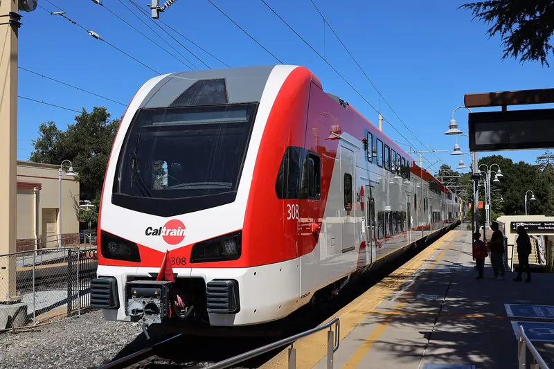
The Mountain View Transit Center sits at 600 West Evelyn Avenue, right where Castro Street meets the tracks. Caltrain stops here and VTA light rail begins its run toward Sunnyvale and San Jose. Buses and free local shuttles stop nearby. On Sundays the station's parking lot hosts the Mountain View farmers market.
What is changing at the crossing
Castro Street used to cross the Caltrain tracks and Central Expressway to reach Moffett Boulevard. Southbound cars have been blocked at the tracks since 2020. On February 10, 2026 the City Council voted 6 to 1 for a scaled-back design that dead-ends Castro Street at West Evelyn Avenue, which will block northbound cars as well. The San José Spotlight reported that design work should finish in fall 2026 and construction is slated to begin in spring 2027.
People on foot and on bikes keep their access. The approved plan moves the crossing to a single spot lined up with the east side of Moffett Boulevard, adds a separated southbound bike lane on Moffett toward Castro and improves the sidewalks between the station and downtown. West Evelyn Avenue will run straight across Castro and gain bike lanes between Wild Cherry Lane and Hope Street. A grade separation, with the street passing under or over the tracks, remains on the books but has no construction date. Check the city's project page for detours once work starts.

City Hall, the theater and Pioneer Park
Midway down the street, past the pedestrian mall, the civic center takes up a full block. City Hall and the Mountain View Center for the Performing Arts share a plaza that opened in 1991. TheatreWorks Silicon Valley stages productions in the center's theaters, as our theater guide explains. Touring and community shows fill other nights.
Behind the civic buildings lies Pioneer Park, a lawn shaded by large trees next to the library. It was the town's first cemetery before it became a park. Today it is the quiet spot downtown, where people eat takeout on the grass, read or wait for a show to start. A section of the Berlin Wall stands near the library on the park's edge.
The Mountain View Public Library
The Mountain View Public Library is at 585 Franklin Street, a short walk west of Castro through Pioneer Park. It has deep roots. According to the library's own history, a reading room opened on December 1, 1890 and the official public library began on April 14, 1905, above a general store. After stints in City Hall and a converted store on Dana Street, the library moved to 585 Franklin in 1958. The current building opened on October 25, 1997. A remodel that began in 2017 debuted in June 2018.
For visitors the library is a good indoor stop on a hot afternoon or a rainy day. Hours vary by day, so check the library's hours page before you go. Our guide to Palo Alto libraries covers the home city's branches if you are comparing.
Eating and drinking on Castro
Restaurants are the reason most people come. The street is known for its range of Asian food, including Chinese, Taiwanese, Japanese, Thai, Indian and Korean spots, alongside pizza, American plates, Mediterranean food and coffee. Dana Street and Villa Street add more choices a block off the main drag.
Turnover is high. Several long-running places have closed in recent years and new ones open every few months. Our separate guide to where to eat in Mountain View lists restaurants we confirmed on their own websites in October 2026, with neutral notes on what each serves.
Getting there from Palo Alto
By train
Caltrain is the simplest way. Mountain View is the third stop south of Palo Alto, after California Avenue and San Antonio. The ride takes about ten minutes. Both stations are in the same fare zone, so a one-zone fare applies. As of October 2026 that is $4.00. Caltrain fares rise on January 1, 2027. Not every train stops at every station. Our Caltrain guide covers schedules, Clipper and tap-to-pay.
By bike
Palo Alto's bike boulevards take you south toward the city line. The Stevens Creek Trail crosses Evelyn Avenue, Central Expressway and the rail lines on a long pedestrian bridge near the station, so riders coming from the bay or from the southern neighborhoods can reach downtown with few street crossings.
By car
Take El Camino Real south and turn north onto Castro, or use Central Expressway and come in on Evelyn Avenue. You cannot drive the length of Castro Street, so plan to park and walk. City lots line Hope Street and garages serve the downtown, including one at Bryant Street and West Evelyn Avenue. Posted time limits apply.
Planning a visit
- Evenings. Dinner hours are the busiest. Weekend nights in good weather bring crowds to the outdoor tables, so book ahead where restaurants take reservations.
- Sundays. Combine the morning farmers market at the station with lunch on Castro.
- Staying over. Mountain View has many more hotel rooms than Palo Alto. Our page on staying in Menlo Park or Mountain View covers the options and you can compare hotels near downtown Mountain View for your dates.
- Tech history. The Computer History Museum is a short drive north across Highway 101. Pair it with dinner on Castro.
If you like Palo Alto's own main street, our guide to downtown Palo Alto and University Avenue makes a good comparison. University Avenue still carries traffic, while Castro's busiest blocks belong to people on foot.
Good to know
- The pedestrian mall is the 100, 200 and 300 blocks only. Cars use Castro again south of California Street.
- Villa and Dana streets cross the mall with traffic. Watch the corners.
- Crossing work at the station is slated to start in spring 2027. Expect changes to walking routes from the platforms during construction.
- Restaurants open and close often here. Check a place's own website before you set out for it.
Frequently asked questions
Is Castro Street in Mountain View closed to cars?
The 100, 200 and 300 blocks are. They run from West Evelyn Avenue to California Street and have been closed to through traffic since 2020. The city made them a pedestrian mall by ordinance on October 25, 2022. South of California Street the street carries cars again.
Can you drive across the tracks at Castro Street?
Southbound drivers have been blocked at the tracks since 2020. In February 2026 the City Council approved a design that will dead-end Castro Street at West Evelyn Avenue for cars in both directions. Pedestrians and cyclists will still cross the tracks. Construction is slated to begin in spring 2027.
How do I get to Castro Street from Palo Alto?
Take Caltrain south to the Mountain View station, which sits at the north end of Castro Street. The ride takes about ten minutes and both stations are in the same fare zone. By bike, ride south on Palo Alto's bike boulevards or come in on the Stevens Creek Trail.
Where do I park for downtown Mountain View?
The city runs surface lots along Hope Street and parking garages downtown, including one at Bryant Street and West Evelyn Avenue. Time limits and rules are posted on each lot. On busy weekend evenings arriving by train is often easier than circling for a space.
What is Pioneer Park in Mountain View?
Pioneer Park is the green space behind City Hall, next to the public library on Franklin Street. It was once the town's first cemetery. Today it is a quiet lawn with trees and paths, handy for a break from the restaurant blocks.