On this page
In 1945 much of what is now south Palo Alto was still orchards, hayfields and county land. By 1970 the city ran from the bay shore to the crest of the Santa Cruz Mountains and held more than three times as many people as it had in 1940. Freeways cut along its edges, glass-walled tract houses filled its southern half and a research park on Stanford land was turning out the companies that would become Silicon Valley.
This page explains how that happened between the end of World War II and 1970. It focuses on land, houses, roads and schools. For the companies, see our Silicon Valley history.
The numbers
The census tells the story in one table. Palo Alto grew steadily before the war, exploded in the 1950s and then nearly stopped.
| Census year | Population | Change |
|---|---|---|
| 1940 | 16,774 | Up 22.9 percent |
| 1950 | 25,475 | Up 51.9 percent |
| 1960 | 52,287 | Up 105.2 percent |
| 1970 | 56,040 | Up 7.2 percent |
| 1980 | 55,225 | Down 1.5 percent |
Some of the jump came from annexing places where people already lived, so not every new resident moved into a new house. Still, the 1950s rank as the fastest decade in the city's history. For comparison, the 2020 census counted 68,572 people.
Why everyone came
Several forces arrived at once. Veterans who had passed through the Bay Area during the war came back with GI Bill benefits and young families. Federal money poured into electronics and defense research. Stanford under engineering dean Frederick Terman set out to capture it. Wallace Sterling became Stanford's president in 1949 and spent two decades building the university into a national power.
Palo Alto also had a reputation. By one account, in the mid-1950s more than a third of the men in the city held college degrees, at a time when only about 7 percent of American adults had finished four years of college. The city ran its own utilities and good schools. In 1950 it adopted the council and city manager system it still uses. For an educated young family, it was an easy sell.
Annexations: how the city got bigger
Palo Alto grew outward by annexing neighboring land, much of it then unincorporated county territory or Stanford property. The main steps:
- 1953: The area of the future Stanford Shopping Center.
- 1950s: Stanford Industrial Park, Embarcadero Road northeast of the Bayshore Highway and the West Bayshore and San Antonio Road area.
- December 29, 1954: A strip between El Camino Real and Alma Street that includes today's Ventura neighborhood.
- 1959 to 1968: Large tracts west of today's Foothill Expressway, mostly undeveloped hills. They include what became Foothills Park, opened on June 19, 1965, now the Foothills Nature Preserve.
- After 1970: Barron Park joined in 1975 after decades of debate. A large area of bay marsh followed in 1979.
Not every proposal for the hills went ahead. Council member Enid Pearson led a fight against a plan for about 550 homes on the steep land above Arastradero Road. A consultants' study argued that serving the houses would cost the city more than buying the land outright. Much of that hillside is now protected as the Pearson-Arastradero Preserve, which carries her name.
Eichler tracts and the new south side
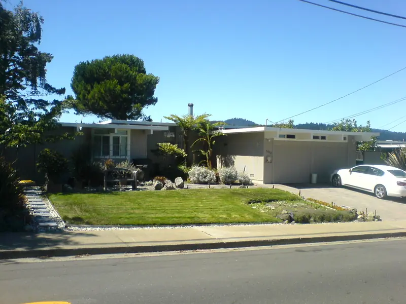
The southern half of the city filled with tract houses. The best known came from Joseph Eichler. His company built its first Palo Alto tract, University Gardens, in 1949 and 1950. Charleston Meadows, Green Gables and Greer Park followed in 1950 and 1951, with Fairmeadow's circular streets from 1951 to 1954 and Greenmeadow, designed by A. Quincy Jones and Frederick Emmons, in 1954 and 1955. The last Eichler house in the city went up on Guinda Street in 1975. The city counts about 2,700 Eichlers, often rounded to 3,000. Our page on Eichler homes has the full tract list.
Eichler stood out for another reason. Many Palo Alto neighborhoods had carried racial covenants since the 1920s. Federal lending rules steered money away from Black buyers. Eichler Homes sold to buyers regardless of race or religion. In 1958 Joseph Eichler resigned from the National Association of Home Builders over its discriminatory policies. Local groups such as the Palo Alto Fair Play Council also worked against housing discrimination in the 1950s. Many Black families were still pushed toward East Palo Alto, across the county line, a legacy that shapes housing debates today.
Other builders filled in around the Eichlers with ranch houses and small-lot homes. Greenmeadow, with its community center and pool, became a National Register historic district in 2005. Walk it with our Greenmeadow walking tour, or read about the wider area in our South Palo Alto guide.

Stanford Industrial Park and new shopping
Stanford had land but little cash after the war. The founding grant barred selling the farm, so Terman proposed leasing it. In 1951 the university and the city created Stanford Industrial Park off Page Mill Road, the first university research park in the world. Varian Associates moved into its first building in 1953. Hewlett-Packard leased land in 1956 and moved its headquarters there in 1960. By 1960 the park had about 40 tenants. It was renamed Stanford Research Park in the 1970s. Our page on Stanford Research Park covers it today.
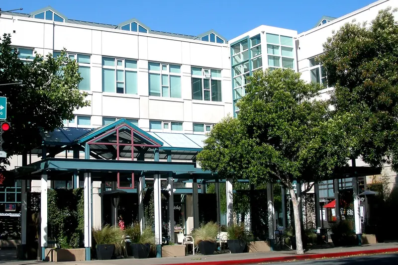
Shopping moved toward the car too. Town & Country Village opened on El Camino Real in 1953. The first store at Stanford Shopping Center opened in September 1955. Stanford's medical school moved from San Francisco to a new campus medical center in 1959, bringing thousands more jobs.

Freeways and expressways
More people and jobs meant more cars. The region rebuilt its roads around them:
- Bayshore Freeway: The old Bayshore Highway was a four-lane road with no median, nicknamed "Bloody Bayshore" for its crashes. A safety campaign that began in Palo Alto pushed the state to extend the six-lane freeway south. By one account it reached Palo Alto in June 1958. It was completed to San Jose in 1962.
- El Camino Real: The old highway filled with motels, car lots and drive-ins. Our El Camino Real history covers the strip.
- Oregon Expressway: Voters narrowly approved widening narrow, residential Oregon Avenue into a divided four-lane expressway on June 5, 1962. About 90 homes on the south side were moved or demolished. The old avenue survives as a frontage street on the north side.
- Foothill Expressway: Built in the mid-1960s, largely on the right of way of the Mayfield Cutoff rail line, whose passenger trains ended in early 1964.
- Interstate 280: Completed through the area in 1969. Page Mill Road was rerouted and widened over the hills. The old road became Old Page Mill Road.
Oregon Expressway also became a social line. Locals still split the city into north and south Palo Alto there, with older homes to the north and postwar tracts to the south.
Schools for the baby boom
The Palo Alto Unified School District struggled to keep up. Henry M. Gunn, superintendent from 1950 to 1961, oversaw an expansion from about 5,500 students to more than 14,000. New schools opened almost every year:
- 1953: Wilbur Junior High, today's Jane Lathrop Stanford Middle School.
- 1956: Cubberley High School on Middlefield Road.
- 1964: Gunn High School on land bought from Stanford, opening with about 600 students. See our Gunn High School page.
Enrollment peaked at 15,575 students in 1967, according to PAUSD's own history (Wikipedia gives 15,576). Then it fell fast. Terman Junior High closed in 1978, Cubberley High closed in 1979 and Jordan Middle School closed in 1985. District enrollment bottomed out at 7,452 in 1989 before climbing again. The closed campuses became community centers and later reopened schools, a cycle still visible at Cubberley today. Our school district history covers the full story.
The legacy
By 1970 the boom was over. Population barely grew in the 1970s. Residents had turned against new freeways, hillside subdivisions and filling the bay. The city bought or protected open space in the foothills and the Baylands. The tension between growth and preservation set in those years still drives Palo Alto politics. Today's debates over housing near El Camino Real and the train stations are, in many ways, the next chapter of the story that began in 1945.
Frequently asked questions
How fast did Palo Alto grow after World War II?
Very fast. The census counted 16,774 residents in 1940, 25,475 in 1950 and 52,287 in 1960, more than double in a decade. Growth slowed sharply after that, reaching 56,040 in 1970 and slipping to 55,225 in 1980.
When did Palo Alto annex its southern neighborhoods?
Much of the growth came through annexation. The Stanford Shopping Center area joined in 1953 and Ventura in December 1954. Land for the research park and areas east of Bayshore came in during the 1950s, the foothills between 1959 and 1968 and Barron Park in 1975.
When was Oregon Expressway built?
Palo Alto voters narrowly approved turning Oregon Avenue into a divided four-lane expressway on June 5, 1962. About 90 homes on the south side of the old avenue were moved or demolished. The county designated the route G3 the same year.
Why did Palo Alto close Cubberley High School?
Enrollment in the Palo Alto Unified School District peaked at 15,575 students in 1967, by the district's own count. It then fell sharply as the postwar baby boom aged out. Cubberley, which opened in 1956, closed in 1979. The campus is now the Cubberley Community Center.
How many Eichler homes are in Palo Alto?
The city counts about 2,700, a figure often rounded to 3,000. Joseph Eichler's company built its first Palo Alto tract, University Gardens, in 1949 and 1950. The last Eichler house in the city went up on Guinda Street in 1975.