On this page
Palo Alto faces the wrong way for an ocean sunset. The city sits on the bay side of the Peninsula with the Santa Cruz Mountains blocking the Pacific to the west. That turns out to be a gift. From the flat shoreline you watch the sun slide behind a long dark ridge while the marsh and the bay catch the color. Drive 25 minutes up the hill and you get the other show: the sun dropping toward the ocean, often over a sea of fog.
This guide covers five places to watch it happen: the Stanford Dish, Byxbee Park, the Baylands, Windy Hill and the preserves along Skyline Boulevard. The catch at every one of them is closing time. Each park sets its own, gates really do lock and a beautiful sunset is a poor excuse at a closed gate. We list the hours each park publishes, as of late October 2026.
The five spots at a glance
| Spot | What you see | Closing time as published | Dogs |
|---|---|---|---|
| Stanford Dish | Sun behind the foothills, campus and bay below | Fixed by month; 5 p.m. in November and December | No |
| Byxbee Park | Sun behind the ridge, marsh in front | Sunset; lot gate at posted time | On leash |
| Baylands boardwalk and levees | Color on water and mudflats | Sunset; gates at posted times | On leash, not on Renzel Ponds trails |
| Windy Hill | Bay to the east, Pacific to the west | Half an hour after sunset | Some trails, on leash |
| Russian Ridge and Skyline | Ocean, fog and ridgelines | Half an hour after sunset | No |
The Stanford Dish
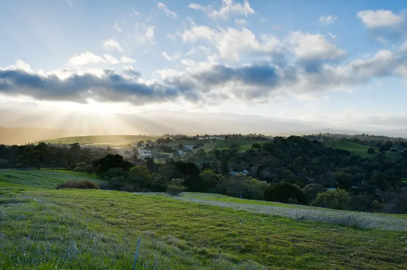
The Dish is the town's favorite late-afternoon walk. The paved loop climbs through Stanford's foothills around the big radio telescope, with the campus, the bay and the East Bay hills spread out below. Look west and the sun sinks behind the Santa Cruz Mountains. The grass glows gold in summer and turns green after the first rains. The light on it in the last hour is the reason people come.
The problem is the clock. Stanford does not tie the Dish to sunset. It sets fixed hours by month on dish.stanford.edu. It says no visitors are allowed on the premises after closing. The published schedule:
- January: 6:30 a.m. to 5 p.m.
- February: 6:30 a.m. to 5:30 p.m.
- March: 6 a.m. to 6:30 p.m.
- April to August: 6 a.m. to 7:30 p.m.
- September: 6:30 a.m. to 7 p.m.
- October: 6:30 a.m. to 6 p.m.
- November and December: 6:30 a.m. to 5 p.m.
In practice that means the Dish is a golden-hour spot, not a sunset-to-dusk spot. In late spring and summer the gates close well before the sun goes down. In winter the 5 p.m. close falls near sunset, so plan to be walking downhill toward a gate as the sky turns. Daylight saving time ends on November 1, 2026, which pulls sunset an hour earlier overnight. The loop is about 3.5 miles, so start at least an hour before closing.

Byxbee Park
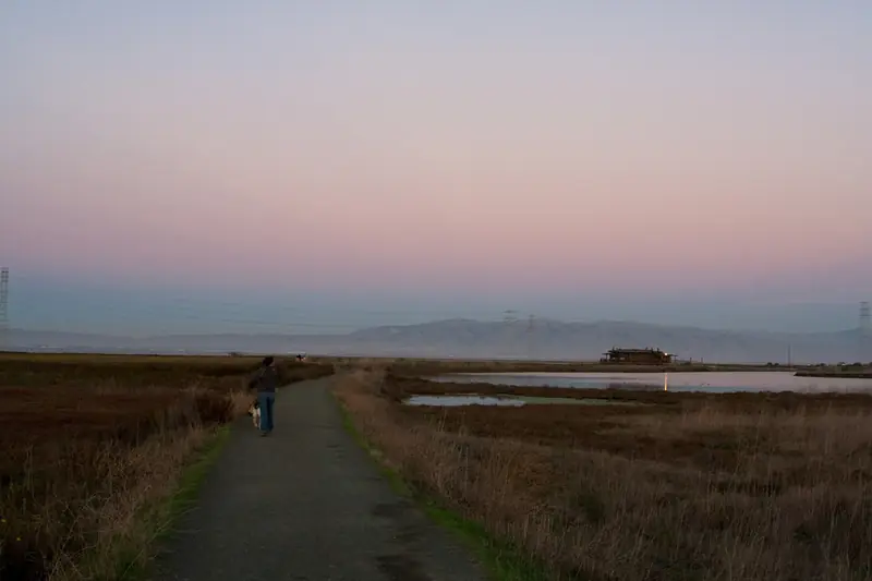
Byxbee Park is the hill at the edge of the bay that most visitors never notice is a hill at all. It is a capped former landfill inside the Baylands, shaped by landscape architects and artists into rolling grassland with paths, a grid of wooden poles and long views. From the top you look west across the marsh to the whole Santa Cruz range. On a clear evening the sun drops behind the ridge, the sky goes orange and the tidal channels below go silver.
Byxbee follows Baylands rules. The city lists the preserve as open from 8 a.m. to sunset. The Byxbee Park Hills lot has a gate that closes at the time posted at the entrance, which changes through the year. Read the sign when you arrive and set an alarm. Parking is free. Leashed dogs are welcome. Bring a jacket: the wind off the bay picks up most afternoons and it can feel ten degrees cooler than downtown.
The Baylands boardwalk and levees
A few minutes north of Byxbee, the rest of the Baylands Nature Preserve gives you water instead of height. The boardwalk from the Lucy Evans nature center runs out over the pickleweed toward open water. The levee trails head out along the sloughs. At sunset the mudflats and channels reflect the sky and flocks of shorebirds move between feeding spots. In winter you may hear the ducks before you see them.
The same 8 a.m. to sunset rule applies here, with gates near the Duck Pond closing at posted times. That means the long levee walks are a poor choice for the last half hour. Watch from the boardwalk or the shore near the parking lots instead, then walk back as the light goes. Our guide to birdwatching explains which birds you are likely to see at dusk in each season.
If you miss the gate time, Shoreline at Mountain View is the next park south on the Bay Trail. Its lake catches sunsets well, but it has its own hours and bans dogs. See our Shoreline park guide.

Windy Hill
Windy Hill is the bald, grassy summit above Portola Valley that you can see from much of Palo Alto. It is run by the Midpeninsula Regional Open Space District, usually called Midpen. It is the easiest place nearby to see both the bay and the ocean in one turn of the head. Midpen describes the short summit trail from Skyline Boulevard as giving a 360-degree panorama of San Francisco Bay and the Pacific Ocean.
For sunset, use the upper access on Skyline. Midpen's 0.6-mile trail runs between the two roadside parking areas there, with detours to the summit and the Herb Grench overlook. You can make it roughly a one-mile loop by returning along Skyline. The lower lot on Portola Road is a long climb from the summit and a poor choice if you want to linger.
Midpen preserves are open from a half hour before sunrise until a half hour after sunset. That extra half hour is the reason Windy Hill works so well: you can watch the sun go down and still walk back in the afterglow. Bring a headlamp anyway. The roadside lots on Skyline are small, so arrive early on clear weekend evenings.
Russian Ridge and the rest of Skyline Boulevard
South of Windy Hill, Skyline Boulevard runs along the crest past a chain of Midpen preserves. The standout for sunset is Russian Ridge, at the corner of Skyline and Page Mill and Alpine roads. The Bay Area Ridge Trail climbs from the main lot past Borel Hill, which Midpen calls the highest named point in San Mateo County with a 360-degree view. Grassland runs down toward the coast with nothing to block the western sky.
A few things to know before you go:
- Hours. Russian Ridge also closes a half hour after sunset. The Mindego Hill area closes on days when the National Weather Service declares a Red Flag Warning.
- Parking. The main lot has 37 spaces. Midpen lists the Caltrans Silicon Valley Vista Point pullout on Skyline as temporarily closed, so do not count on it.
- Fog. On many summer evenings a fog bank sits below the ridge. The sun can set into it rather than the sea, which is its own kind of spectacle.
- Events. Midpen lists a Winter Solstice at Mindego Hill outing on December 21, 2026 and a Borel Hill Sunrise on January 23, 2027.
Next door, Skyline Ridge has Horseshoe Lake and Alpine Pond, where the water picks up the evening color in a calmer, more sheltered setting. Same Midpen hours. Dogs are not allowed at Russian Ridge or Skyline Ridge.
Timing and weather
Sunset in Palo Alto comes earliest in early December and latest in late June. After daylight saving time ends in November, it falls around 5 p.m., so an after-work sunset is easy in winter and nearly impossible in June. Fall and winter also tend to bring the clearest air, especially in the days after a storm clears out. Summer brings long evenings but stronger afternoon wind on the bay and fog on the coast side of the ridge. Our weather guide has month-by-month averages.
Smoke changes everything. Wildfire smoke in late summer and fall can turn the sun into a red disk, but it also makes hiking unpleasant. Check our page on air quality and wildfire smoke before a long walk.
Tips for a good evening
Good to know
- Read the gate sign. City preserves and the Dish lock their gates. Midpen's extra half hour applies only to Midpen land.
- Carry a light. Trails get dark fast once the sun is down, especially under trees on the Skyline side.
- Layer up. The bay shore gets windy and the ridge gets cold after dark, even after a hot day in town.
- Drive carefully. Page Mill Road and Highway 84 are narrow and winding. Watch for deer and cyclists at dusk.
- Skip the drone. Drones are banned in the city preserves and in many parks nearby.
For more ideas on the trails themselves, see our guide to the best hikes in and near Palo Alto.
Frequently asked questions
Can you watch the sunset from the Stanford Dish?
Only part of the year. Stanford closes the Dish at fixed times by month, such as 5 p.m. in November and December and 7:30 p.m. from April through August. In winter the closing time lands close to sunset, so you see the light change but must be at a gate by closing. Check dish.stanford.edu for the current month.
What time does the Palo Alto Baylands close?
The city lists the Baylands Nature Preserve as open from 8 a.m. to sunset. Gates near the Duck Pond and the Byxbee Park Hills lot close at the times posted at each entrance. Park close to your car so you can leave as the light fades.
Where can you see the sun set over the ocean near Palo Alto?
Drive up Page Mill Road or Highway 84 to Skyline Boulevard. The Windy Hill summit trail and the Bay Area Ridge Trail at Russian Ridge both look west to the Pacific on clear evenings. Midpen keeps these preserves open until a half hour after sunset.
Is Byxbee Park good for sunset?
Yes. Byxbee Park sits on the hills above the Baylands and looks west across the marsh toward the Santa Cruz Mountains, so the sun sets behind the ridge. It follows Baylands hours of 8 a.m. to sunset. Its lot gate closes at the posted time.
When is the best season for sunsets in Palo Alto?
Fall and winter usually bring the clearest air and the earliest sunsets, which suits people who work days. Summer evenings are longer but often windy at the bay. The coast side of the ridge can sit under fog.