On this page
Drive west on Alpine Road from Palo Alto and one hill stands out above the trees: a smooth, grassy dome with almost nothing growing on top. That is Windy Hill. The Midpeninsula Regional Open Space District, known as Midpen, manages it as a 1,414-acre preserve of open grassland ridges and forests of redwood, fir and oak. Its name comes from the steady breeze on the summit.
Our Portola Valley guide gives a short introduction. This page goes further: every parking area Midpen lists, three routes for different abilities, the rules for dogs and bikes, what Midpen says about paragliding and how the preserve came together.
Windy Hill at a glance
- Hours: Open from half an hour before sunrise to half an hour after sunset, like most Midpen preserves.
- Cost: Midpen lists no entry or parking fee.
- Two ends: The lower preserve starts on Portola Road in the valley. The upper preserve meets Skyline Boulevard on the ridge. The summit is near the top end.
- Facilities: Midpen lists restrooms at the preserve and picnic tables beside the Spring Ridge parking area on Skyline.
- Allowed: Hiking on all trails. Bikes, horses and leashed dogs on designated trails only. No camping.
Three ways to do Windy Hill
| Route | Start | Distance | Climbing | Good for |
|---|---|---|---|---|
| Skyline summit trail | Skyline Boulevard | 0.6 miles, or about 1 mile as a loop | Small | The view without the climb |
| Sausal Pond loop | Portola Road lot | 1.6 miles | About 200 feet | Families, birdwatching |
| Windy Hill loop | Portola Road lot | 7.2 miles | A long, steady climb | A half-day workout |
From Skyline: the summit the easy way
From Skyline Boulevard, a 0.6-mile trail runs between the two Windy Hill parking areas, with short detours to the summit and to the Herb Grench overlook. Midpen's preserve page gives the distance but does not name the trail. Its easy-access page lists the Anniversary Trail separately, at 200 feet, so the two are not the same thing. Midpen describes a 360-degree panorama with views of both San Francisco Bay and the Pacific. You can make it a loop of about a mile by returning on the track along Skyline. Fog often sits on the ridge, so the view is a gamble on gray mornings.
Sausal Pond loop
From the Portola Road lot, the Sausal Pond loop covers about 1.6 miles with 200 feet of climbing through oak woodland and open meadow. In spring the meadows bloom. At the pond, Midpen says you may see egrets, great blue herons, wood ducks, dragonflies and the western pond turtle, a California species of special concern. Stay on the trail and the observation areas around the pond. Leashed dogs are allowed on this loop. Our birdwatching guide covers more spots for herons and ducks.
The full Windy Hill loop
Midpen's signature loop is about 7.2 miles, using the Spring Ridge Trail, Lost Trail and Hamms Gulch Trail. It passes Sausal Pond, crosses oak woodland, chaparral and grassy meadows and climbs to the summit. The climb is long and exposed on Spring Ridge, so start early in summer and carry plenty of water. Midpen recommends about two quarts per person for every two hours of hiking. Trail runners use the same loop. Our running guide lists more routes.
Parking
Parking is the main headache at Windy Hill. Midpen lists these areas:
| Area | Where | Spaces |
|---|---|---|
| Lower Windy Hill lot | Portola Road | 47 plus 2 accessible |
| Portola Valley Town Center (overflow) | 0.4 miles north on Portola Road | Town lot; walk the Portola Trail |
| Upper Spring Ridge roadside | Skyline Boulevard, north of the Spring Ridge trailhead | 10 |
| Picnic Tables roadside | Skyline Boulevard, just south of the Anniversary trailhead | 11 plus 1 accessible |
| Upper Razorback roadside | Skyline Boulevard at the Razorback Ridge trailhead | 6 |
| Willowbrook-Alpine roadside | Willowbrook Drive and Alpine Road | 4 |
Midpen asks visitors not to park on Portola Road and says parking there is strictly enforced. The lower lot often fills by mid-morning on weekends. The Town Center lot is the practical backup. Our Town Center guide explains the walk. Horse trailers and buses can use a gravel area at the town-owned driveway to the Spring Downs Equestrian Center at 725 Portola Road. Midpen notes that the equestrian center itself is private. A half-mile roadside trail links the driveway to the lower lot.

Views and wildflowers
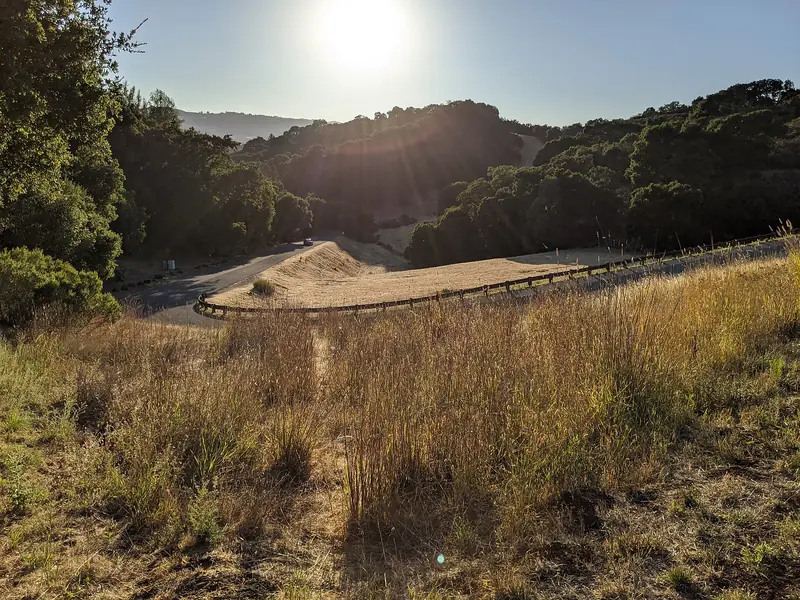
Windy Hill's summit is one of the few places near Palo Alto where you can see both the bay and the ocean on a clear day. To the east the whole South Bay spreads out. To the west the ridges fall away toward the coast. Late afternoon light is often the best, but leave time to get back before closing.
In spring the grassy slopes green up and bloom. Midpen has published a story on the work behind its wildflower displays. Our wildflowers guide explains when the bloom usually peaks and which preserves are best.
Paragliding and hang gliding
Midpen describes Windy Hill as a northeast-facing paragliding and hang gliding site. It says excellent judgment and skill are required to fly there safely. Access and permits are managed through the Wings of Rogallo, a chapter of the United States Hang Gliding and Paragliding Association. Only permitted pilots may launch.
Remote control gliders are allowed at Windy Hill only by permit. Drones, model airplanes and model rockets are not allowed in Midpen preserves. Midpen's description of the Spring Ridge picnic tables suggests them for a break after a hike or a kite flying session.
Rules for dogs, bikes and horses
- Dogs: On designated trails only, on a leash of 6 feet or less. Self-retracting leashes up to 25 feet are allowed but must be locked at 6 feet near other visitors. No more than three dogs per person. See our dog-friendly places guide.
- Bikes: On designated trails only. Helmets are required. The trail speed limit is 15 mph, or 5 mph when passing. Midpen says e-bikes are not allowed on most of its trails.
- Horses: On designated trails. Everyone yields to equestrians. Some trails close to horses in wet weather. In late October 2026 Midpen listed the Betsy Crowder, Hamms Gulch, Lost and Razorback Ridge trails as open to horses.
- Water: No swimming or wading in Sausal Pond or creeks.
- Fire and smoking: Both prohibited.
Midpen also posted a short closure: the trail connector between the Hamms Gulch Trail and the Eagle Trail is closed November 3 to 6, 2026 for bridge repairs, with Alpine Road as the bypass. Check the Windy Hill preserve page for current closures.
How the preserve came together
Midpen calls Windy Hill a significant addition to its lands in 1980. The upper preserve began that year with a 537-acre purchase, with major support from the Peninsula Open Space Trust, a local land trust. A second purchase of 429 acres in 1987 added the lower preserve, including the scenic backdrop of Spring Ridge above Portola Road. Midpen is now working through a multiyear plan for public access to the Hawthorns Area of the preserve. It runs guided walks there. Its calendar lists "Exploring the Hawthorns Area" on Saturday, January 16, 2027.
Getting there from Palo Alto
For the lower lot, take Alpine Road west under Interstate 280, then turn north on Portola Road. Allow about 15 to 20 minutes from downtown Palo Alto. For the Skyline end, drive up Page Mill Road or Alpine Road to Skyline Boulevard and head north. There is no practical transit. If you are visiting without a car, you can compare rental cars for a foothills day. Cyclists ride Portola Road in large numbers. Our biking guide covers the classic loop.
Midpen's fall calendar also lists a dog hike on November 17, 2026, a berries walk on November 21 and a French broom removal workday on November 28. For another big-view hike close to town, try Foothills Nature Preserve.
Good to know
- Arrive before 9 a.m. on weekends for a space in the lower lot.
- The summit is often windy and cooler than the valley. Bring a layer.
- Rattlesnakes, ticks and poison oak are all present. Stay on the trail.
- Cell service is spotty. Download the Midpen map before you leave.
Frequently asked questions
Where do you park for Windy Hill?
The lower lot on Portola Road has 47 spaces plus two accessible spaces and fills fast. Midpen points overflow parking to the Portola Valley Town Center, 0.4 miles north via the Portola Trail. Up top, four small roadside areas on Skyline Boulevard and Alpine Road hold between 4 and 12 cars each.
What is the easiest hike at Windy Hill?
From the bottom, the Sausal Pond loop is about 1.6 miles with 200 feet of climbing. From the top, a 0.6-mile trail runs between the Skyline parking areas with side paths to the summit, or about a mile as a loop. Midpen's preserve page does not name it. Both suit beginners and families.
Can you paraglide at Windy Hill?
Yes, with a permit. Midpen describes Windy Hill as a northeast-facing paragliding and hang gliding site that demands strong pilot skills. Access and permits are managed by the Wings of Rogallo club, a chapter of the U.S. Hang Gliding and Paragliding Association.
Are dogs allowed at Windy Hill?
Yes, on designated trails only, on a leash of 6 feet or less. Midpen allows up to three dogs per person and asks owners to carry out waste. The trail map marks which trails are open to dogs.
How long is the Windy Hill loop?
Midpen's full loop is about 7.2 miles using the Spring Ridge, Lost and Hamms Gulch trails. It passes Sausal Pond and climbs to the summit, where on clear days you can see the bay and the Pacific. Allow most of a morning.