On this page
Greater Miranda is a neighborhood defined by its edges. A creek on one side, an expressway on another and a cemetery on the third leave just one way in: Miranda Avenue. Off that single road, three short cul-de-sacs hold 55 homes. The result is a quiet enclave where kids play in the street, deer wander through front yards and delivery drivers regularly get lost.
Residents call it an oasis. The Palo Alto Weekly has profiled it several times. This guide explains where it is, its history from rancho days to annexation, the homes and the parks, schools, shops and transit residents rely on.
Where Greater Miranda is
The neighborhood sits in the southwest corner of Palo Alto, near the Los Altos border. Palo Alto Online describes boundaries that are unusually firm:
- Alta Mesa Memorial Park, the cemetery on Arastradero Road, on one side.
- Adobe Creek, which runs behind many backyards.
- Foothill Expressway, separated from the homes by a line of trees and a fence.
Miranda Avenue is the only road in and out. Three cul-de-sacs branch east from it: Moana Court, Arroyo Court and Miranda Green. Because nobody drives through, traffic is light. Trees and distance muffle the noise from Foothill Expressway.
Nearby, the VA Palo Alto Health Care System campus sits farther along Miranda Avenue. The Esther Clark Park neighborhood is across Foothill Expressway near Arastradero Road, with Gunn High School close by. Green Acres is a short ride east. Los Altos is just to the south.
From rancho to annexation
Adobe Creek has drawn people for a long time. Don Nielson, a resident since 1973 who has documented the neighborhood's past, traced it back to the creek's role as a water source for the Ohlone. Our page on the Ohlone and the land before 1769 covers that era.
The street name comes from Juana Briones de Miranda, one of the most remarkable figures in early California. Briones bought a large rancho in this area in the 1840s and lived on it for many years. Palo Alto Online reported that she paid $300 for the land, a figure local histories repeat. Juana Briones Park and Juana Briones Elementary nearby also carry her name. Our page on the Spanish and Mexican era explains the ranchos.
The modern neighborhood is younger. Palo Alto Online reported that the City of Palo Alto annexed the area in 1959 and that it has consisted of 55 homes since the 1960s. A resident who moved in in 1968 recalled answering an ad for a big lot by the creek.
One local story stands out. A resident told the Weekly that her sons found a chunk of mosaic in Adobe Creek that she believed came from Stanford Memorial Church, whose front was badly damaged in the 1906 earthquake. She said quake debris had been dumped in the creek. The story is family lore rather than documented history, but it gives the creek a certain mystery.
Housing in general terms
Greater Miranda is all single-family homes on relatively large lots. Expect:
- one-story ranch houses from the 1960s, many updated
- Spanish style homes with stucco and tile
- a cluster of newer homes on Arroyo Court, which backs onto Adobe Creek
- deep, often wooded backyards running down toward the creek
Turnover is low. Residents told the Weekly in 2018 that homes rarely come up for sale and that the bidding frenzy common elsewhere in Palo Alto is less intense here. Because the boundaries are fixed, Nielson predicted little structural change. Creekside lots can come with extra rules for setbacks and drainage, so buyers should check with the city. See our real estate guide for the wider market.
The fight for Miranda Avenue
Greater Miranda's defining civic story is about its only road. Alta Mesa Memorial Park owned part of the roadway that ran through the cemetery grounds. In 2002 the cemetery put up a chain-link fence along the road to keep people out of the graveyard, which left a very narrow path for people on foot and on bikes.
Neighbors organized. They persuaded the cemetery to take the fence down and then pushed the city for a safer, paved road, which it built a couple of years later. Nielson described it to the Weekly as a community effort that secured the neighborhood's rightful access. Arastradero Road beyond still backs up at school times, but residents now describe Miranda Avenue itself as safe for walking and biking.
Traditions include a Fourth of July block party known as the Jelly Bean Olympics, where children compete in games for jelly beans, and, in past years, a monthly potluck lunch group. Like any volunteer tradition, the details can change.

Wildlife and the outdoors
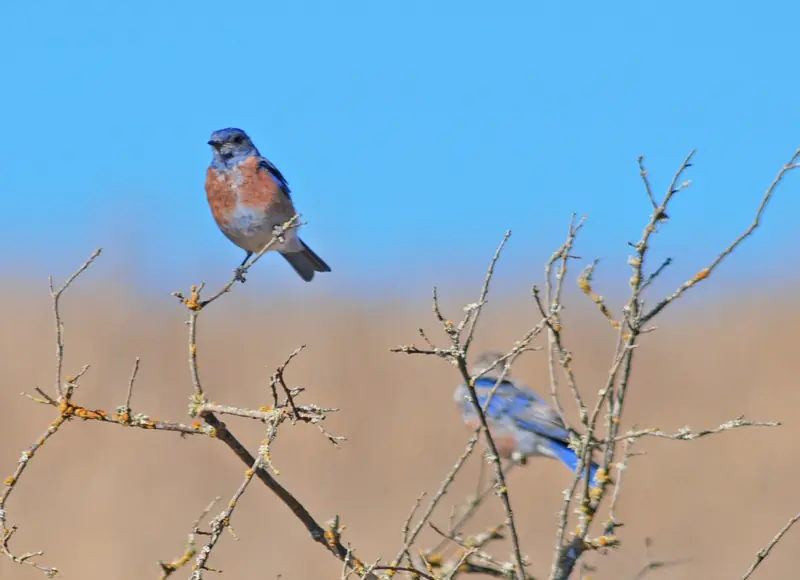
Adobe Creek works as a wildlife corridor through the neighborhood. Residents report deer crossing Miranda Avenue, coyotes and foxes along the creek and a pair of hawks that nested nearby for years. One resident compared living here to camping year round. Keep pets indoors at night, secure trash bins and give deer a wide berth during fawning season.
The bigger open spaces are close. Esther Clark Park, a 21-acre grassland preserve, is just across Foothill Expressway. Pearson-Arastradero Preserve is a short bike ride west with grassland and oak trails. Terman Park at 655 Arastradero Road and Juana Briones Park at 609 Maybell Avenue are the nearest city parks with play areas.
Schools by attendance area
Palo Alto Online listed Juana Briones Elementary at 4100 Orme Street, Ellen Fletcher Middle School at 655 Arastradero Road and Gunn High School at 780 Arastradero Road. Gunn is close enough to walk. Attendance areas can change, so confirm any address with the PAUSD school finder.
Shopping and getting around
There are no stores in the neighborhood. Residents shop along El Camino Real, at the San Antonio Shopping Center in Mountain View and in downtown Los Altos, about 10 minutes away by car. A post office operates inside the VA hospital on Miranda Avenue, according to Palo Alto Online. The Cambridge post office near California Avenue is the main option.
Foothill Expressway connects to Page Mill Road, I-280 and Los Altos. VTA Route 89 runs on weekdays between the California Avenue Caltrain station, Stanford Research Park and the VA hospital, which makes it the closest bus for some trips. Most residents drive or bike.
Neighborhood association
Greater Miranda has a small neighborhood association. Palo Alto Online has named Don Nielson as its longtime leader. Communication is often by email for city matters and over the back fence for everything else. Contacts change, so check the City of Palo Alto's neighborhood association list for the current one.
Good to know
- Miranda Avenue is the only access road. Delivery and rideshare drivers often miss the turn, so give clear directions.
- Wildlife is common. Drive slowly at dawn and dusk.
- Fire Station No. 5 at 600 Arastradero Road serves the area.
Visiting family in Greater Miranda? The nearest hotels are along El Camino Real, a short drive east. Compare hotels on El Camino Real or rent a bike to explore the preserves nearby.
Frequently asked questions
Where is Greater Miranda in Palo Alto?
Greater Miranda is in southwest Palo Alto near the Los Altos border. It is bounded by Alta Mesa Memorial Park, Adobe Creek and Foothill Expressway. Three cul-de-sacs, Moana Court, Arroyo Court and Miranda Green, branch off Miranda Avenue.
How many homes are in Greater Miranda?
Palo Alto Online reported 55 homes, a number that has not changed since the 1960s. With its edges fixed by a creek, an expressway and a cemetery, there is little room for more.
Why is it called Greater Miranda?
It takes its name from Miranda Avenue, which recalls Juana Briones de Miranda, the Californio landowner whose rancho once covered this area. Juana Briones Park and Juana Briones Elementary nearby carry her name too.
Which schools serve Greater Miranda?
Palo Alto Online listed Juana Briones Elementary, Fletcher Middle School and Gunn High School. Confirm any address with the Palo Alto Unified School District school finder, since boundaries can change.
Is there wildlife in Greater Miranda?
Yes. Residents describe deer crossing Miranda Avenue and coyotes, foxes and hawks along Adobe Creek. Hawks have nested near the creek in past years. Keep pets supervised and secure trash.