On this page
Most people know Brisbane only as a blur of office parks beside Highway 101 on the way to San Francisco. Up the hill from the freeway is a different place: a small town of steep streets and wooden houses on the lower slopes of San Bruno Mountain, with a main street called Visitacion Avenue, a community park and views across the bay. In December, big lighted stars hang from homes all over the hillside.
From Palo Alto it is a short trip up the Peninsula and an easy add-on to a day in San Francisco or a flight from SFO. Hikers come for San Bruno Mountain, anglers for the Sierra Point pier and families for the holiday lights. This guide covers the distance and transit, the town's story, the stars and the hydrants, the mountain, the bayfront, the Baylands plan and why it is worth a stop.
Where Brisbane is and how far
Brisbane sits at the northeastern corner of San Mateo County, immediately south of the San Francisco city limit. San Bruno Mountain rises behind it, Daly City lies to the west and South San Francisco to the south. Most of the city's area is water: of about 20 square miles, only about 3 are land, according to the Census Bureau. The rest is the Brisbane Lagoon and the bay.
From downtown Palo Alto it is about 25 miles. Outside rush hour the drive takes 25 to 35 minutes on Highway 101.
Getting there from Palo Alto
By car
Take Highway 101 north. Exit at Sierra Point Parkway for the marina and the lagoon, or continue to the Brisbane exits for Bayshore Boulevard and the town center. Guadalupe Canyon Parkway climbs from Bayshore Boulevard to the main San Bruno Mountain entrance.
By Caltrain
Bayshore station on Tunnel Avenue sits at the north edge of Brisbane. Caltrain places it in zone 1 and Palo Alto in zone 3, a three-zone fare: $8.50 in October 2026 and $9.00 from January 1, 2027. On the fall 2026 weekday timetable, local trains stopped there about every half hour and took about 40 minutes from Palo Alto. See our Caltrain guide for tickets.
By bus
SamTrans Route 292 runs along Bayshore Boulevard through Brisbane every day, between San Francisco, SFO and Hillsdale. Employers and the city also run shuttles to BART, Muni and Caltrain for people who work in Brisbane.
From Visitacion City to Brisbane
The land was once part of Rancho Cañada de Guadalupe la Visitación y Rodeo Viejo, a Mexican grant that also covered Visitacion Valley, the Bayshore district of Daly City and San Bruno Mountain. In 1907 the Southern Pacific finished the Bayshore Cutoff, a faster line into San Francisco. A town called Visitacion City was platted beside it in 1908. The railroad planned a huge yard and locomotive works next door, but the Panic of 1907 halted construction. The shops were finally completed by 1918.
In the 1920s Arthur Annis pushed to rename the town to avoid confusion with San Francisco's Visitacion Valley. Accounts differ on where the new name came from. His daughter said it honored Brisbane, Australia. Another story credits the newspaper columnist Arthur Brisbane. The town incorporated as a city on November 27, 1961. The Brisbane Lagoon is a remnant of the bay, cut off when Highway 101 was built on a causeway. Much of it was later filled.
The stars and the painted hydrants
Brisbane calls itself the City of Stars. The tradition dates to 1939: at the start of the holiday season, residents and businesses hang large illuminated stars on the downhill sides of their buildings. Some are 10 feet or more across. Many stay up all year. The best view is from the town center or from Bayshore Boulevard after dark.
The city's Festival of Lights marks its 40th anniversary on Sunday, December 6, from 5:30 to 8 p.m., with caroling along part of Visitacion Avenue, community performances, a tree lighting and hot cocoa, according to the city's Festival of Lights page. Our holiday lights guide covers displays nearer Palo Alto.
Look down, too. Many fire hydrants in town are painted with whimsical designs. The city traces the custom to the 1976 Bicentennial, when Women's Club artists painted the downtown hydrants. A Hydrant Restoration Weekend is held every other year, most recently on September 12, 2026. The city publishes an online map with a photo and artist credit for each hydrant.

San Bruno Mountain
San Bruno Mountain State and County Park almost surrounds the town. San Mateo County calls it an open-space island in the middle of the Peninsula's development, at the north end of the Santa Cruz Mountains. The park covers 2,416 acres, with elevations from 250 feet to 1,314 feet at the summit. Its east-west ridge gives views of San Francisco and the central bay. The main entrance is at 555 Guadalupe Canyon Parkway. County parks charge a vehicle day use fee.
The mountain is famous among naturalists as home to the endangered mission blue butterfly and other rare species, protected under a long-running habitat conservation plan. Spring wildflowers on the grassy slopes are some of the best near the city. The county opened new day-use improvements in May 2026 and is doing fuel reduction work in parts of the park, so check the county park page for closures. Trails are steep and very windy near the top. Our hiking guide and wildflowers guide suggest similar walks closer to home.
The bayfront: lagoon, marina and pier
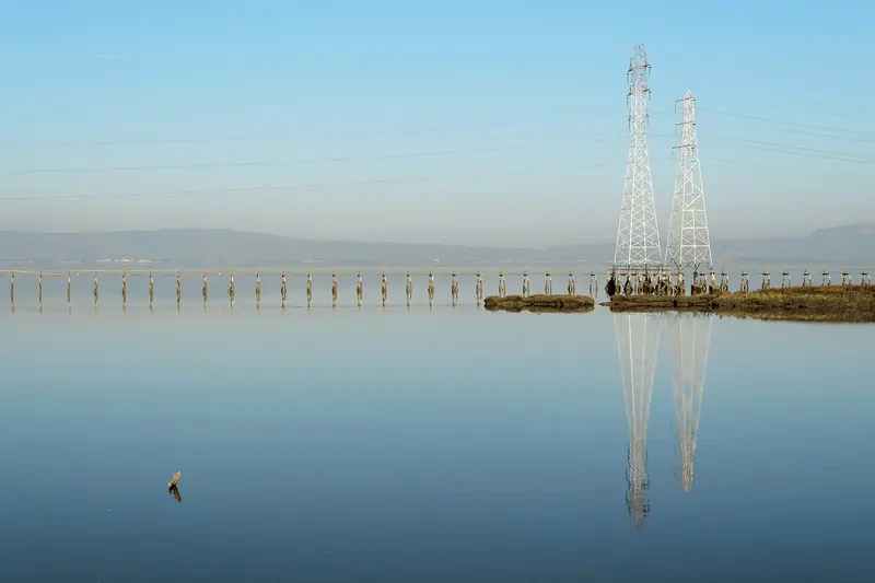
The Bay Trail leaves the Brisbane Lagoon along Sierra Point Parkway and loops around Sierra Point, past a fishing pier to the Brisbane Marina. The city says the marina was completed in 1983, holds up to 580 boats from 10 to 120 feet and has a 270-foot guest dock. It is home to the Sierra Point Yacht Club and has a public 300-foot fishing pier. Office hours are on the marina page. From Sierra Point, a paved 4-mile stretch of the trail continues south to Oyster Point in South San Francisco. See our Bay Trail guide and fishing guide.
In the Crocker Park business area, a level 2.5-mile trail loops around the office buildings, a good flat walk or run.
The town center
Brisbane's small center lies along Visitacion Avenue. Community Park, at the heart of town, has the main playground, a gazebo, picnic tables and a weekly Thursday farmers market, according to the city. A public library, a community pool and a handful of cafes, delis and small restaurants sit nearby. The city also runs a Day in the Park and Derby each October and summer concerts in the park.
The Baylands plan
East of the town, between Bayshore Boulevard and the lagoon, lies the Baylands, a former rail yard and landfill site that has been proposed for a large mixed-use development for years. In August 2026 the Brisbane Planning Commission voted 5 to 0 to recommend that the City Council certify the final environmental impact report and adopt a revised specific plan. The council held a series of public hearings through September and October 2026, with more tentatively set for November and early December. The project's outcome will reshape this corner of the Peninsula, so watch for news if you follow regional housing and transit.
Why a Palo Alto visitor might go
- A big-view hike near the city. San Bruno Mountain gives San Francisco views without San Francisco parking.
- Holiday lights with character. The stars and the Festival of Lights make a December evening trip.
- An easy pairing with SFO or the city. Brisbane is a few minutes from both. If you have an early flight, you can compare hotels near SFO and our SFO guide covers the airport.
- A quiet waterfront. The Sierra Point pier and Bay Trail are rarely crowded.
Good to know
- Wind and fog are common on San Bruno Mountain; bring layers.
- Not every Caltrain stops at Bayshore. Check the timetable.
- Town streets are narrow and steep; park carefully.
- Brisbane's area code is 415, not 650, a reminder of its ties to San Francisco.
Frequently asked questions
Why is Brisbane called the City of Stars?
Since 1939, residents and businesses have hung large illuminated stars on the downhill sides of their homes and offices at the start of the holiday season. Some are 10 feet or more across. Many stay up all year. The city's Festival of Lights celebrates the season each December.
When is the Brisbane Festival of Lights?
The city lists its 40th anniversary Festival of Lights for Sunday, December 6, from 5:30 to 8 p.m. It includes caroling on part of Visitacion Avenue, community performances, a tree lighting, hot cocoa and cookies. Check the city's Parks and Recreation pages for updates.
How do I get to Brisbane from Palo Alto by Caltrain?
Ride Caltrain north to Bayshore station on Tunnel Avenue. Palo Alto is in zone 3 and Bayshore in zone 1, so it is a three-zone fare: $8.50 in October 2026 and $9.00 from January 1, 2027. Local trains on the fall 2026 weekday timetable took about 40 minutes.
Can you fish at Brisbane Marina?
Yes. The City of Brisbane says the marina at 400 Sierra Point Parkway has a public 300-foot fishing pier, along with a stretch of the San Francisco Bay Trail. California does not require a fishing license on public piers in ocean and bay waters.
How big is San Bruno Mountain?
San Mateo County describes San Bruno Mountain State and County Park as 2,416 acres of rugged land, with elevations from 250 feet to 1,314 feet at the summit. Its ridge runs east to west and offers views of San Francisco and the central bay. The main entrance is on Guadalupe Canyon Parkway.