On this page
Most earthquake lessons happen in classrooms. At Los Trancos you walk across the boundary between two tectonic plates and see a fence that the 1906 earthquake pulled apart. The Midpeninsula Regional Open Space District, known as Midpen, calls the 274-acre preserve an ideal spot to learn about earthquake geology because the San Andreas Fault splits it in two.
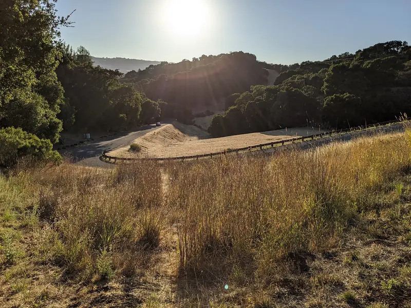
The preserve sits at about 2,000 feet on Page Mill Road above Palo Alto. Midpen describes air scented with bay leaves and grass, rolling grassy knolls between oak woodland and shaded forest. On a clear day you can pick out the towers of San Francisco and Mount Diablo across the bay. It is small, quiet and one of the best short outings near town, especially with curious kids.
Getting there from Palo Alto
Take Page Mill Road west from Foothill Expressway, under Interstate 280 and up into the hills. The road passes the entrance to Foothills Nature Preserve and becomes narrow and winding. Midpen puts the Los Trancos entrance 7 miles west of Interstate 280 and 1.5 miles east of Skyline Boulevard. Allow roughly 25 to 30 minutes from downtown. There is no transit. The road is a popular climb for cyclists, so drive carefully on the bends.
Parking
- Los Trancos Parking Area: 23 spaces plus 1 accessible space.
- LT02 roadside parking: 6 spaces.
- Monte Bello Parking Area: directly across Page Mill Road, with 51 spaces plus 4 accessible spaces and restrooms. Midpen suggests it for extra parking.
Los Trancos itself has no restrooms, so use the ones at Monte Bello. Lock your car and keep valuables out of sight, as Midpen advises at all its lots.
The San Andreas Fault Trail
Midpen lists the route as the Nonette Hanko San Andreas Fault Trail, an easy 1.5-mile self-guided loop. It was set up in 1977 with volunteer help from Foothill College geology professor Tim Hall, Nick Hall and Foothill geology students. Numbered posts mark the stations in Midpen's free trail guide, which is worth downloading before you lose cell signal. Two kinds of posts mark the fault itself: yellow bands for the main break of 1906 and white bands for minor breaks.
A few highlights from the guide:
- Station 1, boulders from Loma Prieta. The trail starts on the western side of the lot. Large conglomerate boulders here came from the flanks of Loma Prieta, 23 miles to the southeast. Water carried them across the fault about 2 million years ago and the Pacific plate has carried them northwest ever since. The guide estimates about 12,000 major earthquakes in that time. Just north of the lot, a sag pond collects water in winter, a sign of stretched ground in the fault zone.
- Station 2, a ridge of headwaters. Stevens Creek flows south from this ridge while Los Trancos and Corte Madera creeks flow north. To the north you can see Crystal Springs Reservoir and San Andreas Lake, which sit in the valley the fault carved.
- Station 3, the 1906 bench. A photo from just after the 1906 earthquake shows two open cracks along what is now a flat, roadlike bench. Benches like this form along faults and were often used as roadbeds.
- Station 4, the offset fence. A fence rebuilt from century-old materials found on the preserve shows how the far segment may have moved as much as 3 feet northwest in 1906. An original section still stands downhill toward Los Trancos Creek.
- Station 5, springs and a landslide. Willows mark springs where crushed fault clay dams groundwater. Below them is a recovering landslide covered in poison oak.
The guide's numbers put the quake in perspective. In 1906 about 400 miles of the fault slipped, from San Juan Bautista to Cape Mendocino. The rupture traveled at over 5,000 miles per hour and took about 20 seconds to reach this spot. North of the Golden Gate the ground shifted 15 to 16 feet. Between San Francisco and Portola Valley it moved 7 to 9 feet. Here it moved only 2 to 3 feet. The guide adds that the fault moves an average of three-quarters of an inch a year on the Peninsula. Our page on the 1906 earthquake at Stanford and Palo Alto covers what the quake did in town. Our earthquake safety guide covers how to prepare for the next one.
The Triple Loop Trail
For a longer walk, Midpen offers a second self-guided route. The Triple Loop Trail runs 2.5 miles past seven points of interest through grassland, chaparral and mixed evergreen forest. Midpen puts the total climb at about 500 feet and the time at one to three hours depending on pace. It makes a good half-morning outing after the fault trail if you want more than a stroll.
Trails from Los Trancos also connect into the larger network along Page Mill Road and the ridge. Across the road, Monte Bello Preserve has the Stevens Creek Nature Trail and the route to Black Mountain. Up the road at Skyline Boulevard, Russian Ridge and Skyline Ridge make it easy to stack two short hikes in one trip.

Rules for dogs, bikes and horses
Los Trancos is one of the stricter Midpen preserves. The rules as Midpen publishes them:
- Dogs: Not allowed. Midpen accommodates service dogs wherever it allows public access.
- Bikes: Not allowed anywhere in the preserve. Monte Bello across the road allows bikes on designated trails.
- Horses: Allowed on designated trails marked on the map. Helmets are recommended for riders.
- Drones and models: Drones, model airplanes and model rockets are not allowed.
- Water: Swimming, wading or any water-contact activity is prohibited.
- Fire, smoking and weapons: All prohibited.
- Groups: Events with 20 or more people, or that charge a fee, need a general access permit.
Most Midpen preserves have no trash cans. Pack out everything you bring in.
Seasonal notes
Each season changes the visit. In winter the sag pond holds water and the trail can be muddy. Spring brings green grass and wildflowers on the knolls; our wildflowers guide covers timing. Summer days can be warm in the open grass while fog pours over the ridge to the west. Fall offers the clearest air and the best chance of seeing San Francisco and Mount Diablo.
Some Midpen areas close when the National Weather Service issues a Red Flag Warning for fire weather. Check the Los Trancos preserve page for closures before you drive up. Midpen docents also lead a San Andreas Fault Exploration Hike here. Its calendar lists dates on Sunday, December 6, 2026, Sunday, January 3, 2027 and Sunday, February 14, 2027. Our nature programs guide lists other ways to learn with a guide.
Safety: lions, ticks and poison oak
Midpen says its trails are generally very safe but lists natural hazards to plan for. Carry water, since none is available at most preserves; Midpen recommends two quarts per person for a two-hour hike. Cell service is sporadic.
- Mountain lions are a natural part of this region and are occasionally seen. Midpen's advice: do not run, keep children and pets close, do not approach the lion, do not turn your back or crouch down. Stand tall, face the animal, make noise and look bigger by waving your arms or throwing objects. Then leave and warn other visitors. Avoid hiking at dawn, dusk and night, when lions are most active.
- Ticks are present and may carry disease. Santa Clara County Vector Control says adult western blacklegged ticks, which can carry Lyme disease, are mostly active from November through March and nymphs from March through May. Stay in the middle of the trail and check yourself afterward.
- Poison oak grows along the trail, including on the landslide at Station 5. Midpen notes that its oil stays potent on bare stems in winter. Wipe exposed skin with rubbing alcohol within minutes of contact or rinse with water before using soap.
- Rattlesnakes are native and most active in warm weather.
In an emergency call 911. For non-emergencies Midpen's office line is 650-691-1200.
How the preserve came to be
Midpen's history of the land starts with a 13,300-acre ranch in the 19th century. In the early 1900s Louis Oneal, a San Jose attorney and state senator who raised horses and owned the nearby O and O Breeding Stables, bought the property. It changed hands in the 1950s. In the 1960s Palo Alto ran water and power lines up to it in expectation of a subdivision. A city study of the high cost of serving the foothills helped stop that plan. Midpen bought most of the property in 1976 and the fault trail opened the next year. Our hiking guide compares Los Trancos with other trails near town.
Frequently asked questions
How long is the San Andreas Fault Trail at Los Trancos?
Midpen describes it as an easy 1.5-mile self-guided interpretive trail. It starts on the western side of the parking lot and has numbered posts that match Midpen's free trail guide. Take your time at the stations.
Can you see the San Andreas Fault at Los Trancos?
Yes. Posts with yellow bands mark the main fault break from the 1906 earthquake and posts with white bands mark minor breaks. A reconstructed fence shows how the ground shifted. A sag pond near the parking lot formed in the fault zone.
Are dogs allowed at Los Trancos Preserve?
No. Midpen does not allow dogs or bicycles in Los Trancos Preserve. Service dogs are accommodated under the Americans with Disabilities Act. Horses are allowed on designated trails marked on the map.
Where do I park for Los Trancos?
The preserve lot on Page Mill Road has 23 spaces plus one accessible space, with a 6-space roadside area nearby. Midpen points visitors to the larger Monte Bello parking area directly across Page Mill Road, which also has restrooms.
How far is Los Trancos from Palo Alto?
The entrance is on Page Mill Road, 7 miles west of Interstate 280 and 1.5 miles east of Skyline Boulevard. From downtown Palo Alto the drive is roughly 25 to 30 minutes on a winding mountain road.