On this page
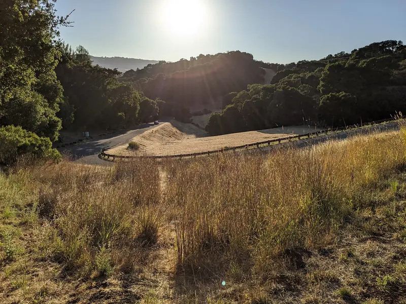
Coal Creek is the small preserve most people drive past on the way to Russian Ridge. That is its appeal. The Midpeninsula Regional Open Space District, known as Midpen, calls it an ideal place for a quick afternoon hike with a dog. Several trails combine into a pleasant 2- or 3-mile loop. From the open grassland below Skyline Boulevard you look out over the South Bay. In the shaded canyons below, a seasonal waterfall runs in winter.
Midpen puts the preserve at around 500 acres. It sits on the steep east-facing slope above Portola Valley, between Alpine Road and Skyline, right next door to Russian Ridge. Unlike that preserve, Coal Creek welcomes leashed dogs. This guide covers parking, the two loops Midpen highlights, the rules and what to expect through the year.
Getting there and parking
From Palo Alto, take Page Mill Road west past Interstate 280 and climb to Skyline Boulevard (Highway 35). At the top, the Russian Ridge lot sits on the corner. Coal Creek's trailheads are just to the north.
| Parking area | Spaces | Notes |
|---|---|---|
| Silicon Valley Vista Point roadside | 25 | Owned and operated by Caltrans; listed as temporarily closed in October 2026 |
| Upper Alpine roadside | 7 | Off Alpine Road; open to hikers, cyclists and riders |
Midpen places the Vista Point pullout on Skyline about 1.2 miles north of Page Mill Road and 6 miles south of Highway 84, opposite Russian Ridge gate RR01. While Caltrans keeps it closed, the Upper Alpine area is the main option and it is tiny. Arrive early on weekends, park fully off the road and do not block gates. If both are full, the larger Russian Ridge lot is close by, though dogs are not allowed in that preserve.
There are no restrooms in the preserve and no transit. Midpen does not charge entry or parking fees. Hours run from half an hour before sunrise to half an hour after sunset. Check the Coal Creek page for parking updates before you go.
Trails and loops
Midpen does not publish a total trail mileage for Coal Creek. It highlights two routes.
Cloud's Rest Trail
Midpen describes this as a 0.9-mile out-and-back trail through grassy meadows below the Caltrans vista point. It promises stunning views of the South Bay. For a longer walk, Midpen says you can join it to the Meadow Trail and Alpine Road to make a 2.4-mile loop. The meadows are open and sunny, so bring a hat.
Crazy Pete's Road and Coal Road loop
This 1.7-mile loop winds through oak woodland and passes a small seasonal waterfall, with views of the South San Francisco Bay. Midpen says it is almost entirely shaded and pleasant even in the middle of the day. Leashed dogs are allowed on it.
Making a longer outing
Coal Creek joins other public land. Midpen's map shows connections toward Russian Ridge, with Monte Bello and Los Trancos farther south along Page Mill Road. Dog rules change as soon as you cross a preserve boundary, so check the map if you have a dog with you.
Keep in mind that this is a hillside preserve. Most routes drop from Skyline toward Alpine Road, so the climb comes on the way back.
Bringing a dog
Coal Creek is one of 11 Midpen preserves that allow dogs. Midpen's dog page lists it as all trails. The preserve page and map say designated trails, so read the signs at each junction. The rules:
- Use a leash of 6 feet or less. Self-retracting leashes may extend up to 25 feet but must be locked at 6 feet near other visitors.
- No more than three dogs per person.
- Dogs are not allowed in any Midpen water areas, including streams and ponds, so keep them out of the creek and the waterfall pool.
- Do not let dogs chase wildlife or bother other visitors.
- Bag the waste and carry it out. Do not leave bags on the trail.
Midpen also asks owners to carry water for their dogs, avoid the heat of the day and check them for ticks afterward. Our dog-friendly places guide covers other options. Palo Alto's licensing rules are on our pets page.
Bikes, horses and other rules
- Bikes: Midpen's biking page marks Coal Creek as open to bikes on all trails. The preserve page says designated trails. Helmets are required, even uphill. The speed limit is 15 mph, or 5 mph when passing or on blind turns. E-bikes are not allowed on most Midpen trails. Our biking guide has more.
- Horses: allowed on designated trails marked on the map. Helmets are recommended. Hikers and cyclists yield to riders.
- Accessibility: Midpen lists no easy-access trails here.
- Also prohibited: drones and model aircraft, fires, smoking, swimming or wading and weapons. Leave plants and wildlife undisturbed.
At the time of writing Midpen reported no trail closures at Coal Creek.

Seasons and events
Winter is the season for the waterfall. Midpen says seasonal falls appear in the wetter months. A run of storms brings them to life. Trails can be muddy then. Spring brings green meadows and wildflowers; see our wildflowers guide. Summer is dry. The meadows on Cloud's Rest are exposed, while the Crazy Pete's loop stays shaded. Fall brings the clearest views over the bay and also the highest fire danger.
Midpen's calendar lists a French broom removal workday at Coal Creek on November 21, 2026. Volunteer days are a good way to see the preserve with staff. Our volunteering page lists more ways to help.
Planning a short visit
Coal Creek suits a hike of an hour or two rather than a full day. A simple plan for a first visit:
- Check the Coal Creek page for parking news, since the Vista Point pullout has been closed.
- Pick the shaded Crazy Pete's loop on a warm day or Cloud's Rest on a cool, clear one.
- Pack water for everyone, including the dog, plus a jacket. Skyline is often windy and foggy even when Palo Alto is warm.
- Download the map before you leave town. Midpen warns that cell service is sporadic.
- Leave time on the way home for a walk at Foothills Nature Preserve or a stop in town.
Families with young children may find the return climb harder than expected. Turn around early if legs are tired, since every route here ends uphill.
Safety
There is no water in the preserve. Midpen recommends two quarts per person for every two hours, plus water for your dog. Cell service is very sporadic. In an emergency call 911. For nonemergencies call Midpen at 650-691-1200.
- Mountain lions live here and are occasionally seen. Midpen's advice: do not hike alone, keep children and pets close and avoid dawn and dusk. If you meet one, do not run. Stand tall, face it, make noise and back away. Report sightings to 650-691-2165.
- Ticks are present and may carry disease. Check yourself and your dog.
- Poison oak grows on most preserves. Dog fur can carry its oil.
- Rattlesnakes are especially active in warm weather. Keep dogs on the trail.
- Valuables: lock the car and keep valuables out of sight at roadside pullouts.
History
Midpen's short history says the land was once a place where Native Americans gathered and ground acorns and other seeds. Midpen's purchase saved it from becoming a residential subdivision. Today it is one of the district's smaller preserves. Its neighbors are much larger. For more on the town below, see our Portola Valley guide. Our hiking guide compares Coal Creek with bigger hikes near town.
Frequently asked questions
Are dogs allowed at Coal Creek Preserve?
Yes. Midpen's dog page lists Coal Creek as dog friendly on all trails, while the preserve page and map say designated trails, so follow the signs. Dogs must be on a leash of 6 feet or less, with a limit of three per person. Carry out the waste, since there are no trash cans or restrooms.
Where do you park for Coal Creek?
Midpen lists two roadside areas. The Silicon Valley Vista Point pullout on Skyline Boulevard, about 1.2 miles north of Page Mill Road, has 25 spaces but is owned by Caltrans and was listed as temporarily closed in October 2026. The Upper Alpine roadside area on Alpine Road has 7 spaces.
How long is the Crazy Pete's Road loop?
Midpen describes the Crazy Pete's Road and Coal Road loop as 1.7 miles. It winds through oak woodland past a small seasonal waterfall, with views of the South Bay. Midpen says it is almost entirely shaded, so it works even at midday.
Is there a waterfall at Coal Creek?
Yes, a small seasonal one. Midpen says waterfalls appear at Coal Creek in the wetter winter months. The Crazy Pete's Road and Coal Road loop passes one. By late summer it is usually dry.
Can I ride a bike at Coal Creek?
Yes. Midpen's biking page lists Coal Creek as open to bikes on all trails, while the preserve page says designated trails. Helmets are required and the speed limit is 15 mph, or 5 mph when passing. E-bikes are not allowed on most Midpen trails.