On this page
South of Midtown is one of those Palo Alto names that does exactly what it says. It is the grid of quiet residential streets just south of the Midtown shopping district, ending at East Meadow Drive and Mitchell Park. Palo Alto Online noted plainly that the area has no formal name of its own, yet the label has stuck in real estate listings, map apps and neighborhood guides.
What it lacks in a catchy name it makes up for in location. Two elementary schools, a middle school, the city's biggest south side park and a full-size library are all within a few blocks. This guide covers the boundaries, how the area was built, the houses, the parks and schools and how to get around.
Where South of Midtown is
Palo Alto Online draws the neighborhood as a rectangle with four clear edges:
- Loma Verde Avenue on the north, the line where Midtown ends.
- East Meadow Drive on the south, with Mitchell Park and the JLS and Fairmeadow campuses on the other side.
- Middlefield Road on the east, the main north to south route through this part of town.
- Alma Street on the west, running beside the Caltrain tracks.
Inside those lines the streets follow the long north to south pattern of old Palo Alto: Bryant, Waverley, Cowper, Emerson and Ramona all continue down from the older parts of the city. Short cross streets and a few courts break up the blocks. The small St. Claire Gardens tract, between Cowper Street and Middlefield Road just south of Loma Verde, sits within the same rectangle and has its own page.
Neighbors on all sides are other postwar tracts. Fairmeadow, with its famous circular streets, lies across East Meadow Drive. Adobe Meadow is across Middlefield. Ventura and Charleston Meadows are on the far side of the tracks.
From walnut orchards to tract homes
Until the late 1940s this land was farmland. Patricia Kollings, a longtime resident who moved in from the Midwest in 1956, told Palo Alto Online that her back fence once looked out over walnut trees toward the bay, with views of the East Bay hills. The area had been mainly agricultural about a decade before she arrived.
Investors began building tract homes just before she came. She recalled that the large liquidambar trees that now shade the streets were young saplings at the time. That timeline fits the wider story of south Palo Alto, where orchards and dairy land were subdivided at speed after World War II as families poured into the area. Our history of postwar growth explains that boom.
Published sources do not name a single builder for the whole area. It was developed tract by tract, which is why house styles and lot sizes shift slightly from block to block. The name South of Midtown appears to be a later convenience, used by the Palo Alto Weekly and real estate agents to describe the zone between Midtown and the Mitchell Park area.
Housing in general terms
Palo Alto Online described most of the original homes as single-story Eichler-style houses from the early years of the city's population boom. The term covers both true Eichlers and the many similar low, modern designs that other builders put up in the same era. Ranch houses with pitched roofs and attached garages are common too.
The neighborhood is also one of the clearest examples of Palo Alto's rebuilding wave. Residents told the Weekly that original houses were more often being torn down than expanded, with larger two- and three-story homes taking their place. A walk down Cowper Street or Emerson Street today shows the result:
- original one-story tract houses with low rooflines and deep front lawns
- remodeled originals with added rooms or a partial second floor
- new two-story houses that fill more of their lots
- a scattering of duplexes and small apartment buildings near the main roads
Unlike tracts such as Triple El or Walnut Grove, South of Midtown is not known as a single-story overlay district, so two-story rebuilds are allowed under normal zoning. Anyone planning work should confirm the rules with the city's planning department. Our guide to building permits and remodeling covers the process. Our real estate guide covers the wider market.

Parks and open space
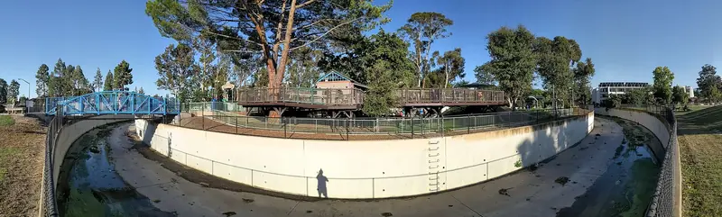
The neighborhood's big asset is Mitchell Park at 600 East Meadow Drive, which the city lists at 21.4 acres. It has the Magical Bridge Playground, an inclusive playground that opened in 2015, plus sports fields, tennis and pickleball courts, picnic areas and a fenced dog run. The Mitchell Park Library and Community Center sit at the park's Middlefield Road edge.
At the northern end, Hoover Park at 2901 Cowper Street adds a playground, a small dog run and shade trees. Families on the north side of the neighborhood often use it for a quick after-school stop, while Mitchell Park is the weekend destination.
Schools by attendance area
Few Palo Alto neighborhoods have this many schools close by. Palo Alto Online listed these public schools for South of Midtown:
- El Carmelo Elementary at 3024 Bryant Street, inside the neighborhood.
- Fairmeadow Elementary at 500 East Meadow Drive, across the street.
- JLS Middle School (Jane Lathrop Stanford) at 480 East Meadow Drive.
- Gunn High School on Arastradero Road, a longer bike ride away.
The split between El Carmelo and Fairmeadow depends on the exact address. Attendance areas can also change, so confirm any home with the PAUSD school finder. Our guide to PAUSD elementary schools compares the campuses.
Several private schools and preschools are nearby on Middlefield Road and Cowper Street. Enrollment details change often, so check each school's own site.
Shopping and services
Errands are easy. The Midtown shops on Middlefield Road around Colorado Avenue are a short walk or bike ride north, with groceries, cafes and services. To the south, the Charleston Shopping Center at Middlefield and East Charleston Road has Piazza's Fine Foods. Alma Village, rebuilt on the old Alma Plaza site, is on Alma Street. See our guides to Midtown shopping and groceries and specialty food.
Civic services are close as well. Fire Station No. 4 is at 3600 Middlefield Road. The Mitchell Park Library at 3700 Middlefield Road is one of the busiest branches in the city. Several churches line the east side of Middlefield Road between Loma Verde and East Meadow.
Getting around
South of Midtown is flat and compact, which makes it easy on a bike. Bryant Street, part of the city's bike boulevard network, runs straight through the neighborhood and carries cyclists north toward downtown. Students bike to El Carmelo, Fairmeadow and JLS in large numbers. See our guide to bike boulevards.
Residents told Palo Alto Online that Middlefield Road, East Meadow Drive and Alma Street can be busy, but traffic inside the neighborhood is rarely a problem. The California Avenue Caltrain station is about a 10 minute bike ride north. San Antonio station in Mountain View is a similar distance south. US 101 is reached by East Meadow Drive or Oregon Expressway.
Neighborhood association and community
South of Midtown has no association of its own. Palo Alto Online lists it as part of the Midtown Residents Association, which speaks for the wider area on city issues such as traffic, development along Middlefield Road and park improvements. Volunteer contacts change, so use the City of Palo Alto's neighborhood association list for the current one.
Block-level traditions fill the gap. A resident who moved from Kansas in 2013 told the Weekly about a welcome block party and a Halloween so popular that one street, South Court, was closed to traffic for trick-or-treaters. Residents describe a mix of young families, longtime owners, artists, musicians and tech workers. Traditions depend on volunteers, so details change from year to year.
Good to know
- East Meadow Drive is busy with bikes and cars at school start and end times.
- Two elementary schools serve the area. Check which one covers a specific address before you buy or rent.
- Mitchell Park's picnic areas can be reserved by residents through the city.
Families visiting relatives here often want a house with a yard near the park. You can browse house rentals in Palo Alto or look for hotels along El Camino Real, a few minutes west by car.
Frequently asked questions
Where is South of Midtown in Palo Alto?
Palo Alto Online defines South of Midtown as the area bounded by Loma Verde Avenue, East Meadow Drive, Middlefield Road and Alma Street. It sits directly south of Midtown and directly north of Mitchell Park. The name is descriptive rather than historic.
Does South of Midtown have its own neighborhood association?
Not a separate one. Palo Alto Online lists the area as part of the Midtown Residents Association, which covers the wider Midtown area. Check the City of Palo Alto's neighborhood association list for current contacts.
Which schools serve South of Midtown?
Palo Alto Online listed El Carmelo and Fairmeadow elementary schools, JLS Middle School and Gunn High School, so the elementary school depends on which side of the neighborhood you live on. Confirm any address with the Palo Alto Unified School District school finder.
What kind of homes are in South of Midtown?
Most original houses are single-story tract homes from the 1950s, many of them Eichler-style designs. Since the 2000s a large share has been remodeled or replaced with two-story houses, so blocks now mix original and new homes.
What parks are near South of Midtown?
Mitchell Park, a 21.4-acre city park with the Magical Bridge Playground and a dog run, is directly across East Meadow Drive. Hoover Park on Cowper Street is at the neighborhood's northern edge.