On this page
Foster City looks nothing like the older Peninsula towns around it. There is no 19th century main street and no train depot. Instead, the whole city sits on reclaimed marsh east of Highway 101, laid out in the 1960s around a winding saltwater lagoon. Houses back onto the water, bridges cross it and on a warm afternoon the channels fill with kayaks, pedal boats and small sailboats.
For a Palo Alto visitor, Foster City is an easy half day on the water. It is one of the few places nearby where you can rent a boat and paddle without dealing with tides. Residents come for the summer concerts, the flat levee trail and the long views of the San Mateo Bridge. This guide covers how to get there, the planned-city history, the lagoon rules, Leo J. Ryan Park and the rest of what is worth your time.
Where Foster City is and how far
Foster City is in San Mateo County, on the bay side of San Mateo, with Belmont and Redwood Shores to the south. Highway 101 forms its western edge. State Route 92 runs through the north end and becomes the San Mateo Bridge to Hayward. About four fifths of the city's total area is water, according to the Census Bureau.
From downtown Palo Alto it is about 15 miles. Outside rush hour the drive takes about 20 minutes on Highway 101. At peak times the stretch through Redwood City and San Mateo slows badly, so allow twice that.
Getting there from Palo Alto
By car
Take Highway 101 north and exit at East Hillsdale Boulevard, which leads straight into the city, or at Route 92 east and then Foster City Boulevard or Edgewater Boulevard. Parking is free and easy at the parks and shopping centers. The city has no paid meters to speak of.
By Caltrain and bus
No train runs into Foster City. The closest station is Hillsdale in San Mateo, which Caltrain places in zone 2, so it is a two-zone fare from Palo Alto: $6.25 in October 2026 and $6.50 from January 1, 2027. On the late October weekday timetable a local train took about 17 minutes. From there, SamTrans route 251 starts at Hillsdale Shopping Center near the station and runs a loop through Foster City. Check the SamTrans schedules page for current times, since buses are not frequent. Our Caltrain guide explains tickets and Clipper.
By bike
The San Francisco Bay Trail follows the Foster City shoreline on top of the levee. You can ride it north from Redwood Shores with almost no climbing. Getting from Palo Alto to Redwood Shores by bike means some busy crossings near Highway 101, so plan your route with care.
The planned-city history
Before the 1960s, this was Brewer Island, a stretch of marsh and diked pasture on the edge of the bay. The real estate developer T. Jack Foster and his firm, Foster Enterprises, bought much of the land and planned a complete new town on it. Crews raised the ground with engineered fill and dredged the lagoon. The lagoon was never just decoration. It was designed as the drainage system that keeps a low-lying city dry. The city still raises its level in summer and lowers it in winter to make room for storm water.
The first residents moved in on March 7, 1964. Wikipedia records that a San Francisco firefighter paid $23,500 for a four-bedroom house on Pilgrim Drive. Neighborhoods were built one after another, each with its own name, schools and small parks. Residents voted to incorporate and Foster City became a city on April 27, 1971. Foster Enterprises moved its offices to San Mateo in 2000 but is still in business.
Living on fill beside the bay has a cost. When FEMA mapped the whole city as a flood zone, residents faced much higher flood insurance bills. The city has been raising and strengthening its levee in response. Sea level rise keeps the topic on the agenda at city hall.
Business arrived along with the houses. Visa ran its headquarters in Foster City for years before moving its executive offices to San Francisco. The biotech company Gilead Sciences is still based here. Most visitors never see the office parks, which sit near Highway 92 and Vintage Park.
On the lagoon
The lagoon covers about 218 acres and winds through most of the city. Its average depth is about six feet. The city publishes clear rules on its water activities page:
- No gas or diesel engines. Boats must run on sail, electric battery or muscle.
- Speed limit 5 miles per hour for every vessel.
- Swimming is allowed everywhere on the lagoon. Use a bright swim cap or buoy so boaters can see you.
- Life jackets are required by state law for children under 13 on a moving boat.
- Fishing is allowed with a state license. The city says halibut and plenty of baitfish live in the lagoon.
Two public boat ramps serve the water, at Boat Park on Bounty Drive and at Leo Ryan Park on Shell Boulevard. Bridge clearance is about 22 feet at most crossings and 15 feet under Rainbow Bridge, which matters for sailboats.
Renting a boat
You do not need to own anything. The city lists a concession at the Leo Ryan Park boathouse that rents kayaks, pedal boats, stand-up paddleboards and windsurf boards and runs beginning windsurfing lessons. Kiteboarding schools work out of Baywinds Park on the bay shore, where the afternoon wind is steady. Our kayaking and paddling guide compares this with Shoreline Lake in Mountain View and tidal paddling at the Palo Alto Baylands.
Leo J. Ryan Park
The city's central park covers about 20 acres on the lagoon at Shell Boulevard and East Hillsdale Boulevard. It opened as Central Park and was renamed in 1979 for Leo J. Ryan, the local congressman who was killed in Guyana in November 1978 while investigating the Peoples Temple. A memorial stone, a plaza and public art honor him. The park was rebuilt in phases and rededicated in 2005.
Today the park holds the boathouse, a boardwalk, lawns, bocce courts, a waterfront amphitheater and a meadow used for festivals. In September 2026 the city opened its new Foster City Community Center in the park, with a grand opening on September 19. The city lists building hours of 8 a.m. to 8 p.m. Monday through Thursday, 8 a.m. to 5 p.m. Friday and Saturday and 8 a.m. to 2 p.m. Sunday, with later hours for some programs.
A loop path circles the park and is accessible. It makes an easy walk with a stroller. The water views change with the light through the day.

The bay shoreline
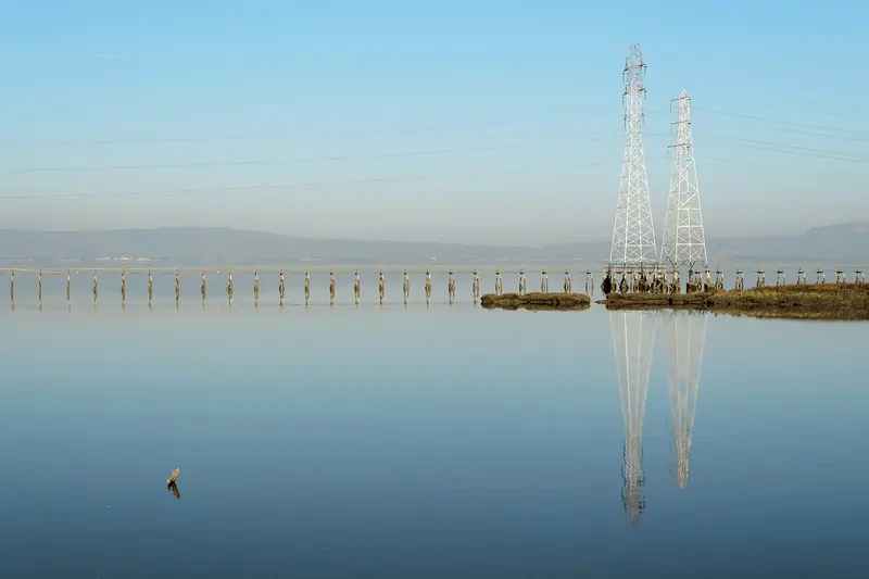
The levee along the outer edge of the city carries a paved section of the Bay Trail. It is flat, open and often windy, with views across to the East Bay hills and of planes heading for SFO. Walkers, runners and cyclists share it. At the north end, near the San Mateo Bridge, the old Werder Pier is a remnant of the original bridge. Wikipedia reports that it has been closed for repairs, so do not count on fishing from it.
Mariners Point, on city land near the bridge, has a 9-hole golf course and a driving range. The nearby shore is one of the best known windsurfing and kitesurfing spots on the Peninsula. On a summer afternoon you can watch dozens of kites over the water.
Events and culture
The city's special events page lists a full year of free or low-cost events:
- Fourth of July: breakfast, games, a bike and dog parade and a fireworks show. Fireworks are banned in Palo Alto, so this is one of the closer public shows. See our Fourth of July guide.
- Summer concerts: Friday nights from 6 to 8 p.m. in July and August at the Leo Ryan Amphitheater. Some listeners arrive by boat.
- Summer Days: a multi-day festival on the third weekend of August with carnival rides, food trucks, a car show and Rubber Ducky Races.
- Halloween Festival: trick or treating and contests for younger kids at the Leo Ryan Park Meadow.
- Holiday Tree Lighting: the second Wednesday of December.
Foster City also has a long-running community theater. Hillbarn Theatre was founded in 1940 and announced an 86th season for 2026 to 2027. It stages musicals and plays in a small house in town. Our theater guide covers the Palo Alto stages for comparison.
Food and shopping
Foster City has no downtown in the usual sense. Food and shopping cluster in a handful of shopping centers along East Hillsdale Boulevard, Foster City Boulevard and the Metro Center area near Route 92. Expect a broad mix: Chinese, Japanese, Indian, Mediterranean and Mexican places, cafes, bakeries and familiar chains, plus large grocery stores. Restaurants change often, so check a current map before you go. For a sit-down dinner, downtown San Mateo is ten minutes away.
If you want to stay near the water, a few business hotels sit near Route 92 and Highway 101. You can compare Foster City and San Mateo hotels for your dates.
Why a Palo Alto visitor might go
- Calm water. The lagoon has no tides, no motorboats and rentals on site, which makes it a gentle first paddle for kids.
- A flat shoreline walk. The levee trail has big views and almost no hills.
- Summer evenings. Free Friday concerts by the water are a pleasant change from a Palo Alto night out.
- Planning history. Foster City is one of the clearest examples of a postwar planned town in the Bay Area.
Good to know
- Wind picks up most afternoons, especially in summer. Paddle in the morning if you are new to it.
- Foster City is east of Highway 101, so allow extra time at rush hour on both the freeway and Route 92.
- The city posts lagoon water quality reports online. Check them before a swim after heavy rain.
- Bring a layer. The bay shore is often several degrees cooler and windier than Palo Alto.
Frequently asked questions
Can you swim in the Foster City lagoon?
Yes. The city says swimming is allowed in all areas of the lagoon. Swimmers should stay visible to boats, swim in daylight and use a bright cap or tow buoy. Buoys can be borrowed free at the Leo Ryan Park boathouse. The county tests the water and posts notices when a health risk is found.
Where can I rent a kayak in Foster City?
The city lists a concession at the Leo Ryan Park boathouse that rents kayaks, pedal boats, stand-up paddleboards and windsurf boards and also teaches beginning windsurfing. Kiteboard lessons are offered at Baywinds Park. Gas and diesel boats are banned on the lagoon and the speed limit is 5 miles per hour.
How far is Foster City from Palo Alto?
Foster City is about 15 miles north of downtown Palo Alto, roughly 20 minutes by car on Highway 101 outside rush hour. By transit, ride Caltrain to Hillsdale station in San Mateo and connect to a SamTrans bus. Check schedules first, since the bus link adds time.
Why is it called Leo J. Ryan Park?
The park opened as Central Park and was renamed in 1979 for Congressman Leo J. Ryan, who represented the area. Ryan was killed in Guyana in November 1978 while investigating the Peoples Temple. A memorial stone and plaza in the park honor him.
When are the Foster City summer concerts?
The city lists free concerts on Friday nights from 6 to 8 p.m. in July and August at the Leo Ryan Amphitheater. Some people arrive by boat and listen from the lagoon. Check the city's special events page each spring for the lineup.