On this page
Drive out Embarcadero Road toward the bay and you pass a small airfield tucked between the golf course and the marsh. Single-engine trainers circle overhead and medical helicopters stop to refuel. This is Palo Alto Airport, known to pilots as PAO.
The airport is easy to overlook, but it has a long history. It began in the 1920s on Stanford land, moved to the Baylands in the 1930s and went through a long fight over who should run it. This page covers each stage and explains how the field works today. If you are flying commercially, see our getting to Palo Alto guide instead.
The first airfield beside Stanford Stadium
Palo Alto's first airport sat next to Stanford Stadium, west of El Camino Real. The city's airport history says it was built in 1923. Other sources date it to the late 1920s. Wikipedia lists the Stanford Flying Club, founded in 1930, as the oldest of the flying clubs based at today's airport.
Planes and a growing college town did not mix well. A noise lawsuit filed in 1934 pushed the airport off Stanford land. The city's account says the airport moved to its present Baylands site in 1935. Wikipedia describes construction there running from 1934 to 1936.
A new home on the marsh
The new site lay at the end of Embarcadero Road on flat, open land at the edge of San Francisco Bay. In the 1930s almost nothing else was out there. A historical review of aerial photos found that before 1956 the only development nearby was the airport and the city's sewage treatment plant at the end of Embarcadero Way.
Neighbors arrived over the following decades. The municipal golf course opened next door in 1956. Business buildings went up along Embarcadero Road in the 1960s and 1970s. A Harvey gum factory stood near the airport until it was torn down in 1982. Much of the surrounding shoreline was later protected as the Baylands Nature Preserve. The old city landfill to the north became Byxbee Park.
The land under the airport has a complicated legal past. Much of the bay edge was once tideland and ownership of some of it is unclear. In 2014 the Federal Aviation Administration required a lease of at least 20 years from the California State Lands Commission so the airport could keep federal funding while the question is settled.

The county years, 1967 to 2014
In 1967 Santa Clara County began running the airport on land leased from the city. The county also runs Reid-Hillview Airport in San Jose and San Martin Airport in south county. The Palo Alto deal ran 50 years and was due to expire in 2017.
The arrangement grew awkward. The county carried the business risk but had little control over how the land was used. In 2006 the county said it did not want to continue after the lease ended. A county report by roads and airports director Michael Murdter found "no compelling reason" for the county to stay. A later consultant's study told Palo Alto it could run the airport at a profit. The city decided to take it back early.
- 2010: Palo Alto begins serious study of a takeover.
- August 5, 2014: The county Board of Supervisors approves the transfer agreement.
- August 11, 2014: The City Council approves the deal unanimously. A $610,000 federal runway grant depended on finishing the handover by mid-August.
- September 2014: The city takes over tenant billing. The county notice of September 3 says control returned to the city effective immediately.
Not everyone was sure it was a good bet. Then-Mayor Nancy Shepherd said it would be "tricky" for the city to make money. A citizen working group had suggested a nonprofit to manage the field, but the city chose to run it through its own staff.
General aviation today
PAO is a towered airport with one asphalt runway, 13/31, measuring 2,443 by 70 feet on about 102 acres. It has no airline service. Its users include private pilots, flight schools, flying clubs, maintenance shops and charter operators. In 2014 the airport manager put traffic at more than 180,000 takeoffs and landings a year, which at the time made it the third-busiest airport in the Bay Area by that measure.
The airport also has a public safety role. The city lists support facilities for CalDART, Life Flight and the county Sheriff's office and medical helicopters use it as a refueling stop. In winter storm season the city has also handed out sandbags at the airport, as our emergency preparedness page explains.
Flying here takes care. PAO sits under the busy airspace of San Francisco International and right next to San Jose's. Pilots also watch for birds and jackrabbits on the field. The only published instrument approach is a GPS approach to runway 31.
Noise, lead and the long-range plan
Three issues dominate airport news in Palo Alto.
- Noise. The airport asks pilots to follow voluntary noise abatement procedures and uses a flight tracking system to spot aircraft that do not. It also works with other Bay Area airports so visiting pilots know the rules.
- Leaded fuel. Most small piston planes still burn leaded avgas. The city presented an unleaded fuel transition plan in September 2024. Swift 100R, a high-octane unleaded fuel, arrived at the airport in December 2024.
- The long-range plan. The city began a Long Range Facilities and Sustainability Plan to guide the next 20 years and more. After a City Council study session on September 16, 2024, staff were told not to expand the airport's footprint. The plan was on pause as of late 2026.
The airport's history also includes tragedy. On February 17, 2010, a twin-engine plane that had just taken off from PAO in heavy fog struck power lines and crashed into an East Palo Alto neighborhood, killing the three people on board. The crash knocked out power across Palo Alto for much of the day. The details are on record with the National Transportation Safety Board.
For current notices, fuel and noise rules, see the city's airport planning page.
Airport timeline at a glance
- 1923 or late 1920s: The first Palo Alto airfield opens beside Stanford Stadium. Sources differ on the year.
- 1930: The Stanford Flying Club is founded.
- 1934: A noise lawsuit is filed against the Stanford-area field.
- About 1935: The airport moves to its Baylands site on Embarcadero Road.
- 1956: The municipal golf course opens next door.
- 1967: Santa Clara County begins operating the airport under a 50-year lease.
- 2006: The county says it will not renew when the lease ends in 2017.
- February 17, 2010: A plane leaving PAO in fog crashes in East Palo Alto.
- August 2014: The county and the city approve an early transfer and the city takes over.
- September 2024: The council holds a study session on the long-range plan and the city presents an unleaded fuel plan.
- December 2024: Unleaded Swift 100R fuel arrives.
Seeing the airport
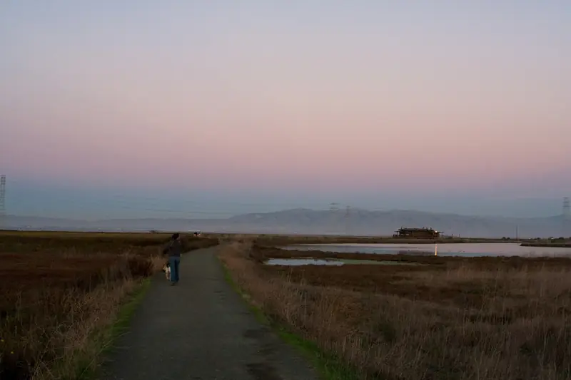
You do not need to fly to enjoy the airport. The levee trails of the Baylands run right beside the runway and give close views of landings, especially on weekend afternoons. Kids who love planes can watch from the trail while parents walk. Birders should note that the marshes around the field are some of the best on the Peninsula. Our birdwatching guide has tips.
Good to know
- The airport is at 1925 Embarcadero Road, east of Highway 101.
- Do not enter the airfield fence or the ramp without permission. Watch from public trails and parking areas.
- Golfers can play next door at Baylands Golf Links. See our golf guide.
- Commercial flights use SFO or San Jose. Our San Jose airport guide covers the closest one.
Frequently asked questions
Does Palo Alto have a commercial airport?
No. Palo Alto Airport is a general aviation field for private planes, flight schools and emergency aircraft. It has no airline service. The nearest commercial airports are San Jose Mineta (SJC) and San Francisco International (SFO).
When did Palo Alto Airport open?
The first Palo Alto airfield was built next to Stanford Stadium in the 1920s. The city dates it to 1923 while other sources say the late 1920s. After a noise lawsuit filed in 1934, the airport moved to its current Baylands site around 1935.
Who runs Palo Alto Airport?
The City of Palo Alto. Santa Clara County ran it from 1967 under a lease that was due to end in 2017. The city took over early, in August 2014, after both the county board and the City Council approved a transfer.
How long is the runway at Palo Alto Airport?
The single runway, 13/31, is 2,443 feet long and 70 feet wide. That suits small single and twin engine planes and helicopters but not airliners or most business jets.
Can you watch planes at Palo Alto Airport?
Yes. The Baylands trails and levees next to the airport give good views of planes landing and taking off. The airport sits beside the Baylands Nature Preserve and the Baylands Golf Links on Embarcadero Road.