On this page
Palo Alto's main roads look permanent now. US 101 runs along the bay, Interstate 280 rolls through the hills, Oregon Expressway and Page Mill Road cut across the middle and El Camino Real runs down the spine. Each was a choice. Most were fought over. This page traces how those roads arrived and the community battles that shaped them.
The story overlaps with the city's postwar boom, covered on our postwar growth page. For the much older road down the middle of town, read our El Camino Real history.
El Camino Real: the first highway
For its first decades Palo Alto had one through road: El Camino Real, the old mission route that became a state highway and then US 101. In 1936 the state tried to move the US 101 signs to the newer Bayshore Highway and re-sign El Camino as US 101 Alternate. Local opposition reversed that two years later. El Camino stayed US 101 and Bayshore was renamed US 101 Bypass. Only in 1962, when the Bayshore Freeway was finished, did US 101 move to the bay for good. El Camino became State Route 82.
Through the postwar years El Camino filled with motels, car lots and drive-ins. It still carries more local traffic than any other Palo Alto street.
The Embarcadero underpass, 1936
The railroad was the first barrier Palo Alto had to bridge. Embarcadero Road crossed the Southern Pacific tracks at grade beside the high school. According to PaloAltoHistory.org, faculty and residents had urged "the construction of a subway" there since 1916. Palo Alto Union High School opened at the corner in 1919 without one. In July 1924 principal Walter Nichols warned city officials that a child would one day be "carried home in a hearse from this corner."
At 8:45 a.m. on October 26, 1927, a train hit a car at the crossing. Mary Collins Harris died instantly and the driver, Max Springer, died later at Palo Alto Hospital. Students passed resolutions demanding an underpass that day. Even so, a $60,000 bond for the project failed in May 1929, a few votes short of the two-thirds it needed.
The money finally came from Washington. The underpass was built in 1936 with New Deal funds from a $4 million grade separation program. It took ten months and cost $160,000. It still carries Embarcadero Road under the tracks next to Palo Alto High School. The question of how roads should cross the railroad has never gone away. The city has spent years studying how to separate the tracks from Churchill Avenue, Meadow Drive and Charleston Road. Our railroad history page covers the line itself.
Bloody Bayshore
The Bayshore Highway was meant to take through traffic off El Camino. Wikipedia dates its first section, a toll road between San Bruno and San Francisco's Visitacion Valley, to 1929. PaloAltoHistory.org says the four-lane road linked San Francisco and San Jose by 1937.
It was not built for the car boom that followed. The road had four lanes divided only by a double yellow line, with traffic lights and left turns across oncoming cars. In the 1940s and 1950s its accident rate was about twice that of the average California highway. Drivers used the center lanes to pass. A police captain quoted in the San Mateo Times complained that motorists had turned it into a speed track. The nickname "Bloody Bayshore" stuck.
- On March 13, 1953, Betty Ireton, 35, of Palo Alto died in a head-on crash on Bayshore that reportedly woke residents a mile around.
- On June 8, 1957, a San Jose driver, Marion Scott, 42, died at Colorado Avenue and Bayshore in Palo Alto after being hit nearly head-on by a car that caught fire.
The Palo Alto Times and its editor Elinor V. Cogswell, for whom downtown's Cogswell Plaza is named, led the campaign for a safer road. Residents wrote letters, signed petitions and staged a "Bloody Bayshore Day." The state was already rebuilding Bayshore as a freeway, starting with a two-mile stretch between San Mateo and Burlingame in 1947, the Bay Area's first freeway. The pressure helped push the six-lane, divided freeway south. By one account it reached Palo Alto in June 1958. It was completed to San Jose and San Francisco in 1962.
The freeway also hardened a line on the map. It cut Palo Alto's Baylands off from the rest of town and ran along the edge of East Palo Alto, which had already been separated from Palo Alto by the county line. Bike and pedestrian bridges have slowly stitched the sides back together. The newest, over 101 at Adobe Creek, opened on November 20, 2021.
Oregon Expressway: the 1962 vote
By the early 1960s Oregon Avenue, a narrow residential street, had become the main link between the new Bayshore Freeway, El Camino Real and the booming Stanford Industrial Park. Traffic studies found it jammed at least three times a day. Santa Clara County proposed widening it into a near-freeway about 1.5 miles long. Its first plan would have removed about 107 homes at a cost of $2.5 million.
The fight split the city. Supporters held that the street was dangerous. On November 3, 1961, they parked more than 20 cars along Oregon Avenue and slowed traffic for more than two hours, one with a roof sign reading "This busy, narrow street is dangerous. Improve Oregon." Opponents, many of them part of the "residentialist" movement that wanted to slow growth, warned of slums along the new road and blamed Stanford, the industrial park and downtown merchants. The council won a modified design with a median, six cross streets and a promised 30 mph limit. It still required more than 90 homes to go.
On June 5, 1962, voters approved the expressway 9,432 to 9,030, a margin of 402. Opponents led until late returns came in from the Walter Hays School area. Mayor David Haight had endorsed it the day before, with a "no trucks on Oregon" pledge. Over the next year houses were moved or bulldozed and the expressway was in use by about 1964. The county numbered the route G3 in 1962.
Oregon Expressway became a social line as well as a road. Locals still divide north and south Palo Alto there. The old avenue survives as a frontage street on the north side. A county rehabilitation project begun in 2014 rebuilt the median and signals.
Page Mill Road and Interstate 280
Page Mill Road began as the Mayfield to Pescadero road, a route over the mountains named for the Page sawmill on the far side, near today's Portola Redwoods State Park. Today the urban part of Page Mill and all of Oregon Expressway form County Route G3, a 4.5-mile route from Interstate 280 to US 101 through the Stanford Research Park.
Interstate 280, the Junipero Serra Freeway, was the second freeway. Its scenic section between Cupertino and Woodside was completed in the late 1960s and has been called the "World's Most Beautiful Freeway" since its dedication. When it came through the Palo Alto hills in 1969, Page Mill Road was moved onto a new alignment over the hills to the south and widened from two lanes to five. The old road past Frenchman's Tower became Old Page Mill Road, with its center line removed and car access limited. It is now a favorite of cyclists. See our biking guide.
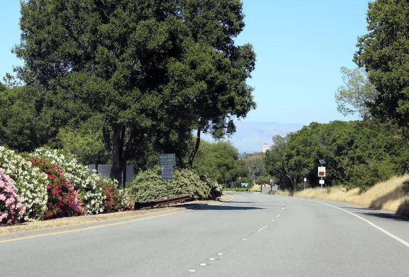

Foothill Expressway followed in the mid-1960s, laid largely on the right of way of the Mayfield Cutoff rail line, whose passenger service ended in early 1964. It meets Page Mill Road at a signal near the research park.
Road timeline
| Year | Event |
|---|---|
| 1927 | Fatal train crash at the Embarcadero crossing on October 26. |
| 1929 | Underpass bond fails. First section of Bayshore Highway opens near San Francisco. |
| 1936 | Embarcadero underpass opens. US 101 signs briefly moved to Bayshore. |
| 1947 | First Bayshore Freeway segment opens between San Mateo and Burlingame. |
| About 1958 | Bayshore Freeway reaches Palo Alto. |
| 1962 | Oregon Expressway approved June 5. Bayshore Freeway completed. El Camino becomes Route 82. |
| Mid-1960s | Oregon and Foothill expressways open. |
| 1969 | Interstate 280 completed through the area. Page Mill Road rerouted. |
| 2021 | Adobe Creek bike and pedestrian bridge over 101 opens. |
Driving these roads today
Highway 101 exits for Palo Alto are San Antonio Road and the shared Oregon Expressway and Embarcadero Road interchange. University Avenue is just over the line in East Palo Alto. From Interstate 280, take Page Mill Road or Sand Hill Road. The Oregon Expressway underpass at Alma Street is notorious for flooding in heavy rain. When it closes, drivers detour to Churchill Avenue or Charleston Road. Our guide to driving to Palo Alto covers parking and peak hours.
Frequently asked questions
Why was the Bayshore Highway called Bloody Bayshore?
The old Bayshore Highway was a four-lane road with only a double yellow line between opposing traffic, plus traffic lights and left turns across oncoming cars. In the 1940s and 1950s its accident rate was about twice the California average. The Palo Alto Times led a campaign that helped bring the divided Bayshore Freeway.
When was Oregon Expressway built?
Palo Alto voters approved it on June 5, 1962, by 9,432 votes to 9,030. More than 90 homes on the south side of Oregon Avenue were moved or torn down over the next year and the expressway was in use by about 1964.
When did Interstate 280 open near Palo Alto?
The scenic section between Cupertino and Woodside, which passes Palo Alto's western hills, was completed in the late 1960s. Wikipedia dates the stretch near Page Mill Road to 1969, when Page Mill Road was rerouted and widened.
What is Old Page Mill Road?
It is the original narrow route of Page Mill Road over the hills near Interstate 280. When the freeway came through in 1969, Page Mill was moved onto a new, wider alignment. The old road was renamed and limited to local and eastbound traffic and is now popular with cyclists.
Why is there an underpass on Embarcadero Road at the railroad?
Residents had asked for one since 1916. After a train killed two people at the crossing next to Palo Alto High School in October 1927 and a bond measure failed in 1929, the city built the underpass in 1936 with New Deal grade separation funds. It cost $160,000.