On this page
The Bay Area is a ring of cities, hills and water and the best way to see it is to drive around the ring once. Palo Alto makes a good starting point. It sits on the southern half of the loop with two airports nearby, so you can pick up a car, drive north through San Francisco and Marin to wine country, come back down through the warm East Bay valleys and finish along the Pacific coast without covering the same road twice.
This plan runs seven days and six nights, with notes on cutting it to five or six. It is written for a first trip by car. If you would rather keep one hotel and do day trips, read our guide to Palo Alto as a base first and compare.
The loop at a glance
| Day | Route | Driving | Night |
|---|---|---|---|
| 1 | Palo Alto to San Francisco | About 1 hour | San Francisco |
| 2 | Golden Gate, Sausalito, Muir Woods, Point Reyes | About 2.5 hours | West Marin or Petaluma |
| 3 | Petaluma and Sonoma | About 1 hour | Sonoma or Napa |
| 4 | Napa Valley | Short hops | Napa |
| 5 | Livermore Valley to Santa Cruz | About 3 hours | Santa Cruz |
| 6 | Monterey and Carmel | About 1 hour | Monterey or Carmel |
| 7 | Point Lobos and the coast home | About 3 hours | Palo Alto |
Five days: drop Day 3 by driving from Point Reyes straight to Sonoma, then skip the Livermore stop on Day 5. Six days: keep everything but spend one night in wine country instead of two.
Before you set off
- The car. Pick it up at SJC or SFO, or in town if the branch hours suit you. A midsize car is plenty. Compare rental cars for a week and check the toll policy before you sign.
- Reservations. Muir Woods parking or shuttle, two or three Napa tastings and Monterey Bay Aquarium tickets. Book hotels for Napa and Monterey early on fall weekends.
- Tolls. Bay Area bridges collect electronically in one direction only. This loop crosses the Golden Gate northbound and the Benicia-Martinez Bridge southbound, both untolled directions. Confirm with our bridges and tolls guide, since a detour can change that.
- Packing. Layers for fog on the coast and heat in the valleys, plus offline maps for West Marin, Big Sur and the San Mateo coast.
Days 1 and 2: San Francisco and Marin
Day 1: into the city
Spend the morning in Palo Alto on the Stanford campus, then drive Interstate 280 north, about an hour to central San Francisco. City parking is scarce and expensive, so one smart variation is to do your San Francisco day by Caltrain before the road trip and pick up the car on Day 2 instead. Either way, cover the Embarcadero, the Ferry Building and North Beach. Alcatraz closed on October 26, 2026 for dock repairs and was expected to reopen by about November 18, so check its status before you plan around it. Our San Francisco guide has a walking plan.

Day 2: over the bridge
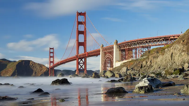
Cross the Golden Gate Bridge early and stop at the Vista Point on the north side. Sausalito is ten minutes beyond. Then head for Muir Woods, where you need a parking reservation for $10 per standard vehicle plus a $15 entrance fee for anyone 16 and older. The flat loops along Redwood Creek take 30 to 90 minutes. Book through GoMuirWoods.
In the afternoon, drive the winding roads west to Point Reyes National Seashore. There is no entrance fee. The lighthouse sits at the bottom of 313 steps that close at 4 p.m., so watch the clock in winter. Tule elk graze at Tomales Point. Sleep in West Marin or drive 40 minutes east to Petaluma, which has more rooms.
Days 3 and 4: Sonoma and Napa
Day 3: Petaluma to Sonoma
Walk Petaluma's iron-front downtown on the river, then visit the Petaluma Adobe, a state historic park open daily for a $3 adult fee. Continue to Sonoma, about 30 minutes east. The town is built around a big plaza with a mission and old adobe barracks. Sonoma wineries tend to be more relaxed than Napa's and many sit close to town. Book one afternoon tasting and walk to dinner.
Day 4: Napa Valley
Napa Valley runs about 30 miles from the city of Napa to Calistoga. Book two or three tastings, not five. Each takes 60 to 90 minutes and Napa fees run well above Sonoma's. Cluster them on one road, eat a proper lunch in Yountville or St. Helena and drink water between pours. You must be 21 to taste and nobody who tastes should drive. The Napa Valley Wine Train, leaving from McKinstry Street in Napa, takes the car out of the day entirely. Our Napa and Sonoma guide compares the two valleys. Harvest ends in October. In November the vine leaves turn gold and the crowds thin.
Day 5: Livermore and on to Santa Cruz
This is the long driving day, so start by 9 a.m. Take Highway 12 and Interstate 80 to Interstate 680 and follow it south over the Benicia-Martinez Bridge, then east on Interstate 580 to the Livermore Valley. It has more than 50 wineries and some of California's oldest: Wente and Concannon were both founded in 1883. Downtown Livermore's First Street is a good lunch stop and the Centennial Light, a bulb burning almost continuously since 1901, hangs in a fire station on East Avenue.
From Livermore, Interstate 680 runs south to San Jose. Pick up Highway 17 over the Santa Cruz Mountains and arrive in Santa Cruz by late afternoon. Walk West Cliff Drive at sunset. From mid-October to mid-February, monarch butterflies cluster in the eucalyptus grove at Natural Bridges.
Day 6: Monterey and Carmel
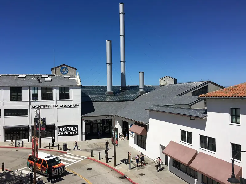
Drive around the bay to Monterey, about an hour south. Spend the morning at the Monterey Bay Aquarium at 886 Cannery Row, where tickets are worth buying ahead. After lunch, take 17-Mile Drive, a private road with a per-car gate fee. Exit at the Carmel gate. Walk Ocean Avenue down to Carmel Beach for sunset. Our Monterey and Carmel guide covers the details. If you want a guide for part of the day, you can browse Monterey and Carmel tours.

Adding Big Sur
With an extra day, drive south from Carmel into Big Sur. Highway 1 reopened on January 14, 2026 and Caltrans listed one-way traffic control at three spots on October 30, 2026. Parking near Bixby Bridge is banned from August 2026 and Pfeiffer Big Sur State Park reopened on October 16, 2026 after the Timber Fire. Gas and cell service are scarce. Check Caltrans QuickMap that morning.
Day 7: Point Lobos and the coast home
Start at Point Lobos, about 3 miles south of Carmel, when the gates open at 8 a.m. The fee is $10 per vehicle and dogs are not allowed, not even in parked cars. Walk the Cypress Grove Trail, then drive north. Skip the freeway through Santa Cruz and stay on Highway 1 past Davenport, Año Nuevo and Pigeon Point Light Station, where the tower is closed for restoration but the grounds stay open. From December 15 to March 31, Año Nuevo runs guided elephant seal walks that you book ahead.
Have a late lunch in Pescadero. Duarte's Tavern has served artichoke soup and pie since 1894 and closes on Tuesdays. Then follow Highway 1 to Half Moon Bay and climb Highway 92 home, about 45 minutes. Our Pescadero and the coast guide covers the stops along this stretch.
Booking the overnights
Book the nights in Napa and Monterey first. Both fill on fall weekends and both are cheaper midweek. Santa Cruz and Petaluma usually have more choice. Starting and ending in Palo Alto also means you can leave extra luggage at your Palo Alto hotel if you have a night there at either end. Compare hotels along the route and look for free cancellation in case the weather moves a day.
Good to know
- Rain is most likely from November to March. Keep a flexible day for storms on the coast.
- Do not leave bags in a parked car at Muir Woods, Point Reyes, Point Lobos or in San Francisco.
- The Golden Gate Bridge has no cash lanes. A southbound crossing is $10.25 with FasTrak from July 1, 2026.
- Fill up before Big Sur, West Marin and the coast south of Half Moon Bay.
Frequently asked questions
How many days do you need for a Bay Area road trip?
Seven days covers San Francisco, Marin, wine country, Santa Cruz, Monterey and the coast at a comfortable pace. Five days works if you skip the Livermore stop and spend one night in wine country instead of two. Fewer than five turns it into a lot of driving.
Which direction should I drive the loop?
Go north first, through San Francisco and over the Golden Gate Bridge, then return south. The Golden Gate charges tolls only southbound, so crossing it northbound costs nothing. Ending on the coast also leaves the most scenic drive for the last day.
Do I need reservations along the way?
For several stops, yes. Muir Woods requires an advance parking or shuttle reservation. Most Napa and Sonoma wineries expect tasting reservations. The Monterey Bay Aquarium sells tickets ahead. Alcatraz closed on October 26, 2026 for dock repairs and was expected back by about November 18.
Is Highway 1 through Big Sur open?
Highway 1 through Big Sur reopened on January 14, 2026 and Caltrans listed one-way traffic control at three spots on October 30, 2026. Parking near Bixby Bridge is banned from August 2026. Check Caltrans QuickMap on the morning you drive, since winter storms can close the road.
Can I do this road trip in winter?
Yes, with some care. Rain is most likely from November to March and storms can close coastal roads for a day or two. In return you get monarch butterflies in Santa Cruz and Pacific Grove, migrating gray whales and, from December 15, the elephant seal walks at Año Nuevo.