On this page
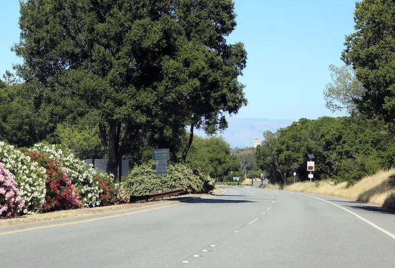
If you ask a Palo Alto cyclist where to ride on a free morning, the answer is often just "the Loop." It is a ring of quiet foothill roads west of town: Arastradero Road over the first ridge, a short stretch of Alpine Road, the length of Portola Road through Portola Valley and the long sweep of Sand Hill Road back toward Stanford. It has no single big climb, but it rolls all the way, with oak woodland, horse pastures and the long green wall of Windy Hill on one side.
This page rides it clockwise from California Avenue station and finishes at Palo Alto station, so you can come and go by Caltrain. For the wider picture of cycling here, start with our biking guide. For the big climbs that branch off the Loop, see our road cycling climbs page.
The ride at a glance
Distances and climbing below are our estimates. We traced the route on OpenStreetMap with a cycling router and sampled U.S. Geological Survey elevation data along it, then checked the result against club descriptions of the ride. Different devices and start points will give slightly different numbers, so read them as approximate.
| Section | Roads | Approximate distance |
|---|---|---|
| Town to the foothills | Park Boulevard, Barron Park streets, Bol Park path, Arastradero Road | About 5.5 miles |
| Over the first ridge | Arastradero Road, a short jog on Page Mill Road | About 2 miles |
| Portola Valley | Alpine Road, then Portola Road | About 4.5 miles |
| Home | Sand Hill Road, Stanford campus | About 6 miles |
| Total | About 18 miles, 1,000 to 1,200 feet of climbing |
Start, parking and Caltrain
The cleanest start is California Avenue station. Caltrain's electric trains carry two bike cars each, so you can arrive from San Francisco or San Jose with your bike and finish at Palo Alto station, one stop north. On weekends, trains run about every 30 minutes, so check the timetable before you set off.
If you drive, park in one of the free public lots around California Avenue on a weekend morning and ride from there, or start at the Pearson-Arastradero Preserve lot at 1530 Arastradero Road. That lot serves hikers first and fills on sunny weekends, so be early or leave it to them. Do not plan on parking along Portola Road, where Midpen warns that enforcement near the Windy Hill lot is strict.
Turn by turn
- California Avenue station to Barron Park. Leave the station on the west side and ride south on Park Boulevard. Follow the quiet streets of Barron Park to the Bol Park path, the paved trail on an old rail line. Our Bol Park guide covers it, donkeys included.
- Arastradero Road. The path ends at Arastradero Road near Gunn High School. Turn right and ride west, crossing Foothill Expressway at the signal. The road climbs gently past the preserve entrance.
- The Page Mill jog. Arastradero meets Page Mill Road. Turn right onto Page Mill for about 0.3 mile, then left to pick up Arastradero again. Traffic on Page Mill moves fast here, so signal early and use the turn lanes.
- Over Interstate 280. Arastradero crosses the freeway and climbs over a low ridge with a couple of short, steep pitches. Then it drops to Alpine Road beside Rossotti's Alpine Inn.
- Alpine Road. Turn left and ride west on Alpine Road for about a mile. It climbs gently along the creek to the junction with Portola Road at Triangle Park.
- Portola Road. Turn right onto Portola Road. You pass the Portola Valley Town Center, the Windy Hill lot and long stretches of pasture. After about 3.4 miles you reach Sand Hill Road.
- Sand Hill Road. Turn right. Sand Hill rises briefly, crosses Interstate 280 at a busy interchange and then descends for miles past SLAC, the Rosewood and Sharon Heights toward Stanford.
- Stanford to the station. Past Stanford Shopping Center, turn right on Arboretum Road and ride through the campus to Palm Drive and Palo Alto station.
Surface and traffic
The whole Loop is paved. Most of it has a bike lane or a usable shoulder, but widths change from block to block and a few spots squeeze down to almost nothing. The traffic picture changes by section.
- Arastradero Road carries school traffic near Gunn on weekdays and steady cars toward Interstate 280. Weekend mornings are calmer.
- Alpine and Portola roads are the heart of the ride. Speeds are lower and you share them with many other cyclists, horse trailers and walkers heading for the trails. Watch for riders pulling out of the Windy Hill lot.
- Sand Hill Road is the busiest part. Cars merge on and off Interstate 280 at speed. Hold your line, look over your shoulder before crossing a ramp and do not assume a driver has seen you.
Group rides are part of the scene here. On Saturday mornings club rides roll through Portola Valley in long lines. Our cycling clubs page explains which rides suit which pace. If you join a group, ride two abreast only where the lane allows it and single out when cars stack up behind.

Water, restrooms and a cafe stop
Carry two bottles. The Loop has fewer public taps than you might expect for a ride so close to town.
- Pearson-Arastradero Preserve. The city's preserve map marks restrooms and drinking water at the parking lot on Arastradero Road. The city's alerts page, updated in September 2026, listed no closure of those facilities, but it did not describe them either, so treat them as likely rather than certain.
- Triangle Park. The Town of Portola Valley describes this small park at the corner of Portola and Alpine roads as a place where cyclists and walkers can take a break, with picnic tables and nearby delis and markets. Its page does not mention restrooms.
- Roberts Market. The Portola Valley store at 4420 Alpine Road sits at the same junction. Its website, updated in November 2026, lists the store and links to its deli menu. Buy a drink or a sandwich and eat it at Triangle Park.
For coffee and a pastry, add a short detour at the end of Portola Road. Turn right onto Sand Hill as usual, then almost at once turn left onto Whiskey Hill Road and follow it about 1.4 miles to Woodside Road. Turn left into the village. The Village Bakery at 3052 Woodside Road lists its bakery counter as open daily from 7 a.m. to 6 p.m. and says it is open for walk-ins. Ride back the same way to Sand Hill. The detour adds about 3.5 miles round trip. Our Woodside food guide covers the other places in the village.
Closures and what we checked
We checked the City of Palo Alto, Midpen, San Mateo County Parks and Caltrans in early November 2026. Here is what we found for this route:
- Roads. We found no posted closures on Arastradero, Alpine, Portola or Sand Hill roads. Caltrans news for the district listed no work on these roads, which are local and county roads rather than state highways.
- Pearson-Arastradero Preserve. The city closed about 4.1 acres of the Page Fire burn scar from June 22, 2026 to June 30, 2027. The city says the closure does not affect trails or fire roads.
- Windy Hill. Midpen listed the trail connector between the Hamms Gulch and Eagle trails as closed for bridge repairs from November 3 to 6 and suggested Alpine Road as the bypass. That affects trail users, not the road loop.
For live conditions, check Caltrans QuickMap for anything on Interstate 280 ramps and the city's preserve alerts page if you plan to stop at Arastradero.
Safety on the Loop
Good to know
- Three feet: California law requires drivers to leave at least 3 feet when passing a bicycle. Since 2023 drivers must also change lanes to pass when another lane is available. Neither rule makes a blind curve safe, so ride predictably.
- Lights: state law requires a white front light and a red rear reflector after dark. Run a flashing rear light by day too. Oak shade on Portola Road hides riders.
- Helmets: required by law for riders under 18 and wise for everyone.
- Horses: Portola Valley is horse country. Slow down, call out early and pass wide.
- Interchanges: the Interstate 280 crossings on Arastradero and Sand Hill are the riskiest moments. Look, signal and commit.
Seasons and weather
The Loop works all year, which is part of its appeal. Winter brings the rain: most of Palo Alto's roughly 15 inches a year falls between November and March. After a storm, Portola Road collects leaves, gravel and the odd fallen branch. Shaded corners stay damp into the afternoon. Daylight saving time ended on November 1, 2026, so by mid-November it is dark before 5 p.m. Leave enough time to finish in daylight or carry real lights.
Spring is the prettiest season, with green hills and wildflowers along Arastradero. Summer mornings are ideal, but afternoons in Portola Valley can be several degrees hotter than downtown. In late summer and fall, check the air quality if there is wildfire smoke in the region. Our weather guide covers the patterns month by month.
Shorter and longer versions
To cut the ride in half, turn right on Alpine Road at the Alpine Inn instead of left and follow it back down to Stanford. That is our Arastradero loop. To make it longer, add Old La Honda Road, which starts from Portola Road just south of Sand Hill and climbs 3.3 miles to Skyline. To add a gentle out-and-back, ride further up Alpine Road past Portola Road; our Alpine Road page describes it. For background on the town you ride through, see our Portola Valley guide.
Frequently asked questions
How long is the Portola Valley Loop?
Our estimate is about 18 miles if you start at California Avenue station and finish at Palo Alto station, with roughly 1,000 to 1,200 feet of climbing. Riders who start and finish at the same spot on Stanford's side of town often ride a little less. Every bike computer reads it a bit differently, so treat these figures as approximate.
Which direction should I ride the Loop?
Both directions are popular. This guide rides it clockwise: Arastradero first, then Alpine, Portola Road and home on Sand Hill. Many club rides go the other way, out on Sand Hill and back on Alpine and Arastradero. Clockwise gives you a long gentle descent on Sand Hill at the end.
Is the Portola Valley Loop good for beginners?
It suits riders who are comfortable on roads with traffic and can climb for a few minutes at a time. There are no long climbs, but Arastradero has a couple of short steep pitches and Sand Hill carries fast cars near Interstate 280. New riders can shorten it to the Arastradero loop.
Where can I get water on the Portola Valley Loop?
Bring two bottles. Roberts Market on Alpine Road at the Portola Road junction sells drinks and sandwiches and Triangle Park beside it has picnic tables. The city's preserve map marks restrooms and water at the Pearson-Arastradero lot, but we could not confirm their 2026 status on a city page.
Is the Loop closed anywhere right now?
We found no road closures on the Loop in early November 2026. Midpen listed a short trail connector closure at Windy Hill for bridge repairs from November 3 to 6, which affects hikers rather than road riders. Check the Caltrans QuickMap and town notices before you go.