On this page
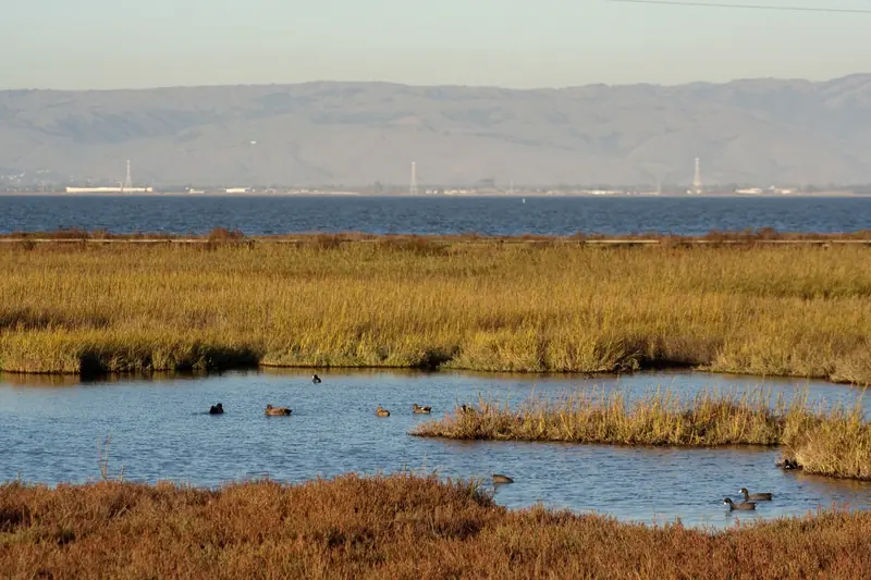
Look east from the Palo Alto Baylands and almost everything you see, the salt ponds, the mudflats, the marsh along the far shore, belongs to one refuge. Don Edwards San Francisco Bay National Wildlife Refuge protects 30,000 acres of habitat around the south bay for millions of migratory birds and several endangered species. The U.S. Fish and Wildlife Service calls it a wildlife oasis in an urban sea.
The refuge was established in 1972 after local activists fought plans to fill the bay. It was the first urban national wildlife refuge in the country. In 1995 it was renamed for Congressman Don Edwards, who pushed to protect the south bay wetlands. This guide focuses on the parts most useful to Palo Alto visitors: the Fremont headquarters across the Dumbarton Bridge, the Alviso unit near San Jose, the best levee trails, the birds and the fishing pier.
Getting there from Palo Alto
The Fremont headquarters is about 20 to 25 minutes from downtown Palo Alto. Take University Avenue or Willow Road to Highway 84 and cross the Dumbarton Bridge. On the Fremont side, follow signs to Thornton Avenue and Marshlands Road. The headquarters is at 1 Marshlands Road.
The Dumbarton Bridge only collects tolls westbound, so the trip over is free and the drive home costs the toll. It is $8.50 for a car in 2026 and rises to $9.00 with FasTrak on January 1, 2027. The bridge also has a separated path for bikes and pedestrians if you want to ride over. Our East Bay travel guide has more on the bridge.
The Alviso unit is the other main visitor area, about 20 minutes south by Highway 101 and Highway 237. The refuge also has small units on the Peninsula: Bair Island in Redwood City and Ravenswood in Menlo Park.
Hours, fees and the visitor center
| Place | Published hours |
|---|---|
| Vehicle entrance gate, Fremont | 7 a.m. to 7 p.m. |
| Trails | Sunrise to sunset |
| Fremont visitor center, 2 Marshlands Road | Saturday and Sunday, 10 a.m. to 2 p.m. (visit page); 7 a.m. to 5 p.m. (home page) |
| Holidays | Buildings closed on federal holidays; Fremont closed Thanksgiving, Christmas and New Year's Day |
The two published visitor center schedules do not match, so call 510-792-0222 before planning around it. The refuge does not list an entry fee on its visit pages. Check the official refuge site for alerts.
When it is open, the visitor center is a good first stop. Staff and volunteers hand out maps and brochures. There are displays, videos and binoculars aimed at the marsh. Kids can explore the Nature Discovery Area just outside.
The Alviso Environmental Education Center
The refuge lists the Environmental Education Center at 1751 Grand Boulevard in Alviso, San Jose, but gives no public hours for it. Its visit page describes a butterfly garden and a self-guided nature play area and suggests pairing it with Fremont for a half-day trip. Santa Clara County lists the center's phone number as (408) 262-5513.
The building is due for change. A Fish and Wildlife Service flyer describes two classrooms, a small auditorium, an enclosed observation platform and limited exhibit space that need updating. The service ran a visioning process with community workshops from November 2023 to April 2024 to plan new facilities. It has not posted a construction schedule. Treat the building as open by program or arrangement only and call before you go. The trails beside it follow the refuge's sunrise to sunset hours.
Trails worth the drive
The refuge has more than 30 miles of trails, mostly flat levees that turn to mud after rain. These are the ones the Fish and Wildlife Service describes in detail.
Fremont, near the visitor center
- Tidelands Trail: a loop of 1 to 1.4 miles through uplands, tidal slough, salt pond and tidal marsh. Shorebirds and grebes crowd the pond in winter; Forster's terns and American avocets take over in summer. Dogs allowed on leash.
- LaRiviere Marsh Trail: 0.7 miles one way on a dirt levee with a wooden boardwalk through a salt marsh restored from a commercial salt crystallizer bed. The refuge's top spot for Ridgway's rails at low tide.
- Newark Slough Trail: a 5.11-mile loop reached by walking the Tidelands Trail and crossing the footbridge over Newark Slough. Tidal marsh, slough and salt ponds, with salt marsh harvest mice and rails in the pickleweed.
- Coyote Creek Lagoon Trail: 2.5 miles one way on a gravel levee behind a Fremont business park, with two trailheads. Wheelchair accessible from the south lot.
A 1.41-mile levee across the Newark salt ponds links the refuge to the Apay Trail in Coyote Hills Regional Park, so you can walk or ride between the two.
Alviso
- Mallard Slough Trail: a 3.72-mile loop. White pelicans, double-crested cormorants, winter ducks, spring and fall shorebirds and Caspian terns in spring and summer. It also gives views of Drawbridge, the refuge's ghost town.
- Alviso Slough Trail: a 10.74-mile loop on levees that the refuge recommends for bikes. Combined with the Mallard Slough Trail it makes a 12.3-mile loop. The refuge says 10,000 ducks use the managed ponds here in winter.
- New Chicago Marsh boardwalk: a 0.39-mile wheelchair-accessible loop from the Environmental Education Center parking lot over a salt marsh with egrets and herons.
On the Peninsula side
The Bair Island Trail in Redwood City runs 1.7 miles one way on its longer section, with an observation platform over restored marsh. The Moffett Bay Trail links Sunnyvale to Mountain View for 2.25 miles one way. The short Faber-Laumeister Trail leads to the bay's edge near the Palo Alto side, with bank fishing at the end. For the routes close to home, see our Bay Trail guide and our Baylands guide.
Closures, hunting and conditions
The refuge warns that storm damage and long-deferred maintenance affect more than 70 miles of habitat berms and 40 miles of public roads and trails. Some places have partial closures for safety. From August 31 through November 2026, levee repairs at Pond A2W close the Song Sparrow Spur Trail along the pond's eastern and northern levee.
Waterfowl hunting is allowed in designated managed ponds from mid-October to late January. Hunters use the Carl Road trailhead and the South Shoreline Trail near Shoreline Amphitheatre to reach blinds. Wear bright colors on those trails in season and obey all signs.
Birds and wildlife
The Fish and Wildlife Service counts 15 habitat types, more than 340 plant species and 280 bird species on the refuge. Millions of birds pass through in peak migration. Two endangered residents are found only around San Francisco Bay: the Ridgway's rail and the salt marsh harvest mouse.
- Winter: ducks by the thousands, northern shovelers and grebes on the ponds, shorebirds on the mudflats at low tide.
- Spring and fall: migrating shorebirds peak. The refuge calls the Alviso trails excellent for birding in migration.
- Summer: American avocets, Forster's terns and Caspian terns.
Time your visit to the tide. A falling tide exposes mudflats and pulls rails to the slough edges. Our birdwatching guide covers the Palo Alto side.

The Dumbarton Fishing Pier
The Dumbarton Fishing Pier is the eastern remnant of the original Dumbarton Bridge, which opened on January 17, 1927 as the first vehicle bridge across San Francisco Bay. The current high bridge replaced it in October 1982. The refuge lists the pier as one of its three fishing spots and says no fishing license is needed on it. Anglers catch striped bass, sculpin, sharks, croaker, halibut, sturgeon and crabs.
The refuge does not post a current status or hours for the pier. A guidebook site says it is not open at night. Given the storm damage notices, call 510-792-0222 before driving over to fish. Our fishing guide covers licenses and the mercury advisory for bay fish.
Dogs, bikes and other rules
- Dogs: on a 6-foot leash only on the Tidelands Trail, Harrier Spur Trail, Quarry Trail and Marshlands Road near the Fremont visitor center. Prohibited everywhere else.
- Bikes: allowed on many multi-use levees. Yield to walkers. E-bikes are allowed where bikes are, if the refuge manager finds them compatible.
- Horses: the refuge does not list horseback riding among its activities.
- Drones: prohibited on refuge land near the ponds, according to Santa Clara County's Alviso notice.
- Groups: organized groups, tours and any portrait or event photography need a special use permit.
- Drawbridge: the ghost town is closed to visitors. View it from the Mallard Slough or Alviso Slough trails.
Safety and what pairs nearby
Good to know
- There is almost no shade on the levees. Bring water, sunscreen and a windbreaker; afternoon wind off the bay is common.
- Levees turn to slick mud after rain. Watch footing near water.
- Restrooms and water are at the Fremont visitor center and the Bair Island lot. Many trailheads have none.
- Mosquitoes can be thick near marshes on warm evenings.
Pair Fremont with Coyote Hills next door. The Apay Way bridge crosses Highway 84 at the toll plaza to link the two. Pair Alviso with the boardwalks at Alviso Marina County Park.
Frequently asked questions
When is the Don Edwards refuge visitor center open?
The refuge's own pages disagree. Its home page lists the Fremont headquarters and visitor center at 7 a.m. to 5 p.m., while its visit page lists the visitor center at 2 Marshlands Road as open Saturday and Sunday from 10 a.m. to 2 p.m. Buildings close on federal holidays. Call 510-792-0222 before a weekday visit.
Is the Alviso Environmental Education Center open?
The U.S. Fish and Wildlife Service lists the center at 1751 Grand Boulevard in San Jose but posts no public hours for it. It ran a public visioning process from November 2023 to April 2024 to plan new facilities. The trails and boardwalk beside it are part of the refuge, which keeps trails open sunrise to sunset. Call before you go.
Can I bring my dog to the Don Edwards refuge?
Only on four routes near the Fremont visitor center: the Tidelands Trail, the Harrier Spur Trail, the Quarry Trail and Marshlands Road. Dogs must be on a 6-foot leash. They are prohibited on all other trails and lands throughout the refuge, including Alviso.
Is the Dumbarton Fishing Pier open?
The Fish and Wildlife Service still lists the pier and says no fishing license is needed there, but it does not post a current status or pier hours. The refuge's entrance gate is listed at 7 a.m. to 7 p.m. Storm damage has caused partial closures across the refuge, so call 510-792-0222 before you go.
Where is the best place to see a Ridgway's rail?
The refuge says the LaRiviere Marsh Trail near the Fremont visitor center is probably the best place on the refuge to see the endangered Ridgway's rail. Look as the tide goes out, when rails come out to feed in the muddy slough channels. The Tidelands Trail marsh is another spot.