On this page
Sunnyvale starts where Mountain View ends, about ten miles southeast of University Avenue. With roughly 156,000 residents it is more than twice the size of Palo Alto and it feels that way: wide boulevards, big office parks to the north and long blocks of homes to the south. Most visitors pass through on Highway 101 without stopping.
That is a mistake if you like old main streets. Sunnyvale's historic downtown on Murphy Avenue sits right beside its Caltrain station and has become a pleasant place to eat and walk. The city also has a small history museum with a working apricot orchard, a bayfront park and a long aerospace story. This guide covers how to get there, what the main areas are and why a Palo Alto visitor might make the trip.
Where Sunnyvale is and how far
Sunnyvale is in Santa Clara County. It borders Mountain View to the west, Cupertino and Los Altos to the south and Santa Clara to the east. Its northern edge reaches the bay at Moffett Field and the salt ponds. El Camino Real, Central Expressway and Highway 101 all run east to west across the city.
From downtown Palo Alto to Murphy Avenue is about 10 miles by road. Outside rush hour the drive takes about 20 minutes. At peak times it can take twice that, so the train is often the better choice.
Getting there from Palo Alto
Caltrain
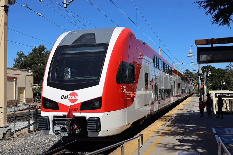
Caltrain is the easy option. The Sunnyvale station is downtown, at the north end of Murphy Avenue, so you step off the train and you are there. Caltrain's fare table puts Sunnyvale in zone 3 with Palo Alto, so the ride costs a one-zone fare. That was $4.00 in October 2026 and fares change on January 1, 2027. A second station, Lawrence, serves the east side of the city. Not every train stops at both, so check the Caltrain timetable. Our Caltrain guide covers Clipper, tap-to-pay and parking.
Car
Central Expressway is usually the calmest route, with fewer stoplights than El Camino Real. El Camino Real is slower but passes everything. Highway 101 is fastest off-peak. Downtown has public parking garages and lots near Murphy Avenue.
VTA
VTA buses run along El Camino Real between Palo Alto and Sunnyvale. VTA light rail serves the north Sunnyvale business district around Moffett Park and Java Drive rather than downtown. Our VTA guide explains routes and fares.
What Sunnyvale is known for
Like most of the valley, the area was farmland for decades. Fruit orchards replaced wheat fields in the 1870s and Santa Clara County became known as the Garden of the World. Martin Murphy Jr. owned much of the land and the main street carries his name. The town incorporated on December 24, 1912. Early boosters marketed it as the City of Destiny.
Fruit packing defined the early town. Libby, McNeill and Libby opened a cannery in 1906. Its water tower, painted to look like a can of fruit cocktail, still marks the site. In 1930 the federal government picked Sunnyvale for its West Coast airship base after local backers sold a 1,000-acre site for $1. That base became Moffett Field and its huge Hangar One is still visible from Highway 101.
The aerospace era followed. Lockheed opened its missiles and space operation in Sunnyvale in 1956 and it became one of the largest employers in the region. Then came video games. In August 1972 the first Pong prototype went into Andy Capp's Tavern, a bar on El Camino Real and Atari later had its headquarters on Borregas Avenue. For the wider story, read our Silicon Valley history.
The main areas
Heritage District and Murphy Avenue
Historic Murphy Avenue is the old downtown, one block of low brick and stucco storefronts running south from the train station. According to a February 2026 report in the Almanac, the city turned it into a pedestrian mall in 2023 and has since upgraded the walking surface. It is lined with restaurants, cafes and bars, many with outdoor tables. The old Del Monte building at the south end is a reminder of the cannery days.
CityLine and the new downtown
South and west of Murphy Avenue, the large CityLine project is replacing the old Sunnyvale Town Center mall with apartments, offices and shops. It was still under construction in early 2026. Its centerpiece is Redwood Square, a 1.5-acre plaza that keeps a grove of mature redwoods and adds a digital water curtain. Plaza del Sol, a 1.6-acre park at 200 West Evelyn Avenue completed in 2004, sits between the station and Murphy Avenue and has a labyrinth and picnic benches.
El Camino Real
Sunnyvale's stretch of El Camino Real is a long strip of shopping centers and restaurants. It is where you find much of the city's Korean, Chinese, Indian and Japanese food. A car helps here.
North Sunnyvale
North of Highway 101 and around Moffett Park the city is almost all offices and research campuses. Lockheed Martin's space campus is there, along with many tech offices. There is little for visitors except the bayfront.
Attractions and parks
- Sunnyvale Heritage Park Museum: At 570 East Remington Drive, next to Orchard Heritage Park. The museum building is a replica of Martin Murphy Jr.'s Bay View house, demolished in 1961. Exhibits cover the Murphy family, the orchards and local industry. The museum lists current hours on its website.
- Orchard Heritage Park: A working apricot orchard beside the museum, a living remnant of the orchard era. It is one of the few places left in the valley where you can stand among rows of fruit trees.
- Baylands Park: A bayfront park in north Sunnyvale with picnic areas and access to levee trails. The Bay Trail runs along this part of the shoreline.
- Las Palmas Park: One of the best-known neighborhood parks. Ortega Park, Seven Seas Park and Washington Park are other well-used city parks.
- Golf: The city runs two public golf courses.
Moffett Field itself is federal land and NASA Ames does not run public tours. You can see Hangar One from Highway 101 or from the Bay Trail.

Shopping and food
Murphy Avenue is the place for a sit-down meal or drinks after work. The block mixes Indian, Mexican, Mediterranean, Italian, Thai and Japanese restaurants with pubs and coffee shops. Because tenants change often, it is best to walk the block and choose on the spot. El Camino Real adds dozens of casual places, especially for Korean barbecue, Chinese food and Indian food.
For shopping, Sunnyvale is more practical than charming. Big-box stores line El Camino Real and Mathilda Avenue. REI moved its store from Mountain View to Sunnyvale in 2021, which matters if you are gearing up for a hike. Our bike and outdoor gear guide has the details.
Sunnyvale also has far more hotel rooms than Palo Alto, many of them near Highway 101 and Mathilda Avenue. Prices are often lower, which makes the city a reasonable base for a longer stay. You can compare Sunnyvale hotels for your dates.
Events
- Sunnyvale Farmers Market: Saturdays from 9 a.m. to 1 p.m. at Murphy and Washington avenues, year-round, rain or shine. It is run by the Urban Village Farmers' Market Association. Our farmers market guide covers the Palo Alto markets too.
- Plaza del Sol: The city uses the plaza for community events and it can be reserved for large gatherings.
- Heritage Park Museum programs: The museum posts teas, talks, book clubs and school programs on its events page.
For festivals, concerts and city programs, check the events calendar on the City of Sunnyvale website. Dates move from year to year.
Why a Palo Alto visitor might go
- An easy evening out by train. Murphy Avenue is a few steps from the platform and the fare is the same as a hop within Palo Alto's zone.
- A Saturday market. The Sunnyvale market adds a third weekend option to Palo Alto's two.
- Orchard history. The Heritage Park Museum and its apricot orchard show what the valley looked like before tech.
- A cheaper bed. Hotels are plentiful and Caltrain gets you back to Palo Alto quickly.
- Aerospace sightseeing. Hangar One and the Lockheed campus tell the story of the region's defense era.
Good to know
- Murphy Avenue is busiest on Friday and Saturday evenings. Weeknights are quieter.
- Downtown construction around CityLine can change walking routes and parking. Follow the posted signs.
- Sunnyvale and Palo Alto share a Caltrain fare zone, but not every train stops at Sunnyvale or Lawrence.
- NASA Ames and Moffett Field are not open for public tours.
Frequently asked questions
How far is Sunnyvale from Palo Alto?
Downtown Sunnyvale is about 10 miles southeast of downtown Palo Alto. The drive takes roughly 20 minutes outside rush hour on Central Expressway, El Camino Real or Highway 101. Caltrain links the two downtowns in about 15 to 20 minutes depending on the train.
Is Sunnyvale in the same Caltrain zone as Palo Alto?
Yes. Caltrain's fare table puts Palo Alto and Sunnyvale in zone 3, so the trip costs a one-zone fare. That was $4.00 in October 2026. Caltrain fares change on January 1, 2027, so check the current fare before you ride.
When is the Sunnyvale farmers market?
The Sunnyvale Farmers Market runs on Saturdays from 9 a.m. to 1 p.m. at Murphy and Washington avenues downtown, according to a February 2026 report. It is run by the Urban Village Farmers' Market Association and operates year-round, rain or shine.
What is Sunnyvale known for?
Sunnyvale is known for its fruit orchard past, for Moffett Field and its giant airship hangar and for decades of aerospace and electronics work. Lockheed set up there in 1956. The first Pong prototype was installed in a Sunnyvale bar in 1972.
Is Sunnyvale bigger than Palo Alto?
Much bigger. Sunnyvale had 155,805 residents in the 2020 census, more than twice Palo Alto's 68,572. It is the second largest city in Santa Clara County after San Jose.