On this page
La Honda is barely a town at all. About a thousand people live in the redwoods and on the hillsides along Highway 84, on the ocean side of the Santa Cruz Mountains. There is a school, a store, a few businesses and a lot of trees. It is only about 20 miles from downtown Palo Alto, but the climb over the ridge makes it feel much farther.
The town has an outsized place in 1960s history. Ken Kesey moved here after writing One Flew Over the Cuckoo's Nest at Stanford. His house became home base for the Merry Pranksters. Today visitors come for quieter reasons: some of the best redwood parks in the Bay Area, quiet trails and one of the classic drives to the coast. This guide covers the road, the history and the parks.
Where La Honda is and how far
La Honda is an unincorporated community in southern San Mateo County. The Census Bureau counts it as a census-designated place of about 4.3 square miles, with 979 residents in 2020. It sits where La Honda Creek meets Alpine Creek, on Highway 84 between Skyline Boulevard and the coast at San Gregorio. Elevations run from about 300 feet in the creek bottoms to more than 1,200 feet on the ridges.
From downtown Palo Alto it is about 20 miles by road and roughly 40 minutes. The usual route is Interstate 280 north to Woodside Road (Highway 84), then west through Woodside, up the winding grade to Skyline Boulevard at Sky Londa and down the other side.
The roads
Highway 84
Highway 84, also called La Honda Road, is the main way in. The section from Woodside to Skyline is steep and full of tight curves through redwood and oak. Past Skyline it descends through La Honda and follows San Gregorio Creek to Highway 1. It is narrow, with few shoulders and many blind bends. Use the turnouts to let faster traffic pass and watch for cyclists on the climbs and motorcyclists on weekends.
Road work, fall and winter 2026
- Caltrans began a resurfacing project on Highway 84 between La Honda and Woodside on September 14, 2026.
- Work is expected to continue through winter 2026, with one-way traffic control in places.
- Check Caltrans QuickMap before you go and allow extra time.
Other routes
Alpine Road and Pescadero Road link La Honda with the parks to the south and with Pescadero. Skyline Boulevard runs along the ridge above town. For cyclists, the famous climb is Old La Honda Road, which rises from Portola Road in Woodside to Skyline. Our biking guide covers the routes and their etiquette.
Transit
There is no regular public transit. SamTrans runs only a school-day route up to Skyline. Drive or ride. If you are visiting without a car, compare rental cars for the day.
Early history
Ohlone people lived in this part of the mountains for thousands of years before the Spanish arrived. The creek through town appears as Arroyo Hondo, the deep creek, on maps of the Mexican land grants, including the 1856 map of Rancho Cañada de Raymundo. The town's name comes from it. The post office was called La Honda in 1880, changed to Lahonda in 1895 and went back to La Honda in 1905.
In 1862 John Howell Sears bought 400 acres and settled here after leaving Searsville, the logging town near today's Stanford lands that was flooded for a reservoir. Early La Honda grew up around logging. One of its first buildings was a general store. Later the hills filled with summer cabins for families escaping the valley heat. Many of those cabins became year-round homes.
Ken Kesey and the Merry Pranksters
Ken Kesey came to Stanford's creative writing program in 1958 and lived on Perry Lane, a cottage enclave near the golf course. Paid drug experiments at the Menlo Park Veterans Administration hospital and a job there fed into One Flew Over the Cuckoo's Nest, published in 1962. When the Perry Lane cottages were torn down in August 1963, Kesey used his book money to move to a log house in La Honda, about 15 miles southwest of Stanford. Our Perry Lane page tells that part of the story.
In La Honda his friends became the Merry Pranksters. Kesey's second novel, Sometimes a Great Notion, came out in 1964. That summer the Pranksters drove a painted school bus named Furthur across the country, with Neal Cassady, the model for a character in Jack Kerouac's On the Road, at the wheel. Back home they threw parties they called Acid Tests around the Bay Area in 1965 and 1966, with the Grateful Dead, a young band with Palo Alto roots, as the house band. Many Pranksters lived at the La Honda place. Tom Wolfe told the story in The Electric Kool-Aid Acid Test (1968).
The La Honda years ended in trouble. Kesey was arrested there for marijuana possession in April 1965. On January 17, 1966 he was sentenced to six months in the San Mateo County jail. Two nights later police arrested him again on a San Francisco rooftop. Facing that second charge, he faked his suicide and fled to Mexico, returning about eight months later. After serving his time he settled in Pleasant Hill, Oregon, where he lived until his death in 2001.
The former Kesey house is a private residence. Do not look for it, stop in front of it or trespass. Our pages on Palo Alto in the 1960s and the Grateful Dead's Palo Alto roots cover the wider scene.
Parks around La Honda
La Honda is surrounded by public land. Most of these parks close at sunset or earlier in winter. San Mateo County parks charge a $6 vehicle fee.
- La Honda Creek Open Space Preserve: a Midpen preserve of grassland, oak and redwood just north of town, with the Sears Ranch Road parking area. Midpen closes the lower preserve on Red Flag Warning days.
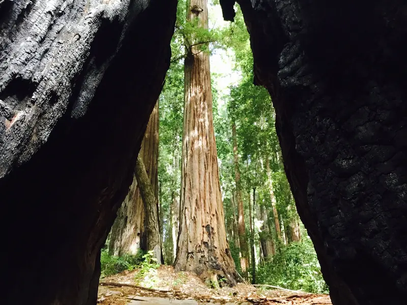
- Sam McDonald County Park: about 3 miles west of town on Pescadero Road, with redwood forest, open ridges and the Heritage Grove of old-growth redwoods. It is named for a Stanford groundskeeper who left the land to the university. No dogs.
- Memorial Park: a 673-acre county park on Pescadero Creek Road with old-growth redwoods, family campgrounds, a nature center and a camp store. The county posted trail closures for culvert work from October 19 to 31, 2026. Check its page before you go.
- Pescadero Creek County Park: the larger wild park linking Memorial and Sam McDonald, with long trails along the creek.
- Portola Redwoods State Park: a deep redwood canyon off Alpine Road and Portola State Park Road.
- Thornewood Preserve: a small Midpen preserve on Highway 84 on the Woodside side of the ridge, with a short walk to Schilling Lake.
Our redwood forests guide compares these with Big Basin and Muir Woods.

Food and supplies
La Honda has only a few places to buy food: a small market and a long-running roadhouse bar near the center of town. Hours vary and we could not confirm them on the businesses' own sites, so do not count on them. Bring snacks, water and a full tank. Sky Londa, at the top of the ridge, has the other nearest store. Memorial Park has a camp store for campers. For a proper meal, continue to the coast at San Gregorio, Pescadero or Half Moon Bay, or return to Woodside.
Why a Palo Alto visitor might go
- Redwoods. Memorial Park and Heritage Grove hold some of the finest old-growth groves near Palo Alto.
- The drive. Highway 84 over the ridge and down to the ocean is a classic Peninsula route. Continue to Pescadero for our coast day trip.
- Literary history. Kesey's years here link Stanford's writing program to the 1960s counterculture.
- A cabin weekend. Rentals in the mountains make a quiet base. You can browse Santa Cruz Mountains cabins.
Good to know
- Cell coverage is patchy in the canyons. Download maps before you leave Woodside.
- The coast side of the mountains is often foggy and cool even when Palo Alto is hot.
- Winter storms bring landslides and road closures. Check conditions after heavy rain.
- Sam McDonald County Park closes at 5 p.m. from November 2, 2026 through February 2027. Check each park's hours before a late start.
Frequently asked questions
How far is La Honda from Palo Alto?
La Honda is about 20 miles from downtown Palo Alto by road, roughly 40 minutes. Take Interstate 280 to Woodside Road (Highway 84), continue west through Woodside, climb to Skyline Boulevard and drop down the other side. The road is narrow and winding, so allow extra time.
Did Ken Kesey live in La Honda?
Yes. After the Perry Lane cottages near Stanford were torn down in August 1963, Kesey moved to a log house in La Honda. His home became the base of the Merry Pranksters, the group that took the bus Furthur across the country in 1964 and staged the Acid Tests in 1965 and 1966. The house is private property and is not open to visitors.
Is there public transit to La Honda?
No regular public transit serves La Honda. SamTrans runs a school-day route up to Skyline Boulevard but no general service into town. Plan to drive, ride a bike if you are fit and experienced or join a group trip.
What parks are near La Honda?
La Honda Creek Open Space Preserve lies just north of town. Sam McDonald County Park is about 3 miles west on Pescadero Road and Memorial Park, with old-growth redwoods and camping, is a few miles farther. Portola Redwoods State Park and Thornewood Preserve are also close.
Is Highway 84 to La Honda under construction?
Caltrans began a resurfacing project on Highway 84 between La Honda and Woodside on September 14, 2026 and expects work to continue through winter 2026. Crews use one-way traffic control in places. Check Caltrans QuickMap before you go.