On this page
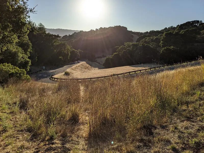
Emerald Hills sits on a knot of oak-covered hills between Redwood City, Woodside and San Carlos, just east of Interstate 280. It is not a city. The area is unincorporated San Mateo County land, home to about 4,400 people on steep, winding streets with no stores, no sidewalks and plenty of trees. Locals call it Emerald Hills or Emerald Lake Hills interchangeably.
A visitor from Palo Alto will mostly come here for one reason: Edgewood Park, the county's famous wildflower preserve, which borders the neighborhood. But the area has a colorful backstory as a 1920s weekend resort, two lakes that gave it its name and a giant cross on the ridge that drivers on Interstate 280 have seen for generations. This guide covers how to get there, the history, what is public and what is not.
Where Emerald Hills is and how far
The census defines Emerald Lake Hills as about 1.2 square miles bounded roughly by Edgewood Road, Alameda de las Pulgas, Farm Hill Boulevard and Interstate 280. Redwood City wraps around it to the east and north, Woodside lies to the southwest and San Carlos to the northwest. Homes use Redwood City mailing addresses even though the county, not the city, governs them.
From downtown Palo Alto it is about 8 miles. Outside rush hour the drive takes about 15 minutes on Interstate 280, using the Farm Hill Boulevard or Edgewood Road exits.
Getting there
- Car: the easiest option. Streets are narrow and steep, with tight bends and few places to pull over. Park only in legal spots and never block driveways.
- Caltrain and bus: ride Caltrain to Redwood City, a two-zone fare from Palo Alto ($6.25 in October 2026, $6.50 from January 1, 2027). SamTrans lists a route from Redwood City station up to Cañada College on Farm Hill Boulevard at the edge of the neighborhood. Check the SamTrans schedules for times. Our Redwood City station guide covers the connection.
- Bike: fit riders can climb up from Redwood City or come over from Cañada Road. Expect stiff grades.
From summer resort to neighborhood
The land was part of Rancho de las Pulgas, granted in 1795 to José Darío Argüello. After the American conquest, squatters and lawyers carved up the rancho. By the 1850s the legislator Horace Hawes owned a large tract here and used an old stock pond for irrigation. In 1885 Moses Hopkins, brother of the railroad baron Mark Hopkins, bought the land and dammed the pond to enlarge it. That pond became Lower Emerald Lake.
The resort era began around 1920. A developer named George Irvine first used the name Emerald Hills in a 1920 brochure but ran out of money. The builders Leonard and Holt took over and marketed the hills to San Francisco families as a sunny, fog-free weekend retreat, busing buyers in for free picnics by the lake. A golf course went in on the hill north of the lake.
In 1926 about 20 lakeside owners bought the lower lake and formed what became the Emerald Lake Country Club. The developers responded by damming a creek to create a second lake, Upper Emerald Lake, by the summer of 1927, with a beach, slide and diving platforms. In 1929 they built an outdoor amphitheater called the Easter Bowl at the crest of the hills and a concrete cross above it.
The 1929 stock market crash ended the resort dream. The golf course was sold and subdivided. After World War II, Emerald Hills slowly turned from vacation cabins into a year-round neighborhood. Residents fought off a plan to route Interstate 280 through the area in the 1950s; the freeway was built just to the west instead. Septic tanks limited building until a sewer system arrived in 1982, when there were about 900 homes. By 1992 there were about 1,400 and most vacant lots were gone.
The Emerald Lakes
The two lakes are named for their green water. They are the first thing many people ask about. Both are private:
- Lower Emerald Lake is owned and run by the Emerald Lake Country Club, the members' club that grew out of the 1926 purchase. Members and their families use it for swimming, sunbathing, picnics and fishing in summer.
- Upper Emerald Lake is privately held by the households around its shore.
There is no public beach, trail or viewpoint on either lake. Please do not trespass on club or private land or stop in the road to look. If you want to swim in a lake near Palo Alto, see our swimming guide for public options.
Edgewood Park
The real public treasure here is Edgewood Park and Natural Preserve, 467 acres of serpentine grassland, chaparral and oak woodland between the neighborhood and Interstate 280. In the 1960s and 1970s the land was eyed for a Cal State campus and then a golf course. The presence of the threatened bay checkerspot butterfly helped defeat the golf plan. Residents of Emerald Hills backed the effort that made the park a permanent natural preserve in 1993.
Edgewood is best known for its spring wildflowers, which grow on soils few other plants tolerate. Key details from San Mateo County and Friends of Edgewood:
- The main entrance is at 10 Old Stage Coach Road off Edgewood Road, beside the Bill and Jean Lane Education Center.
- The park opens at 8 a.m. and closes at 5 p.m. from November 2, 2026.
- About 10 miles of trails. No dogs. Bikes only on paved roads and in parking areas.
- Free docent-led wildflower walks run on spring weekends and some Fridays from March through May. Register in advance.
- Parking is free but the lot fills on spring weekends.
Our wildflowers guide explains when to go for the best bloom.

Other landmarks
The Easter Cross. The concrete cross built above the Easter Bowl in 1929 was later vandalized and rebuilt larger, to about 94 feet. It still stands at the top of the hills and is visible from Interstate 280 as far south as Palo Alto. The Easter Bowl was abandoned in the early 1980s and its traditional Easter services ended.
Handley Rock. A sandstone outcrop about 50 feet tall, described on Wikipedia as the largest of its kind in San Mateo County, stands in a small park run by a residents' group, the Handley Rock Association. Local climbers use it. We could not confirm current access rules, so check before you go and respect the neighbors.
A video game footnote. According to an interview with the Sega programmer Yuji Naka cited on Wikipedia, Emerald Hills inspired the name of Emerald Hill Zone, the first level of Sonic the Hedgehog 2.
Nearby parks and food
Several good parks are within a few minutes:
- Stulsaft Park, a wooded Redwood City park on Farm Hill Boulevard, popular with families.
- Pulgas Ridge Preserve, a Midpen preserve in San Carlos with a large off-leash dog area.
- Huddart Park, redwoods and long trails on the Woodside side of Interstate 280.
There are no restaurants in Emerald Hills. Downtown Redwood City is about 10 minutes down the hill. Our Redwood City food guide lists places to eat. For a stay close to the trailheads, compare Redwood City hotels.
Why a Palo Alto visitor might go
- Wildflowers. Edgewood in April is one of the best spring walks on the Peninsula.
- A quick escape. It is only 15 minutes from Palo Alto, closer than most hill parks.
- Local history. The resort lakes and the cross tell a small story of 1920s Bay Area land booms.
Good to know
- Both Emerald Lakes are private. There is no public lake access.
- Streets are narrow and winding with no sidewalks. Walk with care and drive slowly.
- Edgewood's lot fills by mid-morning on spring weekends. Arrive early or come on a weekday.
- Fire danger is high in late summer and fall. Follow any closures and never smoke on the trails.
Frequently asked questions
Is Emerald Hills part of Redwood City?
No. Emerald Hills, also called Emerald Lake Hills, is unincorporated San Mateo County land, governed by the county rather than a city. Homes use Redwood City mailing addresses. The census counted 4,406 residents in 2020.
Can you swim in Emerald Lake?
Not unless you are a member or guest. Lower Emerald Lake is owned and run by the Emerald Lake Country Club, a private club formed in the 1920s, for its members and their families. Upper Emerald Lake is privately held by the households around its shore. Neither is a public park.
How do I get to Edgewood Park from Emerald Hills?
The main entrance and parking lot are at 10 Old Stage Coach Road off Edgewood Road, on the neighborhood's edge. Wikipedia also lists neighborhood access points at the Sunset Trailhead off Hillcrest Way and at Sylvan Way. Those are on residential streets with little parking, so most visitors use the main lot.
What is the big cross above Redwood City?
It is the Easter Cross at the top of Emerald Hills. Developers built an outdoor amphitheater and a concrete cross on the crest in 1929. The cross was later rebuilt larger, to about 94 feet. It is visible from Interstate 280. The amphitheater was abandoned in the early 1980s.
How far is Emerald Hills from Palo Alto?
About 8 miles northwest of downtown Palo Alto, roughly 15 minutes by car outside rush hour. Take Interstate 280 north to the Farm Hill Boulevard or Edgewood Road exits. By transit, ride Caltrain to Redwood City and continue by bus or rideshare up the hill.