On this page
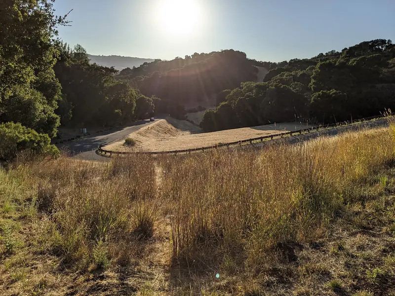
Edgewood Park and Natural Preserve sits on a ridge between Redwood City and Interstate 280, close enough to the freeway that the traffic shapes its ecology, as the butterfly story below shows. In spring the grassland on the ridge turns yellow, purple and orange with wildflowers that grow on few other soils. In summer and fall the same slopes turn gold.
Our wildflowers guide explains why Edgewood is the Peninsula's top spring bloom and how it was saved from becoming a golf course. This page covers the rest: every trail, the three trailheads and how to park, the docent walks, the education center and the long effort to bring back a threatened butterfly.
The basics
- Main entrance: 10 Old Stage Coach Road, Redwood City, off Edgewood Road. The park phone is listed at (650) 368-6283.
- Size: 467 acres of grassland, oak woodland and chaparral, with about ten miles of trails.
- Hours: Open every day from 8 a.m. The county lists closing at 6 p.m. from October 12 to November 1, 2026 and 5 p.m. from November 2, 2026 through February 2027.
- Fees: None listed for entry. Edgewood is not one of the seven county parks with a vehicle fee.
- Facilities: Restrooms, three drop-in family picnic areas, a meadow and an amphitheater near the main entrance.
- Run by: San Mateo County Parks, with heavy support from the volunteer group Friends of Edgewood, founded in 1993.
Why the soil matters
Edgewood's secret is under your feet. According to the county, the rock beneath much of the region formed where two tectonic plates, the Farallon and the North American, converged. The Farallon plate dove under, leaving behind serpentinite, a rare rock that you can see in outcrops and in the grassland soils.
Serpentine soil is poor in nutrients and high in metals. Most grasses from Europe that crowd out wildflowers elsewhere in California struggle on it. Native plants adapted to it thrive. The county says ten rare or endangered plant species have been identified in the park, including the San Mateo thornmint. Friends of Edgewood counts more than 560 plant species, more than 100 bird species, 21 mammal species and 13 reptile and amphibian species.
The ridge in the middle of the preserve is often called Inspiration Heights. The county's trail page puts it at about 875 feet and other county and Friends pages say about 800. From the top you can see Skyline Ridge, Huddart Park, the San Andreas Fault zone, Crystal Springs Reservoir and the bay.
Trails
Most trails are open to horses. The Sylvan Trail is for hikers and runners only. The county describes them this way:
| Trail | Length or feature | What you see |
|---|---|---|
| Sylvan Trail | About 1 mile | Coast live oak and bay woodland, rising from the base of the park. No horses. |
| Old Stage Road | 0.9 miles | A steady gravel climb under oaks that opens onto serpentine grassland. |
| Edgewood Trail | Crosses the north side | From the main lot the first half mile climbs at about a 9.5 percent average grade. |
| Baywood Glen Trail | 0.6 miles | Switchbacks through dense oak woodland with spring flowers and vines. |
| Live Oak Trail | 0.6 miles | Wooded north side of the main ridge. |
| Serpentine Trail | Center of the park | With the Sunset Trail, the best flower viewing in spring. |
| Sunset Trail | 0.8 miles | Gentle grade through serpentine grassland on the south side of the ridge. |
| Ridgeview Trail | South side of the ridge | Views over the grassland. Ends with a short climb to Inspiration Heights. |
| Franciscan Trail | Connector | Links the Edgewood Trail with the Ridgeview Trail. |
| Clarkia Trail | From Cañada Road | The only trail in the southern end, from grassland into chaparral. A rock outcrop sits about 0.3 miles up. |
A good first loop
From the main lot, climb the Sylvan Trail or Old Stage Road to the grassland, walk the Serpentine Trail west, return on the Sunset Trail and come back down. Add the Ridgeview Trail for the view from Inspiration Heights. Friends of Edgewood describes most trails as easy to moderate. Hike single file on narrow trails and do not step off them, since leaving designated trails is prohibited. Our hiking guide compares Edgewood with other walks near Palo Alto.
Current trail work
In late October 2026 Friends of Edgewood flagged trail closures for pipeline work on the Sunset and Ridgeview trails and for wildfire fuel management on the Sylvan, Baywood Glen and Ridgeview trails. Check the county park page before you go.
Trailheads and parking
Edgewood has three entrances, according to Friends of Edgewood. Only the main one has a parking lot and restrooms.
- Main entrance and Education Center. From Interstate 280, take the Edgewood Road exit and head east toward the bay for about a mile. The lot is on the right. From Highway 101, take Whipple Avenue west, turn right on Alameda de las Pulgas and left on Edgewood Road.
- West Edgewood Trailhead. From the 280 exit, head west about 0.4 miles on Edgewood Road. Park on the street near the Cañada Road intersection. The trailhead is on the south side of Edgewood Road.
- Clarkia Trailhead. Follow Edgewood Road west to Cañada Road, turn left and look for the trailhead on the left shortly after you pass under Interstate 280. Roadside parking is limited.
The county warns that parking on weekends and during the spring bloom can be very limited. Visitors who park on Edgewood Road face fast traffic near the freeway ramps, so cross only at marked crossings. Cars in the marked bike lanes are ticketed. The county suggests getting dropped off or starting at one of the side trailheads. Bring water, a hat and sunscreen, since the side trailheads have no facilities.

Docent-led wildflower walks
Friends of Edgewood volunteers lead free wildflower hikes every spring. According to the county, they run on Fridays, Saturdays and Sundays from March through May. Friends of Edgewood says the hikes cover about 3 miles and take about 3 hours. They are aimed at adults and older children. Shorter kid-friendly hikes run on select weekends. Narrow trails mean strollers do not work.
The hikes are free but you must register in advance through the group's Eventbrite page. New hikes are usually added about two weeks ahead, so check back through the season. Outside spring, the group runs monthly nature hikes, bird walks and interpretive walks. Docents also walk the preserve every week year-round to record what is in bloom and publish the results online. Our birdwatching guide and April guide cover the season around Palo Alto.
The Bill and Jean Lane Education Center
The Education Center stands beside the main parking lot. Friends of Edgewood describes it as an environmentally friendly building and a portal for schoolchildren and visitors to learn about the preserve. Volunteer docents staff it on Saturdays and Sundays from 9:30 a.m. to 4 p.m. and on Wednesdays from 9:30 a.m. to 12:30 p.m.
- Exhibits: Panels on land and water, life in serpentine, species that specialize, seeps and springs, invasive plants and the human history of Edgewood, plus a weekly board of flowers in bloom and wildlife sightings.
- The quilt: A handmade quilt depicting Edgewood's plants and animals, made by retired ranger and parks superintendent Lynne Fritz and dedicated in 2013 for the preserve's 20th anniversary. Strips of her old ranger uniform outline the blocks.
- The native garden: Volunteers began turning weedy ground around the center into a native garden in 2013. It now covers about half an acre with more than 100 native plants found in the preserve.
- Gear: The center sells Edgewood merchandise to support the Friends.
Groups can rent the center through the county. The county's fee schedule lists full-day rates that differ for government agencies, nonprofits and private groups and between weekdays and weekends.
The Bay checkerspot butterfly
The Bay checkerspot is a small, federally threatened butterfly whose caterpillars feed on California plantain and owl's-clover, native plants of serpentine grassland. It once lived across thousands of acres around the bay. At Edgewood its numbers fell sharply in the late 1990s and early 2000s. In 2002 conservation biologist Stuart Weiss documented the last caterpillar in the preserve.
Friends of Edgewood points to a surprising cause: air pollution. More than 100,000 vehicles a day pass on Interstate 280. Their nitrogen emissions act as a slow fertilizer. That lets non-native grasses such as Italian ryegrass take over soil that should be too poor for them, choking out the plantain.
Restoration began in 2005 with mowing plots to knock back the grass, funded by PG&E grants. A first reintroduction of caterpillars from Coyote Ridge in Santa Clara County failed in the very dry spring of 2007. Starting in 2011, Weiss's team moved about 4,000 caterpillars, then 4,000 to 5,000 a year through 2016 and another 2,400 in 2017. Volunteer counts rose to a high of 800 adults in 2014 but fell below 50 by 2018. In 2018 Friends of Edgewood launched Project 467, a habitat program for the checkerspot, the San Mateo thornmint and the white-rayed pentachaeta.
People and history
The county's history notes that hunters used the area about 6,000 years ago and that Ohlone-speaking peoples arrived around 500 AD. Archaeologists have found two Ohlone sites nearby, at Filoli and at the Phleger Estate. In 1769 the Portolá expedition passed through the region. In the 1980s the county planned a golf course here. After a long campaign by conservationists, the county declared the land a Natural Preserve in 1993. For a similar landscape with research rather than public access, see our guide to Stanford's Jasper Ridge Biological Preserve.
Rules and safety
- Stay on designated trails. Leaving them is prohibited.
- No dogs or other pets. Our dog-friendly places guide has alternatives.
- Bicycles only on paved roads and in parking areas.
- Do not pick flowers, mushrooms or anything else.
- Watch for rattlesnakes in warm weather, ticks in the grass and yellow jackets. The county runs a long-term Lyme disease study here.
Getting there from Palo Alto
Drive north on Interstate 280 to the Edgewood Road exit, about 15 minutes from Palo Alto outside rush hour. There is no practical transit to the trailheads. If you are visiting without a car, you can compare rental cars for a day of hikes. Combine a morning at Edgewood with lunch in downtown Redwood City, ten minutes east, or with a redwood walk at Huddart Park up the road.
Good to know
- Register for spring docent walks as soon as they are posted on Eventbrite.
- Arrive before 9 a.m. on spring weekends or use a side trailhead.
- Most of the preserve is open grassland with little shade. Bring water and sun protection.
- Check for trail closures before you go. Pipeline and fuel work were under way in fall 2026.
Frequently asked questions
Do I need to register for the Edgewood wildflower walks?
Yes. Friends of Edgewood's spring hikes are free, but the county says you must register in advance on the group's Eventbrite page. New hikes are usually added about two weeks ahead. The county lists them on Fridays, Saturdays and Sundays from March through May.
Is there a fee at Edgewood Park?
San Mateo County does not list Edgewood among the seven county parks that charge a vehicle entry fee. Parking is free but limited, especially on spring weekends. Groups that reserve the Education Center pay a separate rental fee.
When is the Bill and Jean Lane Education Center open?
Friends of Edgewood and the county list it as open Saturdays and Sundays from 9:30 a.m. to 4 p.m. and Wednesdays from 9:30 a.m. to 12:30 p.m. Volunteer docents staff it. It sits beside the main parking lot on Edgewood Road.
Where else can I park for Edgewood Park?
The county suggests street parking near the west Edgewood Trailhead at Edgewood Road and Cañada Road, or at the Clarkia Trailhead on Cañada Road just south of Interstate 280. Neither has restrooms. Do not park in the marked bike lanes on Edgewood Road, since cars there are ticketed.
Are dogs allowed at Edgewood Park?
No. The county's regulations for Edgewood say dogs and other pets are not allowed. Bicycles are allowed only on paved roads and in parking areas. Leaving designated trails is prohibited to protect rare plants.