On this page
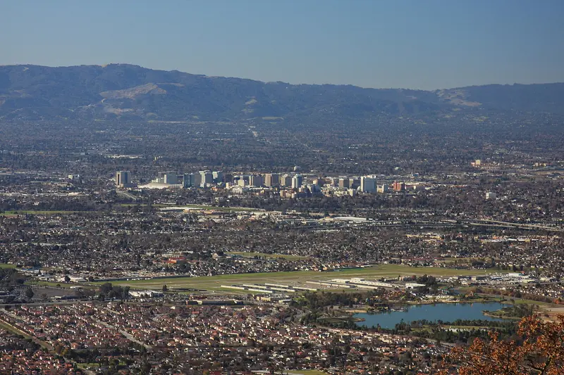
San Jose and Palo Alto sit about 20 miles apart at the south end of the Peninsula. The trip between them is one of the easier ones in the Bay Area. A train runs in about 20 minutes on an express, a rapid bus follows El Camino Real the whole way and two freeways carry the drivers. Which one suits you depends on where in San Jose you start and where in Palo Alto you are going.
This page starts from the city of San Jose. If you are landing at the airport, the free bus and train connection is explained in our San Jose airport guide. For the bigger picture, start with getting to Palo Alto.
The options at a glance
| Option | Typical time | Good for |
|---|---|---|
| Caltrain express from Diridon | About 21 minutes | Downtown San Jose to downtown Palo Alto |
| Caltrain limited or local | About 27 minutes | Off-peak trips and California Avenue |
| VTA Rapid 522 | Much longer, many stops on El Camino | Trips between points along El Camino Real |
| Light rail plus Caltrain | Varies with the transfer | North San Jose and Milpitas |
| Driving or rideshare | 25 minutes to over an hour | Stanford, the foothills, groups |
Train times come from Caltrain's weekday timetable as posted in late October 2026. Road times are rough and swing with traffic.
Caltrain from San Jose Diridon
San Jose Diridon station, at 65 Cahill Street on the west edge of downtown, is the region's busiest rail hub south of San Francisco. Caltrain, Amtrak's Capitol Corridor and Coast Starlight, ACE trains from Stockton and VTA light rail all stop there. For Palo Alto, take any northbound Caltrain.
Every type of train stops at both stations:
- Express trains took about 21 minutes from Diridon to Palo Alto on the late October 2026 weekday timetable.
- Limited and local trains took about 27 minutes, a few locals a bit more.
- Weekend trains are all locals, running about every 30 minutes.
Diridon is in Zone 4 and Palo Alto in Zone 3. The adult fare for two zones was $6.25 in October 2026, rising to $6.50 on January 1, 2027, according to the Caltrain fares page. Tap a Clipper card or contactless bank card on the validator before boarding and again at Palo Alto.
Other San Jose area stations
Caltrain also stops at Tamien, south of downtown. Santa Clara station sits next to Santa Clara University and doubles as Santa Clara Transit Center, the end of the free VTA bus from the airport. Lawrence and Sunnyvale serve the area to the north. Check the train type before you board, since express trains skip several of these. Our Caltrain guide explains train types, bikes on board and how the numbers work.
Caltrain has posted track changes at Diridon during construction, so look at the platform signs and the service status page when you arrive at the station.
VTA buses on El Camino Real
El Camino Real runs straight from San Jose through Santa Clara, Sunnyvale, Mountain View and Los Altos into Palo Alto. Two VTA routes follow it:
- Rapid 522 is the limited stop service, with stops spaced about a mile apart. It ends at the Palo Alto Transit Center beside the Caltrain station.
- Route 22 makes local stops along the same road and runs into the early morning hours.
Both run every day. The adult VTA fare was $2.50 a ride in October 2026, paid with Clipper or a contactless card. The bus takes far longer than the train end to end. It shines for trips between points on El Camino, such as Santa Clara University to Stanford Shopping Center or the California Avenue area. Our page on VTA buses and shuttles lists the stops that matter in Palo Alto.
From north San Jose and Milpitas
If you start near the tech campuses of north San Jose or in Milpitas, downtown Diridon can be out of the way. VTA's Orange Line light rail runs from Alum Rock through Milpitas, north San Jose and Sunnyvale to Mountain View station, where it meets Caltrain. From there Palo Alto is one or two stops north, depending on the train. Our guide to Mountain View station explains the transfer. VTA light rail fares match the bus fare, while Caltrain charges separately.
Driving from San Jose
Two freeways run north from San Jose toward Palo Alto.
US 101
US 101 is the direct route along the bay side. Exit at San Antonio Road for south Palo Alto, Oregon Expressway for Midtown and California Avenue, Embarcadero Road for Stanford Shopping Center and Town and Country Village, or University Avenue for downtown. Express lanes run on 101 in Santa Clara County and continue into San Mateo County as a separate system. You need a FasTrak tag to use them during toll hours, as explained on the FasTrak express lanes page.
Interstate 280
Interstate 280 swings west through Cupertino and Los Altos Hills. For Stanford Research Park or the California Avenue side of town, exit at Page Mill Road. For the Stanford campus and Stanford Shopping Center, continue to Alpine Road or Sand Hill Road. It is often the calmer drive, especially in the afternoon.
El Camino Real
El Camino Real is the surface route and the slowest, with traffic lights every few blocks. It still works for short trips from Santa Clara or Mountain View, or if a freeway is jammed. See our driving guide for every Palo Alto exit and parking tips.

Rideshare and robotaxis
Uber and Lyft both cover San Jose and Palo Alto. A ride takes about as long as driving yourself, with prices that climb at rush hour. Waymo's service area covers the Peninsula down to San Jose and includes Palo Alto, so a driverless ride between the two cities may be possible. Open the app to see the current boundary, which matters for the Stanford campus and the hills. More detail is in our page on robotaxis and rideshare.
Timing your trip
Commute traffic on this stretch flows both ways because both cities are big employers. Weekday peaks run roughly 7 to 10 a.m. and 3 to 7 p.m. Northbound 101 through Mountain View and Palo Alto is slow on many weekday mornings. Late afternoons are slow in both directions.
- Weekday commute hours: take an express train. At 21 minutes it is hard to beat by road.
- Big events in Santa Clara: games and concerts at Levi's Stadium crowd Caltrain and the roads near Santa Clara and Mountain View.
- Stanford events: commencement weekend and home football games fill roads and parking around campus. Check our Stanford sports guide for game days.
- Evenings: check the last northbound train on the day before you head out, since late trains are spaced further apart.
Good to know
- Caltrain ended its Clipper discount on January 1, 2026. Clipper, contactless cards and phone wallets all pay the same fare.
- VTA and Caltrain fares are separate. Budget for both if you combine a bus or light rail ride with the train.
- Caltrain day passes cost twice the one-way fare and are sold only at station machines.
- If you need a car for the trip, compare rental cars in San Jose before you book.
Arriving in Palo Alto
Most trains and the 522 end up at Palo Alto station, at the foot of University Avenue. Downtown is east through the underpass. The free Stanford Marguerite shuttles leave from the bus plaza on weekdays. For California Avenue, a limited or local train stops one station south. If you are coming for a day out, our downtown guide is a good first stop. Heading the other way? See our San Jose day trip.
Frequently asked questions
How long is Caltrain from San Jose to Palo Alto?
On Caltrain's weekday timetable in late October 2026, express trains took about 21 minutes from San Jose Diridon to Palo Alto. Limited and local trains took about 27 minutes. Weekend trains are locals, so allow a little more time.
How much is Caltrain from San Jose to Palo Alto?
San Jose Diridon is in Zone 4 and Palo Alto in Zone 3, so it is a two zone ride. The adult fare was $6.25 one way in October 2026, with a rise to $6.50 listed from January 1, 2027. Youth riders pay $1.00.
Is there a bus from San Jose to Palo Alto?
Yes. VTA Rapid 522 and local Route 22 both run along El Camino Real between San Jose and the Palo Alto Transit Center every day. They are slower than Caltrain but stop all along El Camino. The adult VTA fare was $2.50 in October 2026.
Should I take 101 or 280 from San Jose to Palo Alto?
Take US 101 for downtown Palo Alto, the Baylands and the east side of town. Take Interstate 280 for Stanford, Stanford Research Park and the foothills. Check live traffic before you go, since the faster road changes with the time of day.