On this page
Our Rancho San Antonio overview covers the basics: how the county park and the preserve fit together, the parking crunch, the rules and the history. This page is the companion for hikers who already know they are going and want to pick a route. It goes trail by trail, using the distances published by the Midpeninsula Regional Open Space District (Midpen) and by Peninsula Open Space Trust. Where neither gives a number, we say so instead of guessing.
Midpen counts more than 25 miles of trail across the 2,180-acre preserve and the 293-acre county park. Several of the main routes start near Deer Hollow Farm, west of the parking lots. Bring Midpen's downloadable map, which shows the mileage of each segment between junctions.
Choosing a parking lot
Midpen lists six lots in the county park plus a small one on the north side of the preserve. All six county lots are reached from the entrance on Cristo Rey Drive. An electronic sign at the gate shows live space counts. The same numbers appear on Midpen's parking page.
| Lot | Spaces | Notes |
|---|---|---|
| Lot 1 | 80 plus 4 accessible and 2 equestrian | County park land |
| Lot 2 | 48 plus 1 accessible | County park land |
| Lot 3 | 22 plus 2 accessible | County park land |
| Lot 4 | 46 plus 2 accessible | County park land |
| Lot 5 | 30 | County park land |
| Lot 6 | 83 plus 5 accessible | Turn right after entering, about 0.3 mile; start for Midpen's Rogue Valley walks |
| Rhus Ridge | 9 plus 1 accessible | North end of the preserve |
Midpen says the preserve trailhead is next to the northwest lot, Lot 6 in the table above, with 83 regular spaces plus 5 accessible ones. Parking can be congested at busy times, so arrive early, come on a weekday or use the Silicon Valley Hopper shared ride or a bike. The overview page has the details on those options.
The routes at a glance
| Route | Published distance | Climb | Source |
|---|---|---|---|
| Wildcat Loop Trail | About 3 miles | Moderate | Midpen |
| Stephen E. Abbors (PG&E) Trail | 3.7 miles | 1,600 feet | Midpen |
| Chamise Trail | 2.1 miles | Gradual | Midpen |
| Black Mountain Trail | About 4 miles | To a 2,800-foot summit | Midpen |
| Rogue, Upper Rogue and High Meadow loop | Not published | About 700 feet | Midpen guided hike |
| High Meadow route via Upper Wildcat Canyon | 5.5 miles round trip | 800 feet | Peninsula Open Space Trust |
Getting to Deer Hollow Farm
Almost every hike passes the farm. The wide farm road is the gentlest route in the park and the one to take with small children or a stroller. From the northwest lot you can also use the Permanente Creek Trail and the Lower Meadow Trail. Bikes are allowed to the farm on designated routes but not beyond it. The farm has its own hours and programs; our Deer Hollow Farm guide covers them.
Wildcat Canyon and the Wildcat Loop
Midpen calls the Wildcat Loop Trail a popular route for hikers and joggers. The three-mile loop follows a creek into a cool, narrow canyon walled with ferns, climbs through chaparral to open meadows on the middle ridge and loops back to Deer Hollow Farm. In spring, lupine, poppies and blue-eyed grass bloom in the meadows. On a clear day the meadows look north to Mount Tamalpais and east to Mount Hamilton.
The canyon is the shadiest stretch in the park, so it is the best choice on a hot afternoon. Its upper end, the Upper Wildcat Canyon Trail, appears in both Midpen's and POST's suggested longer loops with the High Meadow and Abbors trails. Midpen volunteers are scheduled to work on the south leg of the Wildcat Loop on November 5, 2026, so expect crews that day.
The PG&E Trail, now the Stephen E. Abbors Trail
This is the hard one. Midpen describes a challenging 3.7-mile hike with 1,600 feet of elevation gain, following the line of electrical towers up toward Black Mountain. The reward is wide views of the Bay Area and the western foothills. Locals called it the PG&E Trail for decades because of the power line. New signs use the Abbors name.
Midpen suggests combining it with the Wildcat Canyon or Upper High Meadow trails to make a longer loop. A sensible plan is to climb the exposed Abbors Trail while you are fresh and come down through the shade of Wildcat Canyon. Check the map for the junctions. The route is exposed, so start early in summer and carry more water than you think you need.

Rogue Valley and Upper Rogue Valley
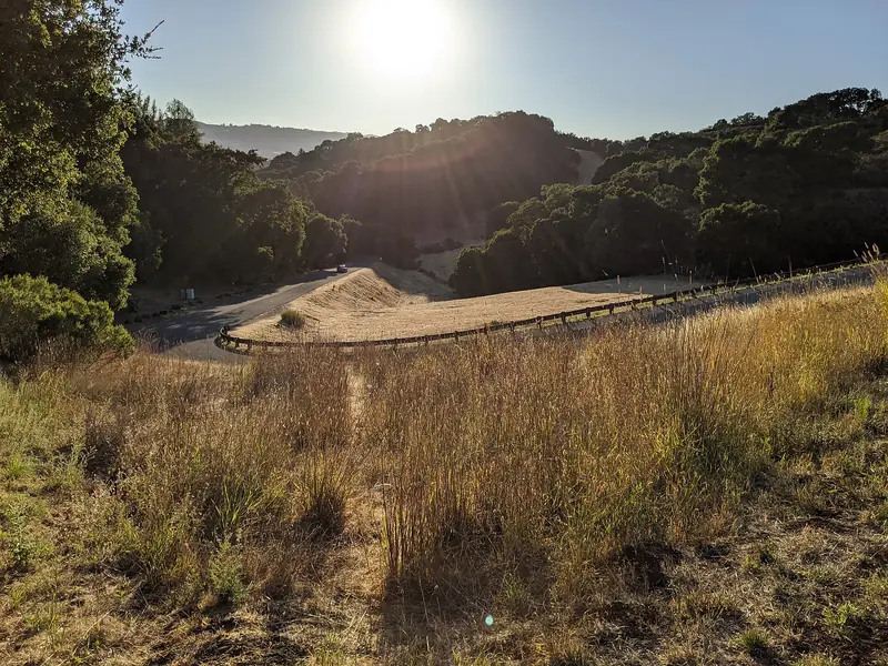
Midpen's docents start their Rogue Valley walks from Lot 6. Midpen does not publish a distance for the Rogue Valley trails on its preserve page. Its docent-led Rogue Valley aerobic hike follows the Rogue, Upper Rogue and High Meadow Loop trails, with about 700 feet of elevation gain on a mix of fire roads and single-track. Midpen notes a grade about a mile long with good views and says that after rain you may see a waterfall beyond the pond. It makes a solid workout loop.
High Meadow and Upper High Meadow
The High Meadow Trail climbs from near Deer Hollow Farm to open grass above the valley. Peninsula Open Space Trust publishes a route that starts on the Permanente Creek Trail from the northwest lot, takes the Lower Meadow Trail, turns right onto the High Meadow Trail and left onto the Upper Wildcat Canyon Trail before returning the same way. It lists 5.5 miles round trip, 800 feet of gain and four to five hours on an uneven surface. The Upper High Meadow Trail continues higher and links to the Abbors Trail for a bigger day.
Chamise and Black Mountain
Two longer routes leave the main loops behind. The Chamise Trail climbs gradually for 2.1 miles to a quiet meadow in the north of the preserve, next to Hidden Villa, where a ranch windmill once stood. The Black Mountain Trail climbs about four miles through chaparral, grassland and oak woodland to the 2,800-foot summit and into Monte Bello Preserve. Plan most of a day for the summit. Midpen's calendar lists a docent Ramble from Rancho to Black Mountain on November 16, 2026.
Rules on the trail
- Dogs: not allowed anywhere in the preserve. Service dogs are accommodated.
- Bikes: designated trails only and none west of Deer Hollow Farm. Helmets are required and the speed limit is 15 mph, or 5 mph when passing. Class 1 and Class 2 e-bikes are allowed only on a limited set of improved trails.
- Horses: Midpen says riders are limited to the equestrian staging area and the Coyote Trail within the county park, plus designated preserve trails marked on the map. Helmets are recommended and everyone yields to riders.
- Groups: 20 or more people need a general access permit.
- Water: no swimming or wading in the creeks.
Seasons and safety
Spring is the best season for the Wildcat meadows; our wildflowers guide covers bloom timing. In summer, start the exposed Abbors and Black Mountain climbs early. Fall brings clear air and Midpen's Turkey Trot explorer hike, listed for November 18, 2026. After winter rain, look for the waterfall beyond the pond in Rogue Valley and expect mud. Santa Clara County Vector Control says adult western blacklegged ticks are most active from November through March and nymphs from March through May, so check yourself after every hike.
- Mountain lions: do not run. Back away slowly, keep children close, face the lion and look big. Midpen asks visitors to report sightings to a ranger at 650-691-2165.
- Coyotes: Midpen has reported them here and says they can be aggressive around pets in the spring and early summer denning season.
- Poison oak: grows along the canyon trails. Its oil stays potent on bare stems in winter.
- Water: Midpen recommends two quarts per person for every two hours of hiking.
For other big hikes near town, see our hiking guide.
Frequently asked questions
Is the PG&E Trail the same as the Abbors Trail?
Yes. Midpen now lists the steep route that follows the electrical towers up toward Black Mountain as the Stephen E. Abbors Trail. It describes a challenging 3.7-mile hike with 1,600 feet of elevation gain. Many hikers and older maps still call it the PG&E Trail.
What is the best loop at Rancho San Antonio?
For a first visit, the Wildcat Loop Trail is Midpen's classic choice at about three miles, through a shady canyon and up to meadows. For more of a workout, Peninsula Open Space Trust describes a 5.5-mile High Meadow route with 800 feet of gain. The Abbors Trail is the hardest regular climb.
How do I hike Rogue Valley at Rancho San Antonio?
Midpen docents lead a Rogue to Upper Rogue to High Meadow loop with about 700 feet of gain on fire roads and single-track, including a grade about a mile long. They start from Lot 6, reached by turning right after entering and driving about 0.3 mile. After rain you may see a waterfall beyond the pond.
Can I ride a bike to Deer Hollow Farm?
Yes, on designated trails. Midpen does not allow bikes west of Deer Hollow Farm. Helmets are required and the speed limit is 15 mph, or 5 mph when passing. Class 1 and Class 2 e-bikes are allowed only on a limited set of improved trails.
Which lot is closest to the trails?
Midpen says the preserve trailhead is next to the northwest lot, Lot 6, which has 83 regular spaces plus 5 accessible ones. The county park has six numbered lots in all, from 22 to 83 regular spaces each. Midpen shows live space counts on a sign at the entrance and online.