On this page
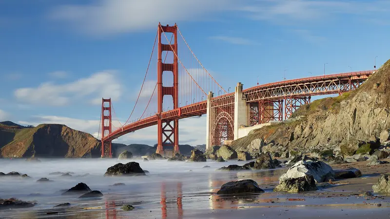
Cross the Golden Gate Bridge northbound, take the first exit and within five minutes you are on a ridge with the whole bridge below you, the city behind it and the Pacific on the other side. The Marin Headlands are that close to San Francisco and yet feel wild. For more than a century the Army guarded the harbor entrance from these hills. The gun batteries, bunkers and a Cold War missile site are still here, now part of Golden Gate National Recreation Area.
Our Sausalito and Marin guide gives the Headlands one section alongside Sausalito and Muir Woods. This page is for a full day in the Headlands: how the roads work, which viewpoints are worth the stop, the monthly open days for the missile site and the lighthouse, Rodeo Beach and the forts.
Getting there from Palo Alto
Take Interstate 280 north to 19th Avenue (Highway 1) through San Francisco, or US 101 north through the city. Follow signs to the Golden Gate Bridge. After crossing, take the Alexander Avenue exit, the first one on the Marin side. The trip is about 45 miles and about an hour in light traffic. Sunny weekends bring heavy traffic into the Headlands from late morning, so leave early.
From Alexander Avenue, follow the signs under the freeway to the Baker-Barry Tunnel on Bunker Road. It is the main way into the park, toward Rodeo Beach, Fort Barry and the missile site. The tunnel has a single lane, so traffic takes turns at a signal. Expect a wait of several minutes on busy days.
Conzelman Road, the viewpoint road, needs care. Large stretches are one-way and the NPS says you cannot drive up Conzelman from US 101. Instead, go through the tunnel, turn right on McCullough Road and follow it to the roundabout, where you join Conzelman and its viewpoints. Past Hawk Hill, the road becomes a steep, narrow one-way descent toward Point Bonita. Watch for cyclists on every grade.
The Golden Gate Bridge toll is charged southbound only, on your way home. It has no cash lanes. From July 1, 2026, a two-axle car pays $10.25 with FasTrak. Our bridges and tolls guide has the other payment options.
The bridge viewpoints
Most visitors come for the view of the Golden Gate Bridge. The Headlands have several, each a little different:
- Battery Spencer: a short walk from Conzelman Road just above the north tower. This is the famous close view, looking straight down the length of the bridge to the city. The small lot fills early.
- Hawk Hill: higher up Conzelman, a short climb from the roadside parking. You look down on the bridge with the whole bay behind it. In fall, migrating hawks and other raptors pass over in numbers.
- Slacker Ridge: a short but steep hike from the Conzelman roundabout, about 0.5 mile, for a quieter view of the city.
- Kirby Cove: a mile-long dirt road walk down from near Battery Spencer to a small beach under the bridge.
- Battery Rathbone-McIndoe: a concrete battery past Hawk Hill on the one-way stretch, with views of Point Bonita and the bridge.
The NPS lists the western part of Conzelman Road, between the traffic circle and Field Road, as open from 6 a.m. until one hour after sunset. Sunset from Hawk Hill is spectacular, but fog often rolls through the Golden Gate in the late afternoon, especially in summer. Never leave anything visible in a parked car at these viewpoints. Break-ins are common.
Forts, the missile site and the lighthouse
The Headlands hold the remains of three Army posts: Fort Baker by the bay, Fort Barry around Rodeo Lagoon and Fort Cronkhite by Rodeo Beach. Several sites open to the public only on set days, so plan around them.
| Site | When it is open (NPS, 2026) | What you see |
|---|---|---|
| Nike Missile Site SF-88 | First Saturday of each month, noon to 3 p.m.; closed in bad weather | The most fully restored Nike site in the country, with missiles, launch pits and radar |
| Point Bonita Trail | Third Saturday of each month, 12:30 to 3:30 p.m. | A tunnel and cliff path to the lighthouse viewing platform; the suspension bridge is closed |
| Battery Townsley | Open houses on dates in the park calendar | A 1940 casemate that held two 16-inch guns, restored by volunteers |
The Nike site, SF-88, was one of close to 300 Nike sites the Army built from 1953 to 1979 as a last line of defense against Soviet bombers. Volunteers help the park keep it as it looked during operations. The only restrooms there are portable ones; a larger rest stop with running water is about a mile back on Field Road.
The Point Bonita Lighthouse has guided ships since 1855. Pets, bikes and smoking are not allowed on its trail and parking is tight, so use the Battery Alexander lot nearby if the trailhead fills. Battery Townsley sits 0.7 mile up the Coastal Trail from the Rodeo Beach trailhead on a steep grade. Allow 45 minutes to walk up. When it fired test shots in 1940, the roar was heard across San Francisco. Check the NPS Marin Headlands page and its calendar before you build a day around any of these.
Rodeo Beach and the lagoon
Rodeo Beach is a cove of dark, pebbly sand at the end of Bunker Road, with Rodeo Lagoon behind it. Look closely at the sand. It is made of tiny colored pebbles, including red and green chert worn down from the cliffs. The beach is dog-friendly and popular with surfers. Swimming in the lagoon is banned to protect endangered species. Ocean currents here can be strong, so most visitors stay on the sand.
The lot has restrooms, cold showers and a water fountain. On sunny weekends it fills. The NPS points to overflow parking at the lower lot of The Marine Mammal Center, about 0.5 mile away, plus the Smith lot across from the Presidio Riding Club, over a mile away. For an easy walk, the Rodeo Lagoon Loop is about 1.5 miles. For a harder one, Hill 88 is about two miles up the Coastal Trail from the beach and is the highest point in the park you can hike to.
The Marine Mammal Center, up the hill from the beach, treats injured seals and sea lions and welcomes visitors. Check its website for open days and tours.

Food and supplies
The NPS is blunt about it: bring your own snacks and water, because food vendors in the Headlands are limited. The picnic area at Battery Wallace, near the Point Bonita trailhead, has tables and grills but no water. Cell service drops out in parts of the park, so download maps before you go.
For a real meal, Sausalito is ten minutes away. Two long-running choices:
- Sushi Ran, 107 Caledonia Street, open for 40 years. Its site lists dinner nightly and lunch Thursday to Sunday.
- Barrel House Tavern on the downtown waterfront, which says it is open every day, with bay views toward the city.
Check hours on each restaurant's site before you go.
Best time to go
September and October are the best months. The summer fog thins out, days are often clear and warm. Fall is also hawk migration season on Hawk Hill. Spring brings green hills and wildflowers in Tennessee Valley. Summer is the foggiest season. You may drive up to Battery Spencer and see nothing but gray, then find sunshine on the Sausalito side ten minutes later. Winter brings clear days between storms, though wind and rain can be fierce on the ridges.
Whatever the month, bring a windproof layer. The Headlands are often 15 to 20 degrees cooler than Palo Alto and far windier. Our weather guide explains why.
A sample day
This plan fits a first Saturday, when the Nike site is open. On a third Saturday, swap in Point Bonita instead.
- 8 a.m. Leave Palo Alto and drive north through San Francisco.
- 9:15 a.m. Battery Spencer for the bridge view before the lot fills.
- 10 a.m. Continue up Conzelman Road to Hawk Hill.
- 11 a.m. Down to Rodeo Beach. Walk the Rodeo Lagoon Loop.
- 12:15 p.m. Picnic lunch at Battery Wallace.
- 1 p.m. Nike Missile Site SF-88.
- 3 p.m. Through the tunnel to Sausalito for a waterfront walk and early dinner, then home across the bridge.
To go farther, Muir Woods and Stinson Beach are 30 to 45 minutes beyond. Prefer to skip the driving? Many Golden Gate and Marin tours leave from San Francisco. Browse all our day trips from Palo Alto for more.
Frequently asked questions
Is there a fee to visit the Marin Headlands?
No. The Marin Headlands are part of Golden Gate National Recreation Area, which charges no entrance fee except at Muir Woods. Parking at the viewpoints, Rodeo Beach and the visitor center area is free. You do pay the Golden Gate Bridge toll when you drive back south into San Francisco.
When is the Nike Missile Site open?
The National Park Service lists the Nike Missile Site, SF-88, as open only on the first Saturday of every month from noon to 3 p.m. It closes in bad weather. Check the park calendar before you go.
Can you walk to the Point Bonita Lighthouse?
Only on certain days. The NPS says the Point Bonita Trail is open on the third Saturday of every month from 12:30 to 3:30 p.m. The suspension bridge to the lighthouse itself is closed until further notice, but you can reach the viewing platform during open hours.
Where is the best view of the Golden Gate Bridge in the Marin Headlands?
Battery Spencer, a short walk from Conzelman Road just above the north end of the bridge, gives the classic close view. Hawk Hill, higher up the same road, looks down on the bridge with the city behind it. Slacker Ridge is a steeper, quieter option.
Are dogs allowed in the Marin Headlands?
On many trails, yes. The NPS says many Headlands trails welcome dogs and Rodeo Beach is dog-friendly. Rules differ by trail, so check the park's dog page. Dogs are not allowed on the Point Bonita Trail.