On this page
Half Moon Bay is the nearest coast to Palo Alto and the easiest way to swap the warm inland valley for wind, surf and sea air. It is a small town of farms, flower nurseries and a working harbor, strung along Highway 1 on a long curve of sandy beach. You can drive there in under an hour, walk the bluffs, eat fish at the harbor and be home for dinner.
The coast south of town is even quieter. Highway 1 runs past empty beaches and artichoke fields to Pescadero, a farm hamlet with an old tavern and a famous bakery counter. This guide covers the route over the hills, the best beaches, Pillar Point Harbor, the Coastside Trail, pumpkin season and how to add Pescadero to the day.
Getting there from Palo Alto
The standard route takes Interstate 280 north from Page Mill Road or Sand Hill Road to Highway 92, then Highway 92 west over the Santa Cruz Mountains and down into town. It is about 30 miles and takes 40 to 50 minutes with normal traffic. The last section of Highway 92 is two lanes with few places to pass, which is why it jams on busy weekends.
For a slower and prettier route, take Highway 84 through Woodside and La Honda to San Gregorio on the coast, then drive north on Highway 1. It winds through redwoods and takes longer, but it makes a good loop: go out one way and come back the other. You could also stop at Filoli on Cañada Road on the way out, since it is close to Highway 92.
Public transit is not practical for a day trip, so you need a car. If you do not have one, compare rental cars for a day. Download offline maps first. Cell coverage is patchy south of town.
The beaches
Half Moon Bay State Beach is a string of four beaches along the south side of town: Francis, Venice, Dunes and Roosevelt. Each has its own parking lot with a day use fee and the park is open from 8 a.m. to sunset. Francis Beach also has a campground. Dogs are not allowed on the state beaches, though leashed dogs may use the Coastside Trail and the picnic areas.
The water here is cold all year and California State Parks warns that strong rip currents can pull even strong swimmers offshore. Treat these as walking beaches. Sneaker waves can surge far up the sand without warning, so keep an eye on the sea and on children. Check the Half Moon Bay State Beach page for current fees and rules.
North of town, the beaches near Pillar Point Harbor are more sheltered. Farther north in Moss Beach, the Fitzgerald Marine Reserve has some of the best tide pools on the Peninsula. Go at a low tide and follow the rules: look closely, but do not touch or take anything. The ramp down to the tide pools has been closed indefinitely since August 26, 2026. Reach them instead by the Coastal Trail to Cypress Avenue and the Seal Cove stairs.

The Coastside Trail
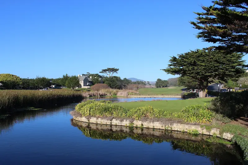
The Coastside Trail is the easiest way to see the coast here on foot or by bike. It runs for about three miles along the bluffs behind the state beaches, a paved and mostly flat path with ocean views most of the way. It is part of the longer California Coastal Trail, which continues north toward Pillar Point.
A good plan is to park at one of the state beach lots and walk or bike north toward the harbor, then turn back when you have had enough. Bring a windbreaker. Afternoon wind on the coast can be strong even on a sunny day. For more trail ideas on both sides of the hills, see our guide to the best hikes near Palo Alto.
Pillar Point Harbor and Mavericks
Pillar Point Harbor sits a few miles north of downtown Half Moon Bay in Princeton-by-the-Sea. It is a working fishing harbor with seafood restaurants, a breakwater walk and boats that sell fresh catch at the docks when they have it. Whale watching and fishing trips also leave from here in season.
Just beyond the harbor, past the radar station on the headland, is Mavericks, the big wave surf break that draws the world's best surfers when large winter swells arrive. You can walk out on the bluff trails at Pillar Point to look, but the break is far offshore and only lights up on the right winter days. The bluff trails are worth it any time for the views and the marsh behind the beach.
If you want someone else to handle the logistics, you can book a whale watching or coastal tour. Gray whales pass this coast in winter and spring and humpbacks feed offshore in summer and fall.
Downtown Half Moon Bay
Main Street is the town's old center, lined with low wooden buildings, cafes, galleries and shops. It is short and walkable and makes a good lunch stop between the beaches and the harbor. The town grew up as a farming center and you still pass greenhouses, flower fields and farm stands on the way in on Highway 92.
Pumpkin season
October is Half Moon Bay's busiest month. Farms along Highway 92 open pumpkin patches, corn mazes and hay rides and the town calls itself the pumpkin capital of the world. Two events anchor the season.
- The Safeway World Championship Pumpkin Weigh-Off brings giant pumpkins, some well over a ton, to town for an official weighing earlier in the festival week. In 2026 it took place on Monday, October 12.
- The Half Moon Bay Art and Pumpkin Festival fills Main Street for a weekend in mid-October with food, crafts, music stages, a parade and the giant pumpkins on display. The 54th festival ran October 17 and 18, 2026, with free admission.
Pumpkin patch weekends mean heavy traffic on Highway 92. Arrive early in the morning or come on a weekday. By the end of October most patches are winding down. Check our events calendar for what is on back in Palo Alto.
South to Pescadero
From Half Moon Bay, Highway 1 runs south along open coast past San Gregorio and Pomponio state beaches. After about 15 miles you reach the turn for Pescadero, a tiny town a mile or so inland. Two places define it.
- Duarte's Tavern has been on Stage Road since 1894. It is known for cream of artichoke soup, cioppino and fruit pies. It closes on Tuesdays and keeps fairly short hours, so check before you go.
- Arcangeli Grocery, also called Norm's Market, bakes the artichoke bread that people drive down the coast to buy.
From Pescadero you can continue south to Pigeon Point Light Station, about 20 miles south of Half Moon Bay. The lighthouse tower itself has been closed since restoration work began in February 2024, but the grounds are open from 8 a.m. to sunset and the Fog Signal Building displays the lighthouse's original Fresnel lens. State Parks says the lens is due to return to the tower next year (2027). Seals and passing whales are often visible from shore. See the Pigeon Point page for visitor center days.
On the way home, cut inland on Pescadero Road and Alpine Road or return north and climb Highway 84 back to Woodside. Either way you pass through redwood country. Our redwood forests guide covers parks along both roads, including Purisima Creek, which overlooks Half Moon Bay from Skyline Boulevard.
Staying overnight
The coast makes a calm one night break. Options range from bluff-top resorts to small inns and cottages. Families and groups often do better with a house rental. You can look at coastside vacation rentals along Highway 1. Waking up on the coast also means you can hit the tide pools or the trails before the day-trippers arrive.
Good to know
- Bring layers. The coast is often 10 to 20 degrees cooler than Palo Alto and foggy in early summer. See our weather guide.
- Gas and food are scarce south of Half Moon Bay. Fill up in town.
- Do not leave valuables in the car at beach lots and trailheads.
- State park fees apply at the state beach lots. Many pullouts along Highway 1 are free but fill early on sunny weekends.
Frequently asked questions
How long does it take to drive from Palo Alto to Half Moon Bay?
Usually 40 to 50 minutes. Take Interstate 280 north to Highway 92 and follow it west over the hills to Highway 1. On October weekends during pumpkin season and on sunny summer weekends, Highway 92 can back up badly, so leave early.
Can you swim at Half Moon Bay?
The water is very cold all year and California State Parks warns of strong rip currents. Most people walk, picnic and wade rather than swim. There are no lifeguards on most of the coast, so keep children close and never turn your back on the waves.
When is the Half Moon Bay pumpkin festival?
The Half Moon Bay Art and Pumpkin Festival is held on Main Street each October. The 54th festival ran October 17 and 18, 2026. The giant pumpkin weigh-off takes place earlier in the same week.
Is Half Moon Bay worth visiting in summer?
Yes, but expect fog. Early summer often brings gray, cool mornings on the coast even when Palo Alto is hot. The fog often lifts by afternoon. September and October usually bring the clearest days.
What is there to do in Pescadero?
Pescadero is a tiny farm town about 15 miles south of Half Moon Bay. Visitors come for Duarte's Tavern, open since 1894, the artichoke bread at Arcangeli Grocery, nearby farm stands and the beaches and tide pools along Highway 1.